
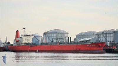
ISLA DE BIOKO
Tanker
Current Trip
USSNJ
| Time Travelled | 17 days |
|---|---|
| Remaining Time | --- |
| Distance Travelled | 5077.14 nm |
| Remaining Distance | --- |
| AVG Speed | 12.2 Knots |
| MAX Speed | 15.2 Knots |
| AVG Wind | 9.5 knots |
| MAX Wind | 20.8 knots |
| MIN Temp | 17°C / 62.6°F |
| MAX Temp | 29.8°C / 85.64°F |
| Draught | 9.2 m |
| Position Received | 2 d ago |
Current Position
| Longitude | -79.86487° |
|---|---|
| Latitude | 24.47246° |
| Status | Under way using engine |
| Speed | 11.5 Knots |
| Course | 238.6° |
| Area | North Atlantic Ocean |
| Station | T-AIS |
| Position Received | 2 d ago |
Info
Information
The current position of ISLA DE BIOKO is in North Atlantic Ocean with coordinates 24.47246° / -79.86487° as reported on 2024-06-27 18:15 by AIS to our vessel tracker app. The vessel's current speed is 11.5 Knots
The vessel ISLA DE BIOKO (IMO: 9767235, MMSI: 374402000) is a Tanker It's sailing under the flag of [PA] Panama.
In this page you can find informations about the vessels current position, last detected port calls, and current voyage information. If the vessels is not in coverage by AIS you will find the latest position.
The current position of ISLA DE BIOKO is detected by our AIS receivers and we are not responsible for the reliability of the data. The last position was recorded while the vessel was in Coverage by the Ais receivers of our vessel tracking app.
The current draught of ISLA DE BIOKO as reported by AIS is 9.2 meters
Weather
| Temperature | 27.3°C / 81.14°F |
|---|---|
| Wind Speed | 5 knots |
| Direction | 180° S |
| Pressure | 1019.6 hPa |
| Humidity | 83.2 % |
| Cloud Coverage | --- |
Featured Company
Last Port Calls
| Port | Arrival | Departure | Time In Port |
|---|---|---|---|
| 2024-06-11 18:20 | 2024-06-12 20:24 | 1 d | |
| 2024-06-01 11:47 | 2024-06-02 21:20 | 1 d | |
| 2024-05-31 10:31 | 2024-06-01 09:20 | 22 h | |
| 2024-05-09 10:24 | 2024-05-10 08:28 | 22 h | |
| 2024-04-23 18:02 | 2024-04-24 12:28 | 18 h | |
| 2024-04-19 11:27 | 2024-04-20 19:18 | 1 d | |
| 2024-04-17 17:08 | 2024-04-19 09:00 | 1 d |
Most Visited Ports (Last year)
| Port | Arrivals | |
|---|---|---|
| 9 | ||
| 8 | ||
| 5 | ||
| 3 | ||
| 2 | ||
| 1 |
Last Trips
| Origin | Departure | Destination | Arrival | Distance | |
|---|---|---|---|---|---|
| 2024-06-02 23:20 | 2024-06-11 20:20 | 1860.07 nm | |||
| 2024-06-01 11:20 | 2024-06-01 13:47 | 18.25 nm | |||
| 2024-05-10 09:28 | 2024-05-31 12:31 | 5464.49 nm | |||
| 2024-04-24 14:28 | 2024-05-09 11:24 | 4358.59 nm | |||
| 2024-04-20 21:18 | 2024-04-23 20:02 | 931.44 nm | |||
| 2024-04-19 11:00 | 2024-04-19 13:27 | 17.25 nm | |||
| 2024-03-01 09:01 | 2024-04-17 19:08 | 10143.79 nm |
Events
| Time | Event | Details | Position / Dest | Info |
|---|---|---|---|---|
| 2024-06-27 18:24 | Status Changed | Default Under way using engine |
24.45819 / -79.89061
USSNJ
|
Speed: 11.5 kn Course: 238.6° |
| 2024-06-27 18:15 | OUT of Coverage |
24.47246 / -79.86487
North Atlantic Ocean
USSNJ
|
Speed: 11.5 kn Course: 238.6° |
|
| 2024-06-27 17:08 | Status Changed | Under way using engine Default |
24.58879 / -79.66344
USSNJ
|
Speed: 12.1 kn Course: 192° |
| 2024-06-27 17:08 | IN Coverage |
24.58397 / -79.67088
North Atlantic Ocean
USSNJ
|
Speed: 11.7 kn Course: 238.1° |
|
| 2024-06-27 16:09 | Status Changed | Default Under way using engine |
24.77976 / -79.60741
USSNJ
|
Speed: 11.7 kn Course: 195.2° |
| 2024-06-27 16:04 | OUT of Coverage |
24.79555 / -79.60275
North Atlantic Ocean
USSNJ
|
Speed: 11.7 kn Course: 195.2° |
|
| 2024-06-27 15:54 | Status Changed | Under way using engine Default |
24.82621 / -79.59371
USSNJ
|
Speed: 11.8 kn Course: 195° |
| 2024-06-27 15:49 | Status Changed | Default Under way using engine |
24.84358 / -79.58864
USSNJ
|
Speed: 11.7 kn Course: 194.8° |
| 2024-06-27 15:40 | Status Changed | Under way using engine Default |
24.87046 / -79.58073
USSNJ
|
Speed: 11.6 kn Course: 195° |
| 2024-06-27 15:25 | Status Changed | Default Under way using engine |
24.91986 / -79.56632
USSNJ
|
Speed: 11.6 kn Course: 195.2° |