
ISLAND PRIDE
Offshore Supply Ship
Current Trip
SURVEY CPA 1NM
| Time Travelled | 15 days |
|---|---|
| Remaining Time | --- |
| Distance Travelled | 889.36 nm |
| Remaining Distance | --- |
| AVG Speed | 4.9 Knots |
| MAX Speed | 12.8 Knots |
| AVG Wind | 17.4 knots |
| MAX Wind | 33.8 knots |
| MIN Temp | 8.1°C / 46.58°F |
| MAX Temp | 22.9°C / 73.22°F |
| Draught | 7.2 m |
| Position Received | 1 m ago |
Current Position
| Longitude | -121.91259° |
|---|---|
| Latitude | 35.58674° |
| Status | Restricted manoeuverability |
| Speed | 1.5 Knots |
| Course | 330° |
| Area | North Pacific Ocean |
| Station | T-AIS |
| Position Received | 1 m ago |
Info
Information
The current position of ISLAND PRIDE is in North Pacific Ocean with coordinates 35.58674° / -121.91259° as reported on 2024-05-11 19:54 by AIS to our vessel tracker app. The vessel's current speed is 1.5 Knots
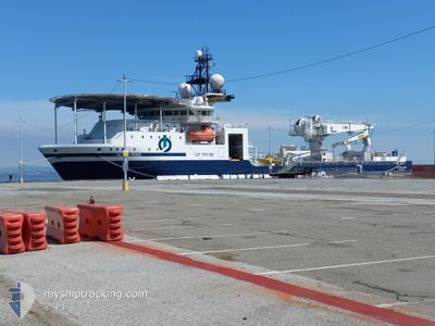
The vessel ISLAND PRIDE (IMO: 9630547, MMSI: 257406000) is a Offshore Supply Ship that was built in 2014 ( 10 years old ). It's sailing under the flag of [NO] Norway.
In this page you can find informations about the vessels current position, last detected port calls, and current voyage information. If the vessels is not in coverage by AIS you will find the latest position.
The current position of ISLAND PRIDE is detected by our AIS receivers and we are not responsible for the reliability of the data. The last position was recorded while the vessel was in Coverage by the Ais receivers of our vessel tracking app.
The current draught of ISLAND PRIDE as reported by AIS is 7.2 meters
Weather
| Temperature | 14.1°C / 57.38°F |
|---|---|
| Wind Speed | 7 knots |
| Direction | 326° NW |
| Pressure | 1015.2 hPa |
| Humidity | 85.7 % |
| Cloud Coverage | --- |
Featured Company
Last Port Calls
| Port | Arrival | Departure | Time In Port |
|---|---|---|---|
| 2024-04-25 15:44 | 2024-04-26 05:07 | 13 h | |
| 2024-04-24 14:59 | 2024-04-25 04:08 | 13 h | |
| 2024-04-14 16:26 | 2024-04-19 03:02 | 4 d | |
| 2024-04-14 16:00 | 2024-04-14 16:05 | 5 m | |
| 2024-03-14 14:18 | 2024-03-15 07:36 | 17 h | |
| 2024-03-06 03:28 |
Most Visited Ports (Last year)
| Port | Arrivals | |
|---|---|---|
| 4 | ||
| 4 | ||
| 3 | ||
| 3 | ||
| 3 | ||
| 3 |
Last Trips
| Origin | Departure | Destination | Arrival | Distance | |
|---|---|---|---|---|---|
| 2024-04-24 21:08 | 2024-04-25 08:44 | 2.66 nm | |||
| 2024-04-18 20:02 | 2024-04-24 07:59 | 394.70 nm | |||
| 2024-04-14 09:05 | 2024-04-14 09:26 | 1.33 nm | |||
| 2024-03-15 00:36 | 2024-04-14 09:00 | 990.18 nm | |||
| 2024-03-05 19:28 | 2024-03-14 07:18 | 1118.87 nm |
Events
| Time | Event | Details | Position / Dest | Info |
|---|---|---|---|---|
| 2024-05-11 17:59 | START Moving |
35.67996 / -121.91066
SURVEY CPA 1NM
|
Speed: 3.2 kn Course: 151° |
|
| 2024-05-11 17:10 | STOP Moving |
35.68502 / -121.91230
SURVEY CPA 1NM
|
Speed: 0.3 kn Course: 120° |
|
| 2024-05-11 16:46 | START Moving |
35.68067 / -121.92342
SURVEY CPA 1NM
|
Speed: 3.1 kn Course: 16° |
|
| 2024-05-11 15:33 | STOP Moving |
35.67191 / -121.93523
SURVEY CPA 1NM
|
Speed: 0.3 kn Course: 32° |
|
| 2024-05-11 15:07 | START Moving |
35.65785 / -121.96283
SURVEY CPA 1NM
|
Speed: 3.2 kn Course: 33° |
|
| 2024-05-11 14:32 | IN Coverage |
35.65770 / -121.97048
North Pacific Ocean
|
Speed: 0.7 kn Course: 103.8° |
|
| 2024-05-11 13:21 | OUT of Coverage |
35.65581 / -121.97247
North Pacific Ocean
|
Speed: 0.2 kn Course: 338.8° |
|
| 2024-05-11 07:09 | STOP Moving |
35.65459 / -121.97199
SURVEY CPA 1NM
|
Speed: 0.3 kn Course: 345° |
|
| 2024-05-11 05:32 | START Moving |
35.66835 / -121.94391
SURVEY CPA 1NM
|
Speed: 3.1 kn Course: 114° |
|
| 2024-05-11 05:26 | STOP Moving |
35.66949 / -121.94663
SURVEY CPA 1NM
|
Speed: 0.3 kn Course: 119° |