
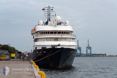
ISLAND SKY
Passengers Ship
Current Trip
| Trip Time | 9 days |
|---|---|
| Trip Distance | 1445.77 nm |
| AVG Speed | 9.5 Knots |
| MAX Speed | 15 Knots |
| Draught | 4.3 m |
| AVG Wind | 11.6 knots |
| MAX Wind | 22.3 knots |
| MIN Temp | 10.2°C / 50.36°F |
| MAX Temp | 14.3°C / 57.74°F |
| Position Received | 2 m ago |
Current Position
| Longitude | -2.08862° |
|---|---|
| Latitude | 57.14517° |
| Status | Moored |
| Speed | |
| Course | 107° |
| Area | North Sea |
| Station | T-AIS |
| Position Received | 2 m ago |
Info
Information
The current position of ISLAND SKY is in North Sea with coordinates 57.14517° / -2.08862° as reported on 2024-06-03 14:55 by AIS to our vessel tracker app. The vessel's current speed is 0 Knots and is currently inside the port of ABERDEEN.
The vessel ISLAND SKY (IMO: 8802894, MMSI: 311743000) is a Passengers Ship that was built in 1992 ( 32 years old ). It's sailing under the flag of [BS] Bahamas.
In this page you can find informations about the vessels current position, last detected port calls, and current voyage information. If the vessels is not in coverage by AIS you will find the latest position.
The current position of ISLAND SKY is detected by our AIS receivers and we are not responsible for the reliability of the data. The last position was recorded while the vessel was in Coverage by the Ais receivers of our vessel tracking app.
The current draught of ISLAND SKY as reported by AIS is 4.3 meters
Weather
| Temperature | 16.6°C / 61.88°F |
|---|---|
| Wind Speed | 4 knots |
| Direction | 249° WSW |
| Pressure | 1014.4 hPa |
| Humidity | 60.2 % |
| Cloud Coverage | 100 % |
Featured Company
Last Port Calls
| Port | Arrival | Departure | Time In Port |
|---|---|---|---|
| 2024-06-03 04:54 | |||
| 2024-05-24 05:46 | 2024-05-24 11:47 | 6 h | |
| 2024-05-23 06:08 | 2024-05-23 18:05 | 11 h | |
| 2024-05-20 04:40 | 2024-05-20 16:06 | 11 h | |
| 2024-05-19 11:18 | 2024-05-19 16:22 | 5 h | |
| 2024-04-21 22:20 | 2024-04-22 15:30 | 17 h | |
| 2024-04-18 11:20 | 2024-04-19 00:05 | 12 h | |
| 2024-04-17 12:26 | 2024-04-18 00:19 | 11 h | |
| 2024-04-15 12:08 | 2024-04-15 21:09 | 9 h | |
| 2024-04-13 15:31 | 2024-04-13 23:43 | 8 h |
Last Trips
| Origin | Departure | Destination | Arrival | Distance | |
|---|---|---|---|---|---|
| 2024-05-24 12:47 | 2024-06-03 05:54 | 1445.77 nm | |||
| 2024-05-23 19:05 | 2024-05-24 06:46 | 108.30 nm | |||
| 2024-05-20 18:06 | 2024-05-23 07:08 | 592.09 nm | |||
| 2024-05-19 18:22 | 2024-05-20 06:40 | 148.03 nm | |||
| 2024-04-22 11:30 | 2024-05-19 13:18 | 4645.41 nm | |||
| 2024-04-18 20:05 | 2024-04-21 18:20 | 372.15 nm | |||
| 2024-04-17 20:19 | 2024-04-18 07:20 | 104.43 nm | |||
| 2024-04-15 17:09 | 2024-04-17 08:26 | 472.08 nm | |||
| 2024-04-13 18:43 | 2024-04-15 08:08 | 357.13 nm | |||
| 2024-04-12 18:46 | 2024-04-13 10:31 | 130.39 nm |
Events
| Time | Event | Details | Position / Dest | Info |
|---|---|---|---|---|
| 2024-06-03 05:31 | Status Changed | Moored Under way using engine |
57.14518 / -2.08863
[GB] ABERDEEN
|
Speed: Course: 107° |
| 2024-06-03 05:07 | STOP Moving |
57.14267 / -2.07610
[GB] ABERDEEN
|
Speed: 0.3 kn Course: 99° |
|
| 2024-06-03 04:54 | PORT ARRIVAL |
|
57.14532 / -2.05852
[GB] ABERDEEN
|
Speed: 6 kn Course: 236.6° |
| 2024-06-03 00:30 | Destination Changed | GB ABD FAIR ISLE |
57.75419 / -1.59631
GB ABD
|
Speed: 10.2 kn Course: 186.7° |
| 2024-06-03 00:30 | ETA Changed | 2024/06/03 05:45 2024/06/02 06:00 |
57.75419 / -1.59631
GB ABD
|
Speed: 10.2 kn Course: 186.7° |
| 2024-06-02 21:00 | Status Changed | Under way using engine Default |
58.30894 / -1.53810
FAIR ISLE
|
Speed: 9.3 kn Course: 182° |
| 2024-06-02 20:52 | IN Coverage |
58.30550 / -1.53807
North Sea
|
Speed: 9.5 kn Course: 179.8° |
|
| 2024-06-02 13:12 | Status Changed | Default Under way using engine |
59.55946 / -1.62425
FAIR ISLE
|
Speed: 10.9 kn Course: 329.2° |
| 2024-06-02 13:05 | OUT of Coverage |
59.55861 / -1.59377
North Sea
|
Speed: 10.9 kn Course: 329.2° |
|
| 2024-06-02 13:03 | Status Changed | Under way using engine Default |
59.55144 / -1.58837
FAIR ISLE
|
Speed: 11.7 kn Course: 2° |