
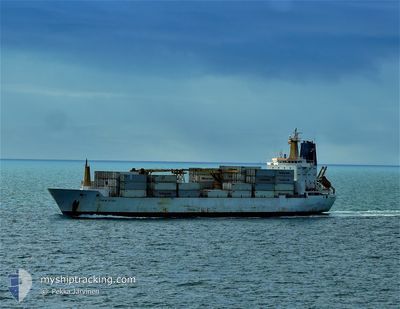
ITALIA STREAM
Reefer
Current Trip
| Time Travelled | 3 days |
|---|---|
| Remaining Time | 1 day |
| Distance Travelled | 1090.74 nm |
| Remaining Distance | 421.73 nm |
| AVG Speed | 12.5 Knots |
| MAX Speed | 14.3 Knots |
| AVG Wind | 7.8 knots |
| MAX Wind | 21 knots |
| MIN Temp | 14.2°C / 57.56°F |
| MAX Temp | 17.9°C / 64.22°F |
| Draught | 9.5 m |
| Position Received | 3 h, 18 m ago |
Current Position
| Longitude | 19.55112° |
|---|---|
| Latitude | 57.09627° |
| Status | Under way using engine |
| Speed | 13.2 Knots |
| Course | 24° |
| Area | Baltic Sea |
| Station | T-AIS |
| Position Received | 3 h, 18 m ago |
Info
Information
The current position of ITALIA STREAM is in Baltic Sea with coordinates 57.09627° / 19.55112° as reported on 2024-06-25 20:21 by AIS to our vessel tracker app. The vessel's current speed is 13.2 Knots and is heading at the port of ST PETERSBURG. The estimated time of arrival as calculated by vessel tracking app is 2024-06-27 04:36 LT
The vessel ITALIA STREAM (IMO: 9030137, MMSI: 308438000) is a Reefer that was built in 1992 ( 32 years old ). It's sailing under the flag of [BS] Bahamas.
In this page you can find informations about the vessels current position, last detected port calls, and current voyage information. If the vessels is not in coverage by AIS you will find the latest position.
The current position of ITALIA STREAM is detected by our AIS receivers and we are not responsible for the reliability of the data. The last position was recorded while the vessel was in Coverage by the Ais receivers of our vessel tracking app.
The current draught of ITALIA STREAM as reported by AIS is 9.5 meters
Weather
| Temperature | 16.7°C / 62.06°F |
|---|---|
| Wind Speed | 7 knots |
| Direction | 213° SSW |
| Pressure | 1020.3 hPa |
| Humidity | 67.6 % |
| Cloud Coverage | --- |
Featured Company
Last Port Calls
| Port | Arrival | Departure | Time In Port |
|---|---|---|---|
| 2024-06-21 17:02 | 2024-06-22 09:33 | 16 h | |
| 2024-06-21 12:04 | 2024-06-21 16:38 | 4 h | |
| 2024-06-20 09:19 | 2024-06-20 12:21 | 3 h | |
| 2024-05-28 13:35 | 2024-06-02 04:36 | 4 d | |
| 2024-05-25 09:23 | 2024-05-27 02:52 | 1 d | |
| 2024-05-11 09:31 | 2024-05-24 01:35 | 12 d | |
| 2024-05-01 23:03 | 2024-05-03 13:46 | 1 d | |
| 2024-04-13 09:03 | 2024-04-13 10:58 | 1 h | |
| 2024-04-12 07:05 | 2024-04-12 23:35 | 16 h | |
| 2024-04-05 18:10 |
Most Visited Ports (Last year)
| Port | Arrivals | |
|---|---|---|
| 7 | ||
| 5 | ||
| 5 | ||
| 3 | ||
| 2 | ||
| 2 |
Last Trips
| Origin | Departure | Destination | Arrival | Distance | |
|---|---|---|---|---|---|
| 2024-06-21 18:38 | 2024-06-21 19:02 | 1.63 nm | |||
| 2024-06-20 13:21 | 2024-06-21 14:04 | 150.13 nm | |||
| 2024-06-02 06:36 | 2024-06-20 10:19 | 6145.56 nm | |||
| 2024-05-27 04:52 | 2024-05-28 15:35 | 435.33 nm | |||
| 2024-05-24 03:35 | 2024-05-25 11:23 | 393.51 nm | |||
| 2024-05-03 15:46 | 2024-05-11 11:31 | 886.54 nm | |||
| 2024-04-13 11:58 | 2024-05-02 01:03 | 6217.31 nm | |||
| 2024-04-13 01:35 | 2024-04-13 10:03 | 101.16 nm | |||
| 2024-04-05 20:10 | 2024-04-12 09:05 | 137.36 nm |
Events
| Time | Event | Details | Position / Dest | Info |
|---|---|---|---|---|
| 2024-06-25 20:26 | Status Changed | Default Under way using engine |
57.11118 / 19.56442
RU LED
|
Speed: 13.2 kn Course: 24° |
| 2024-06-25 20:21 | OUT of Coverage |
57.09627 / 19.55112
Baltic Sea
RU LED
|
Speed: 13.2 kn Course: 24° |
|
| 2024-06-25 19:52 | Status Changed | Under way using engine Default |
57.00033 / 19.46811
RU LED
|
Speed: 13.2 kn Course: 26° |
| 2024-06-25 19:33 | IN Coverage |
57.00033 / 19.46811
Baltic Sea
RU LED
|
Speed: 13.1 kn Course: 25.6° |
|
| 2024-06-25 18:34 | Status Changed | Default Under way using engine |
56.74271 / 19.24918
RU LED
|
Speed: 12.8 kn Course: 26.4° |
| 2024-06-25 18:29 | OUT of Coverage |
56.72771 / 19.23613
Baltic Sea
RU LED
|
Speed: 12.8 kn Course: 26.4° |
|
| 2024-06-25 18:26 | Status Changed | Under way using engine Default |
56.71806 / 19.22758
RU LED
|
Speed: 12.8 kn Course: 26° |
| 2024-06-25 17:46 | Status Changed | Default Under way using engine |
56.59064 / 19.11129
RU LED
|
Speed: 12.8 kn Course: 30.5° |
| 2024-06-25 12:32 | Status Changed | Under way using engine Default |
55.90496 / 17.64175
RU LED
|
Speed: 12.6 kn Course: 78° |
| 2024-06-25 12:25 | Status Changed | Default Under way using engine |
55.90081 / 17.60287
RU LED
|
Speed: 12.6 kn Course: 79° |