
ITS ALLIANCE
Military ops
Current Trip
Unknown
| Time Travelled | 6 days |
|---|---|
| Remaining Time | --- |
| Distance Travelled | 371.87 nm |
| Remaining Distance | --- |
| AVG Speed | 7.8 Knots |
| MAX Speed | 12.1 Knots |
| AVG Wind | 11.1 knots |
| MAX Wind | 20.8 knots |
| MIN Temp | 2°C / 35.6°F |
| MAX Temp | 8.6°C / 47.48°F |
| Draught | 5.7 m |
| Position Received | 4 d ago |
Current Position
| Longitude | 22.45917° |
|---|---|
| Latitude | 74.52898° |
| Status | Under way using engine |
| Speed | 2.1 Knots |
| Course | 330° |
| Area | Barentsz Sea |
| Station | T-AIS |
| Position Received | 4 d ago |
Info
Information
The current position of ITS ALLIANCE is in Barentsz Sea with coordinates 74.52898° / 22.45917° as reported on 2024-06-10 09:44 by AIS to our vessel tracker app. The vessel's current speed is 2.1 Knots
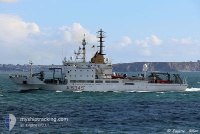
The vessel ITS ALLIANCE (MMSI: 247366500) is a Military ops It's sailing under the flag of [IT] Italy.
In this page you can find informations about the vessels current position, last detected port calls, and current voyage information. If the vessels is not in coverage by AIS you will find the latest position.
The current position of ITS ALLIANCE is detected by our AIS receivers and we are not responsible for the reliability of the data. The last position was recorded while the vessel was in Coverage by the Ais receivers of our vessel tracking app.
The current draught of ITS ALLIANCE as reported by AIS is 5.7 meters
Weather
| Temperature | 2.1°C / 35.78°F |
|---|---|
| Wind Speed | 12 knots |
| Direction | 63° ENE |
| Pressure | 1009.9 hPa |
| Humidity | 85.3 % |
| Cloud Coverage | 100 % |
Featured Company
Most Visited Ports (Last year)
| Port | Arrivals | |
|---|---|---|
| 10 | ||
| 4 | ||
| 1 |
Last Trips
Events
| Time | Event | Details | Position / Dest | Info |
|---|---|---|---|---|
| 2024-06-10 09:44 | OUT of Coverage |
74.52898 / 22.45917
Barentsz Sea
|
Speed: 2.1 kn Course: 297.5° |
|
| 2024-06-10 05:11 | START Moving |
74.13187 / 22.47474
|
Speed: 3.3 kn Course: 24° |
|
| 2024-06-10 04:08 | STOP Moving |
74.12733 / 22.50908
|
Speed: 0.3 kn Course: 24° |
|
| 2024-06-09 20:37 | Change Sea Area | Norwegian part of the Barentsz Sea Norwegian part of the Norwegian Sea |
73.40918 / 21.03924
Barentsz Sea
|
Speed: 9.5 kn Course: 31.7° |
| 2024-06-09 19:19 | IN Coverage |
73.22571 / 20.72718
Norwegian Sea
|
Speed: 9.8 kn Course: 22.5° |
|
| 2024-06-09 12:20 | OUT of Coverage |
72.25848 / 19.09398
Norwegian Sea
|
Speed: 8.8 kn Course: 30.9° |
|
| 2024-06-09 10:52 | IN Coverage |
72.07114 / 18.71222
Norwegian Sea
|
Speed: 8.5 kn Course: 34.5° |
|
| 2024-06-08 18:26 | OUT of Coverage |
70.35036 / 16.26038
Norwegian Sea
|
Speed: 11 kn Course: 320.4° |
|
| 2024-06-08 10:09 | PORT DEPARTURE |
|
69.67825 / 19.00472
|
Speed: 5.9 kn Course: 109° |
| 2024-06-08 10:09 | START Moving |
69.67871 / 19.00187
[NO] TROMSO
|
Speed: 5.8 kn Course: 106° |