
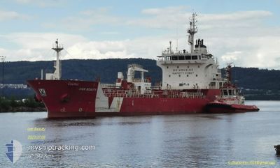
IVER BEAUTY
Asphalt/Bitumen Tanker
Aktuelle Reise
| Bisherige Reisezeit | 6 Tage |
|---|---|
| Verbleibende Reisezeit | --- |
| Zurückgelegte Distanz | 599.03 nm |
| Verbleibende Distanz | --- |
| Durchschnittliche Geschwindigkeit | 9.7 Knoten |
| Maximale Geschwindigkeit | 11.7 Knoten |
| Durchschnittliche Windgeschwindigkeit | 7.9 Knoten |
| Maximale Windgeschwindigkeit | 15.9 Knoten |
| Minimale Temperatur | 19.2°C / 66.56°F |
| Maximale Temperatur | 22.2°C / 71.96°F |
| Tiefgang | 5.3 m |
| Position erhalten | 1 d alt |
Aktuelle Position
| Länge | --- |
|---|---|
| Breite | --- |
| Zustand | At anchor |
| Geschwindigkeit | 0.1 Knoten |
| Kurs | 3° |
| Gebiet | Mediterranean Sea - Eastern Basin |
| Station | T-AIS |
| Position erhalten | 1 d alt |
Schiffsdetails
Information
Die IVER BEAUTY befindet sich derzeit in Mediterranean Sea - Eastern Basin mit den Koordinaten 35.91651° / 14.83780°, Diese Position wurde am 2024-10-30 17:59 von unserer Schiffsverfolgungs-App über AIS erfasst. Das Schiff fährt momentan mit einer Geschwindigkeit von 0.1 Knoten
Das Schiff IVER BEAUTY (IMO: 9588263, MMSI: 236594000) ist Asphalt/Bitumen Tanker das wurde im Jahr 2011 ( 13 Jahre alt ) gebaut. und fährt unter der Flagge von [GI] Gibraltar.
Auf dieser Seite erhalten Sie Informationen zur aktuellen Position des Schiffes, zu den letzten bekannten Hafenanläufen und zu den aktuellen Reiseinformationen. Sollte das Schiff nicht durch AIS abgedeckt sein, wird die zuletzt erfasste Position angezeigt.
Die IVER BEAUTY wird durch unsere AIS-Empfänger ermittelt. Wir übernehmen keine Gewähr für die Richtigkeit der Daten. Die letzte Position wurde von unseren AIS-Empfängern aufgezeichnet, während das Schiff in Reichweite war.
Der aktuelle Entwurf von IVER BEAUTY, wie von AIS gemeldet, betragt 5.3 meter
Wetter
| Temperatur | 21.4°C / 70.52°F |
|---|---|
| Windgeschwindigkeit | 10 Knoten |
| Windrichtung | 72° ENE |
| Luftdruck | 1023 hPa |
| Luftfeuchtigkeit | 70.8 % |
| Wolken | 43 % |
Featured Company
Letzte Hafenanläufe
| Hafen | Ankunft | Abfahrt | Time In Port |
|---|---|---|---|
| 2024-10-18 07:04 | 2024-10-25 13:00 | 7 d | |
| 2024-10-14 14:54 | 2024-10-15 11:16 | 20 h | |
| 2024-10-07 20:04 | 2024-10-08 18:12 | 22 h | |
| 2024-10-02 20:37 | 2024-10-04 18:33 | 1 d | |
| 2024-09-17 12:50 | 2024-09-19 19:04 | 2 d | |
| 2024-09-09 18:44 | 2024-09-10 15:03 | 20 h | |
| 2024-08-31 12:59 | 2024-09-02 11:25 | 1 d | |
| 2024-08-22 14:00 | 2024-08-23 15:37 | 1 d | |
| 2024-08-17 04:20 | 2024-08-19 06:36 | 2 d | |
| 2024-08-14 15:16 | 2024-08-15 11:39 | 20 h |
Meistbesuchte Häfen (Letztes Jahr)
| Hafen | Ankünfte | |
|---|---|---|
| 7 | ||
| 4 | ||
| 4 | ||
| 2 | ||
| 2 | ||
| 2 |
Letzte Reisen
| Herkunft | Abfahrt | Ziel | Ankunft | Distanz | |
|---|---|---|---|---|---|
| 2024-10-15 14:16 | 2024-10-18 09:04 | 759.45 nm | |||
| 2024-10-08 20:12 | 2024-10-14 17:54 | 1235.74 nm | |||
| 2024-10-04 20:33 | 2024-10-07 22:04 | 744.44 nm | |||
| 2024-09-19 20:04 | 2024-10-02 22:37 | 1273.60 nm | |||
| 2024-09-10 18:03 | 2024-09-17 13:50 | 1739.02 nm | |||
| 2024-09-02 12:25 | 2024-09-09 21:44 | 1778.36 nm | |||
| 2024-08-23 18:37 | 2024-08-31 13:59 | 1740.79 nm | |||
| 2024-08-19 07:36 | 2024-08-22 17:00 | 909.21 nm | |||
| 2024-08-15 13:39 | 2024-08-17 05:20 | 425.69 nm | |||
| 2024-08-13 08:42 | 2024-08-14 17:16 | 356.29 nm |
Events
| Zeit | Ereignis | Details | Position / Ziel | Information |
|---|---|---|---|---|
| 2024-10-30 18:08 | geänderter Status | Default At anchor |
35.91640 / 14.83778
MT MLA
|
Geschwindigkeit: 0.1 kn Kurs: 3° |
| 2024-10-30 17:59 | geänderter Status | At anchor Default |
35.91651 / 14.83780
MT MLA
|
Geschwindigkeit: Kurs: 3° |
| 2024-10-30 17:59 | außerhalb Abdeckung |
35.91651 / 14.83780
Mediterranean Sea - Eastern Basin
|
Geschwindigkeit: 0.1 kn Kurs: 211.9° |
|
| 2024-10-30 17:38 | geänderter Status | Default At anchor |
35.91644 / 14.83786
MT MLA
|
Geschwindigkeit: Kurs: 0° |
| 2024-10-30 17:32 | geänderter Status | At anchor Default |
35.91647 / 14.83785
MT MLA
|
Geschwindigkeit: 0.1 kn Kurs: 3° |
| 2024-10-30 17:17 | in Abdeckung |
35.91647 / 14.83785
Mediterranean Sea - Eastern Basin
|
Geschwindigkeit: 0.1 kn Kurs: 211.4° |
|
| 2024-10-30 16:32 | geänderter Status | Default At anchor |
35.91656 / 14.83784
MT MLA
|
Geschwindigkeit: 0.1 kn Kurs: 11° |
| 2024-10-30 16:26 | außerhalb Abdeckung |
35.91656 / 14.83771
Mediterranean Sea - Eastern Basin
|
Geschwindigkeit: 0.1 kn Kurs: 74.6° |
|
| 2024-10-30 16:23 | geänderter Status | At anchor Default |
35.91654 / 14.83768
MT MLA
|
Geschwindigkeit: 0.1 kn Kurs: 10° |
| 2024-10-30 15:56 | geänderter Status | Default At anchor |
35.91650 / 14.83767
MT MLA
|
Geschwindigkeit: 0.1 kn Kurs: 16° |