
IZUMO HERMES
Cargo
Current Trip
| Trip Time | 8 days |
|---|---|
| Trip Distance | 2188.69 nm |
| AVG Speed | 11.3 Knots |
| MAX Speed | 14 Knots |
| Draught | 9.6 m |
| AVG Wind | 10.5 knots |
| MAX Wind | 20 knots |
| MIN Temp | 13.4°C / 56.12°F |
| MAX Temp | 31.2°C / 88.16°F |
| Position Received | 2 d ago |
Current Position
| Longitude | -77.98893° |
|---|---|
| Latitude | -12.61566° |
| Status | Under way using engine |
| Speed | 12.4 Knots |
| Course | 147.8° |
| Area | South Pacific Ocean |
| Station | T-AIS |
| Position Received | 2 d ago |
Info
Information
The current position of IZUMO HERMES is in South Pacific Ocean with coordinates -12.61566° / -77.98893° as reported on 2024-06-23 15:50 by AIS to our vessel tracker app. The vessel's current speed is 12.4 Knots and is currently inside the port of MATARANI.
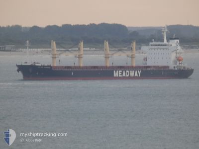
The vessel IZUMO HERMES (IMO: 9852212, MMSI: 374134000) is a Cargo It's sailing under the flag of [PA] Panama.
In this page you can find informations about the vessels current position, last detected port calls, and current voyage information. If the vessels is not in coverage by AIS you will find the latest position.
The current position of IZUMO HERMES is detected by our AIS receivers and we are not responsible for the reliability of the data. The last position was recorded while the vessel was in Coverage by the Ais receivers of our vessel tracking app.
The current draught of IZUMO HERMES as reported by AIS is 9.6 meters
Weather
| Temperature | 14.7°C / 58.46°F |
|---|---|
| Wind Speed | 7 knots |
| Direction | 123° ESE |
| Pressure | 1019.2 hPa |
| Humidity | 86 % |
| Cloud Coverage | 98 % |
Featured Company
Last Port Calls
| Port | Arrival | Departure | Time In Port |
|---|---|---|---|
| 2024-06-25 08:41 | |||
| 2024-06-12 19:49 | 2024-06-16 12:24 | 3 d | |
| 2024-06-09 00:39 | 2024-06-11 14:43 | 2 d | |
| 2024-06-08 10:12 | |||
| 2024-05-29 12:06 | 2024-06-04 11:12 | 5 d | |
| 2024-05-22 03:18 | 2024-05-25 02:25 | 2 d | |
| 2024-04-22 10:55 | 2024-04-29 17:56 | 7 d | |
| 2024-04-11 04:18 | 2024-04-18 17:20 | 7 d | |
| 2024-04-10 11:26 |
Most Visited Ports (Last year)
| Port | Arrivals | |
|---|---|---|
| 3 | ||
| 2 | ||
| 2 | ||
| 1 | ||
| 1 | ||
| 1 |
Last Trips
| Origin | Departure | Destination | Arrival | Distance | |
|---|---|---|---|---|---|
| 2024-06-16 07:24 | 2024-06-25 03:41 | 2188.69 nm | |||
| 2024-06-11 09:43 | 2024-06-12 14:49 | 339.49 nm | |||
| 2024-06-08 04:12 | 2024-06-08 19:39 | 193.52 nm | |||
| 2024-05-24 22:25 | 2024-05-29 07:06 | 539.07 nm | |||
| 2024-04-29 20:56 | 2024-05-21 23:18 | 5461.36 nm | |||
| 2024-04-18 19:20 | 2024-04-22 13:55 | 1053.06 nm | |||
| 2024-04-10 13:26 | 2024-04-11 06:18 | 158.69 nm |
Events
| Time | Event | Details | Position / Dest | Info |
|---|---|---|---|---|
| 2024-06-25 08:52 | STOP Moving |
-16.99813 / -72.10694
[PE] MATARANI
|
Speed: 0.3 kn Course: 71° |
|
| 2024-06-25 08:41 | PORT ARRIVAL |
|
-16.99514 / -72.10767
[PE] MATARANI
|
Speed: 2.7 kn Course: 114° |
| 2024-06-25 08:06 | START Moving | 1.16 nm, West of MATARANI |
-16.99936 / -72.12685
PE MRI
|
Speed: 3.3 kn Course: 333° |
| 2024-06-25 06:18 | STOP Moving | 0.82 nm, West of MATARANI |
-16.99895 / -72.12102
PE MRI
|
Speed: 0.2 kn Course: 154° |
| 2024-06-23 16:01 | Status Changed | Default Under way using engine |
-12.64625 / -77.96941
PE MRI
|
Speed: 12.4 kn Course: 147.8° |
| 2024-06-23 15:50 | OUT of Coverage |
-12.61566 / -77.98893
South Pacific Ocean
PE MRI
|
Speed: 12.4 kn Course: 147.8° |
|
| 2024-06-23 15:43 | Status Changed | Under way using engine Default |
-12.59530 / -78.00220
PE MRI
|
Speed: 12.3 kn Course: 148° |
| 2024-06-23 15:14 | Status Changed | Default Under way using engine |
-12.50990 / -78.05672
PE MRI
|
Speed: 12.1 kn Course: 149.1° |
| 2024-06-23 14:56 | Detected in Sea | Peruvian (disputed - Peruvian point of view) part of the South Pacific Ocean |
-12.45963 / -78.08863
South Pacific Ocean
PE MRI
|
Speed: 12.1 kn Course: 147.7° |
| 2024-06-23 14:54 | Status Changed | Under way using engine Default |
-12.45338 / -78.09264
PE MRI
|
Speed: 12.1 kn Course: 149° |