
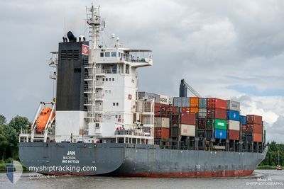
JAN
Container Ship
Current Trip
| Time Travelled | 5 days |
|---|---|
| Remaining Time | 5 h, 51 mins |
| Distance Travelled | 1353.99 nm |
| Remaining Distance | 68.66 nm |
| AVG Speed | 11.7 Knots |
| MAX Speed | 17.8 Knots |
| AVG Wind | 12.6 knots |
| MAX Wind | 24 knots |
| MIN Temp | 17.1°C / 62.78°F |
| MAX Temp | 23°C / 73.4°F |
| Draught | 6.7 m |
| Position Received | 3 h, 14 m ago |
Current Position
| Longitude | 12.81850° |
|---|---|
| Latitude | 36.52100° |
| Status | Under way using engine |
| Speed | 10.7 Knots |
| Course | 128° |
| Area | Mediterranean Sea - Eastern Basin |
| Station | T-AIS |
| Position Received | 3 h, 14 m ago |
Info
Information
The current position of JAN is in Mediterranean Sea - Eastern Basin with coordinates 36.52100° / 12.81850° as reported on 2024-06-23 15:38 by AIS to our vessel tracker app. The vessel's current speed is 10.7 Knots and is heading at the port of VALLETTA. The estimated time of arrival as calculated by vessel tracking app is 2024-06-24 00:43 LT
The vessel JAN (IMO: 9477335, MMSI: 255805788) is a Container Ship that was built in 2009 ( 15 years old ). It's sailing under the flag of [PT] Portugal.
In this page you can find informations about the vessels current position, last detected port calls, and current voyage information. If the vessels is not in coverage by AIS you will find the latest position.
The current position of JAN is detected by our AIS receivers and we are not responsible for the reliability of the data. The last position was recorded while the vessel was in Coverage by the Ais receivers of our vessel tracking app.
The current draught of JAN as reported by AIS is 6.7 meters
Weather
| Temperature | 22.4°C / 72.32°F |
|---|---|
| Wind Speed | 18 knots |
| Direction | 308° NW |
| Pressure | 1010.8 hPa |
| Humidity | 86.4 % |
| Cloud Coverage | 11 % |
Featured Company
Last Port Calls
| Port | Arrival | Departure | Time In Port |
|---|---|---|---|
| 2024-06-18 18:34 | |||
| 2024-06-15 03:42 | 2024-06-16 05:46 | 1 d | |
| 2024-06-12 10:49 | 2024-06-12 20:45 | 9 h | |
| 2024-06-09 09:25 | 2024-06-10 01:15 | 15 h | |
| 2024-06-06 09:53 | 2024-06-07 03:40 | 17 h | |
| 2024-06-04 16:26 | 2024-06-05 04:06 | 11 h | |
| 2024-06-03 22:17 | 2024-06-04 04:59 | 6 h | |
| 2024-05-31 02:59 | 2024-06-01 03:00 | 1 d | |
| 2024-05-30 01:28 | 2024-05-30 16:42 | 15 h | |
| 2024-05-28 06:04 | 2024-05-28 19:32 | 13 h |
Most Visited Ports (Last year)
| Port | Arrivals | |
|---|---|---|
| 22 | ||
| 20 | ||
| 15 | ||
| 13 | ||
| 13 | ||
| 12 |
Last Trips
| Origin | Departure | Destination | Arrival | Distance | |
|---|---|---|---|---|---|
| 2024-06-12 21:45 | 2024-06-15 04:42 | 195.55 nm | |||
| 2024-06-10 03:15 | 2024-06-12 11:49 | 568.94 nm | |||
| 2024-06-07 05:40 | 2024-06-09 11:25 | 745.59 nm | |||
| 2024-06-05 06:06 | 2024-06-06 11:53 | 272.09 nm | |||
| 2024-06-04 06:59 | 2024-06-04 18:26 | 105.95 nm | |||
| 2024-06-01 05:00 | 2024-06-04 00:17 | 320.54 nm | |||
| 2024-05-30 18:42 | 2024-05-31 04:59 | 116.58 nm | |||
| 2024-05-28 21:32 | 2024-05-30 03:28 | 342.92 nm | |||
| 2024-05-25 10:07 | 2024-05-28 08:04 | 817.18 nm | |||
| 2024-05-24 18:38 | 2024-05-25 01:40 | 93.41 nm |
Events
| Time | Event | Details | Position / Dest | Info |
|---|---|---|---|---|
| 2024-06-23 15:40 | Status Changed | Default Under way using engine |
36.51646 / 12.82580
MTMLA
|
Speed: 10.7 kn Course: 128° |
| 2024-06-23 15:38 | OUT of Coverage |
36.52100 / 12.81850
Mediterranean Sea - Eastern Basin
MTMLA
|
Speed: 10.7 kn Course: 128° |
|
| 2024-06-23 15:24 | Status Changed | Under way using engine Default |
36.54683 / 12.77733
MTMLA
|
Speed: 10.7 kn Course: 127° |
| 2024-06-23 15:17 | Status Changed | Default Under way using engine |
36.55850 / 12.75817
MTMLA
|
Speed: 10.8 kn Course: 125° |
| 2024-06-23 14:37 | ETA Changed | 2024/06/24 05:00 2024/06/24 13:00 |
36.62900 / 12.63683
MTMLA
|
Speed: 10.7 kn Course: 124° |
| 2024-06-23 14:35 | Status Changed | Under way using engine Default |
36.63183 / 12.63167
MTMLA
|
Speed: 10.8 kn Course: 127° |
| 2024-06-23 14:27 | Status Changed | Default Under way using engine |
36.64716 / 12.60583
MTMLA
|
Speed: 10.7 kn Course: 126° |
| 2024-06-23 14:20 | Status Changed | Under way using engine Default |
36.65839 / 12.58688
MTMLA
|
Speed: 10.7 kn Course: 125° |
| 2024-06-23 14:03 | Status Changed | Default Under way using engine |
36.68867 / 12.53583
MTMLA
|
Speed: 10.8 kn Course: 127° |
| 2024-06-23 13:58 | Change Sea Area | Italian part of the Mediterranean Sea - Eastern Basin Tunisian part of the Mediterranean Sea - Western Basin |
36.69867 / 12.51933
Mediterranean Sea - Eastern Basin
MTMLA
|
Speed: 10.7 kn Course: 126° |