
JEAN PIERRE A
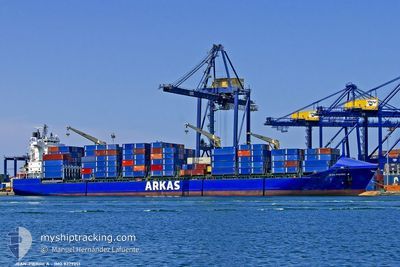
Container Ship
Current Trip
ESALG
| Time Travelled | 1 day |
|---|---|
| Remaining Time | --- |
| Distance Travelled | 415.89 nm |
| Remaining Distance | --- |
| AVG Speed | 13.4 Knots |
| MAX Speed | 14.9 Knots |
| AVG Wind | 13.1 knots |
| MAX Wind | 27.7 knots |
| MIN Temp | 12.4°C / 54.32°F |
| MAX Temp | 18.3°C / 64.94°F |
| Draught | 8.5 m |
| Position Received | 1 m ago |
Current Position
| Longitude | 1.58204° |
|---|---|
| Latitude | 40.49510° |
| Status | Under way using engine |
| Speed | 13.6 Knots |
| Course | 205.7° |
| Area | Balearic Sea |
| Station | T-AIS |
| Position Received | 1 m ago |
Info
Information
The current position of JEAN PIERRE A is in Balearic Sea with coordinates 40.49510° / 1.58204° as reported on 2024-05-09 00:16 by AIS to our vessel tracker app. The vessel's current speed is 13.6 Knots
The vessel JEAN PIERRE A (IMO: 9379351, MMSI: 215418000) is a Container Ship that was built in 2007 ( 17 years old ). It's sailing under the flag of [MT] Malta.
In this page you can find informations about the vessels current position, last detected port calls, and current voyage information. If the vessels is not in coverage by AIS you will find the latest position.
The current position of JEAN PIERRE A is detected by our AIS receivers and we are not responsible for the reliability of the data. The last position was recorded while the vessel was in Coverage by the Ais receivers of our vessel tracking app.
The current draught of JEAN PIERRE A as reported by AIS is 8.5 meters
Weather
| Temperature | 17.3°C / 63.14°F |
|---|---|
| Wind Speed | 8 knots |
| Direction | 242° WSW |
| Pressure | 1020.5 hPa |
| Humidity | 73.2 % |
| Cloud Coverage | --- |
Featured Company
Last Port Calls
| Port | Arrival | Departure | Time In Port |
|---|---|---|---|
| 2024-05-06 20:35 | 2024-05-07 17:14 | 20 h | |
| 2024-05-05 12:20 | 2024-05-06 16:33 | 1 d | |
| 2024-05-03 17:27 | 2024-05-04 11:26 | 17 h | |
| 2024-04-29 15:16 | 2024-04-30 18:32 | 1 d | |
| 2024-04-27 18:12 | 2024-04-28 15:40 | 21 h | |
| 2024-04-26 09:32 | 2024-04-26 21:50 | 12 h | |
| 2024-04-25 01:16 | 2024-04-26 01:50 | 1 d | |
| 2024-04-22 04:30 | 2024-04-23 03:44 | 23 h | |
| 2024-04-15 05:30 | 2024-04-16 18:16 | 1 d | |
| 2024-04-12 01:29 | 2024-04-12 21:05 | 19 h |
Last Trips
| Origin | Departure | Destination | Arrival | Distance | |
|---|---|---|---|---|---|
| 2024-05-06 18:33 | 2024-05-06 22:35 | 52.43 nm | |||
| 2024-05-04 13:26 | 2024-05-05 14:20 | 363.34 nm | |||
| 2024-04-30 20:32 | 2024-05-03 19:27 | 1018.69 nm | |||
| 2024-04-28 18:40 | 2024-04-29 17:16 | 351.51 nm | |||
| 2024-04-27 00:50 | 2024-04-27 21:12 | 140.36 nm | |||
| 2024-04-26 04:50 | 2024-04-26 12:32 | 100.54 nm | |||
| 2024-04-23 06:44 | 2024-04-25 04:16 | 692.94 nm | |||
| 2024-04-16 20:16 | 2024-04-22 07:30 | 536.58 nm | |||
| 2024-04-12 23:05 | 2024-04-15 07:30 | 828.25 nm | |||
| 2024-04-09 12:25 | 2024-04-12 03:29 | 26.97 nm |
Events
| Time | Event | Details | Position / Dest | Info |
|---|---|---|---|---|
| 2024-05-08 16:11 | Status Changed | Under way using engine Default |
41.56493 / 3.23442
ESALG
|
Speed: 12.9 kn Course: 220° |
| 2024-05-08 15:52 | Status Changed | Default Under way using engine |
41.61544 / 3.29060
ESALG
|
Speed: 13.3 kn Course: 217.3° |
| 2024-05-08 15:47 | Detected in Sea | Spanish part of the Balearic Sea |
41.63121 / 3.30648
Balearic Sea
|
Speed: 13.3 kn Course: 217.3° |
| 2024-05-08 15:47 | Status Changed | Under way using engine Default |
41.63121 / 3.30648
ESALG
|
Speed: 13.6 kn Course: 215° |
| 2024-05-08 15:47 | IN Coverage |
41.63121 / 3.30648
Balearic Sea
|
Speed: 13.3 kn Course: 217.3° |
|
| 2024-05-08 02:50 | Status Changed | Default Under way using engine |
42.86666 / 6.66500
ESALG
|
Speed: 14.3 kn Course: 231° |
| 2024-05-08 02:37 | OUT of Coverage |
42.90395 / 6.72185
Mediterranean Sea - Western Basin
|
Speed: 14.3 kn Course: 231° |
|
| 2024-05-08 02:34 | Status Changed | Under way using engine Default |
42.91102 / 6.73304
ESALG
|
Speed: 14 kn Course: 229° |
| 2024-05-08 02:29 | Status Changed | Default Under way using engine |
42.92166 / 6.75167
ESALG
|
Speed: 14.2 kn Course: 230° |
| 2024-05-07 23:20 | Change Sea Area | French part of the Mediterranean Sea - Western Basin Mon�gasque part of the Mediterranean Sea - Western Basin |
43.40578 / 7.52966
Mediterranean Sea - Western Basin
|
Speed: 14.2 kn Course: 231.6° |