
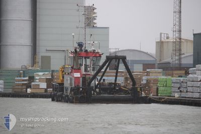
JENNY D
Utility Vessel
Current Trip
HENGISTBURY HD
| Time Travelled | 2 days |
|---|---|
| Remaining Time | --- |
| Distance Travelled | 50.96 nm |
| Remaining Distance | --- |
| AVG Speed | 5.1 Knots |
| MAX Speed | 7.4 Knots |
| AVG Wind | 13.2 knots |
| MAX Wind | 19 knots |
| MIN Temp | 9.6°C / 49.28°F |
| MAX Temp | 13°C / 55.4°F |
| Draught | 2.3 m |
| Position Received | Now |
Current Position
| Longitude | -1.76139° |
|---|---|
| Latitude | 50.71414° |
| Status | Restricted manoeuverability |
| Speed | |
| Course | 29° |
| Area | English Channel |
| Station | T-AIS |
| Position Received | Now |
Info
Information
The current position of JENNY D is in English Channel with coordinates 50.71414° / -1.76139° as reported on 2024-05-04 19:46 by AIS to our vessel tracker app. The vessel's current speed is 0 Knots
The vessel JENNY D (IMO: 9570905, MMSI: 235075339) is a Utility Vessel that was built in 2009 ( 15 years old ). It's sailing under the flag of [GB] United Kingdom.
In this page you can find informations about the vessels current position, last detected port calls, and current voyage information. If the vessels is not in coverage by AIS you will find the latest position.
The current position of JENNY D is detected by our AIS receivers and we are not responsible for the reliability of the data. The last position was recorded while the vessel was in Coverage by the Ais receivers of our vessel tracking app.
The current draught of JENNY D as reported by AIS is 2.3 meters
Weather
| Temperature | 10.2°C / 50.36°F |
|---|---|
| Wind Speed | 4 knots |
| Direction | 157° SSE |
| Pressure | 1009.2 hPa |
| Humidity | 86 % |
| Cloud Coverage | --- |
Featured Company
Last Port Calls
| Port | Arrival | Departure | Time In Port |
|---|---|---|---|
| 2024-04-27 17:38 | 2024-05-02 13:19 | 4 d | |
| 2024-04-25 19:31 |
Last Trips
| Origin | Departure | Destination | Arrival | Distance | |
|---|---|---|---|---|---|
| 2024-04-25 20:31 | 2024-04-27 18:38 | 344.98 nm |
Events
| Time | Event | Details | Position / Dest | Info |
|---|---|---|---|---|
| 2024-05-04 13:03 | STOP Moving | 1.05 nm, South West of CHRISTCHURCH |
50.70693 / -1.76424
HENGISTBURY HD
|
Speed: 0.2 kn Course: 285° |
| 2024-05-04 11:24 | ETA Changed | 2024/05/04 13:00 2024/05/04 14:00 |
50.65138 / -1.87043
HENGISTBURY HD
|
Speed: 3.8 kn Course: 49° |
| 2024-05-04 10:22 | START Moving | 0.62 nm, North East of SWANAGE |
50.61717 / -1.93762
HENGISTBURY HD
|
Speed: 3.2 kn Course: 100° |
| 2024-05-04 09:58 | ETA Changed | 2024/05/04 14:00 2024/05/04 19:00 |
50.61901 / -1.93603
HENGISTBURY HD
|
Speed: Course: 214° |
| 2024-05-04 09:21 | STOP Moving | 0.76 nm, North East of SWANAGE |
50.61908 / -1.93546
HENGISTBURY HD
|
Speed: 0.2 kn Course: 200° |
| 2024-05-04 09:19 | START Moving | 0.77 nm, North East of SWANAGE |
50.61921 / -1.93548
HENGISTBURY HD
|
Speed: 3.1 kn Course: 60° |
| 2024-05-04 09:16 | ETA Changed | 2024/05/04 19:00 2024/05/02 19:00 |
50.61874 / -1.93598
HENGISTBURY HD
|
Speed: Course: 30° |
| 2024-05-04 08:59 | Destination Changed | HENGISTBURY HD SWANAGE BAY |
50.61888 / -1.93581
HENGISTBURY HD
|
Speed: Course: 28° |
| 2024-05-04 08:47 | Status Changed | Restricted manoeuverability Moored |
50.61890 / -1.93576
SWANAGE BAY
|
Speed: Course: 28° |
| 2024-05-04 08:27 | Status Changed | Moored Default |
50.61891 / -1.93568
SWANAGE BAY
|
Speed: Course: 30° |