
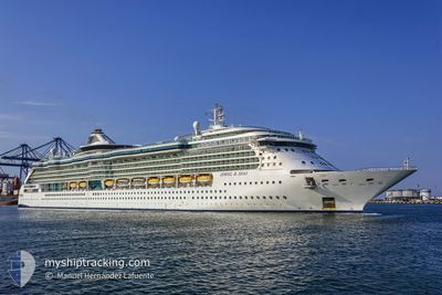
JEWEL OF THE SEAS
Passengers Ship
Current Trip
| Time Travelled | 15 h, 21 mins |
|---|---|
| Remaining Time | 22 h, 26 mins |
| Distance Travelled | 254.98 nm |
| Remaining Distance | 391.76 nm |
| AVG Speed | 16.5 Knots |
| MAX Speed | 20.3 Knots |
| AVG Wind | 5.4 knots |
| MAX Wind | 13.4 knots |
| MIN Temp | 7.9°C / 46.22°F |
| MAX Temp | 11.4°C / 52.52°F |
| Draught | 8.7 m |
| Position Received | 7 m ago |
Current Position
| Longitude | 8.59640° |
|---|---|
| Latitude | 65.36296° |
| Status | Under way using engine |
| Speed | 17.5 Knots |
| Course | 26.2° |
| Area | Norwegian Sea |
| Station | T-AIS |
| Position Received | 7 m ago |
Info
Information
The current position of JEWEL OF THE SEAS is in Norwegian Sea with coordinates 65.36296° / 8.59640° as reported on 2024-06-02 08:35 by AIS to our vessel tracker app. The vessel's current speed is 17.5 Knots and is heading at the port of TROMSO. The estimated time of arrival as calculated by vessel tracking app is 2024-06-03 07:09 LT
The vessel JEWEL OF THE SEAS (IMO: 9228356, MMSI: 311583000) is a Passengers Ship that was built in 2004 ( 20 years old ). It's sailing under the flag of [BS] Bahamas.
In this page you can find informations about the vessels current position, last detected port calls, and current voyage information. If the vessels is not in coverage by AIS you will find the latest position.
The current position of JEWEL OF THE SEAS is detected by our AIS receivers and we are not responsible for the reliability of the data. The last position was recorded while the vessel was in Coverage by the Ais receivers of our vessel tracking app.
The current draught of JEWEL OF THE SEAS as reported by AIS is 8.7 meters
Weather
| Temperature | 11°C / 51.8°F |
|---|---|
| Wind Speed | 13 knots |
| Direction | 213° SSW |
| Pressure | 1016.7 hPa |
| Humidity | 87.9 % |
| Cloud Coverage | 98 % |
Featured Company
Last Port Calls
| Port | Arrival | Departure | Time In Port |
|---|---|---|---|
| 2024-06-01 07:24 | 2024-06-01 17:22 | 9 h | |
| 2024-05-30 16:42 | 2024-05-30 17:27 | 45 m | |
| 2024-05-30 02:08 | 2024-05-30 15:02 | 12 h | |
| 2024-05-30 00:15 | 2024-05-30 00:46 | 30 m | |
| 2024-05-29 05:13 | 2024-05-29 16:28 | 11 h | |
| 2024-05-27 08:32 | 2024-05-27 17:52 | 9 h | |
| 2024-05-27 07:57 | 2024-05-27 08:07 | 9 m | |
| 2024-05-26 08:35 | 2024-05-26 16:39 | 8 h | |
| 2024-05-23 09:45 | 2024-05-24 12:35 | 1 d | |
| 2024-05-21 07:44 | 2024-05-22 14:18 | 1 d |
Most Visited Ports (Last year)
| Port | Arrivals | |
|---|---|---|
| 20 | ||
| 20 | ||
| 18 | ||
| 18 | ||
| 17 | ||
| 16 |
Last Trips
| Origin | Departure | Destination | Arrival | Distance | |
|---|---|---|---|---|---|
| 2024-05-30 19:27 | 2024-06-01 09:24 | 714.06 nm | |||
| 2024-05-30 17:02 | 2024-05-30 18:42 | 9.97 nm | |||
| 2024-05-30 02:46 | 2024-05-30 04:08 | 9.23 nm | |||
| 2024-05-29 18:28 | 2024-05-30 02:15 | 127.31 nm | |||
| 2024-05-27 18:52 | 2024-05-29 07:13 | 545.05 nm | |||
| 2024-05-27 09:07 | 2024-05-27 09:32 | 2.13 nm | |||
| 2024-05-26 17:39 | 2024-05-27 08:57 | 263.80 nm | |||
| 2024-05-24 12:35 | 2024-05-26 09:35 | 823.65 nm | |||
| 2024-05-22 14:18 | 2024-05-23 09:45 | 349.41 nm | |||
| 2024-05-18 18:27 | 2024-05-21 07:44 | 896.83 nm |
Events
| Time | Event | Details | Position / Dest | Info |
|---|---|---|---|---|
| 2024-06-01 17:22 | START Moving | 0.33 nm, North West of GEIRANGER |
62.10586 / 7.19203
TROMSO
|
Speed: 6 kn Course: 317° |
| 2024-06-01 17:22 | PORT DEPARTURE |
|
62.10586 / 7.19203
TROMSO
|
Speed: 3.1 kn Course: 307° |
| 2024-06-01 17:14 | Status Changed | Under way using engine Moored |
62.10390 / 7.19880
[NO] GEIRANGER
|
Speed: 0.1 kn Course: 319° |
| 2024-06-01 17:01 | Destination Changed | TROMSO FLAM,NORWAY |
62.10371 / 7.19910
[NO] GEIRANGER
|
Speed: Course: 318° |
| 2024-06-01 15:19 | Destination Changed | FLAM,NORWAY GEIRANGER,NORWAY |
62.10370 / 7.19906
[NO] GEIRANGER
|
Speed: Course: 317° |
| 2024-06-01 15:19 | ETA Changed | 2024/06/03 05:00 2024/06/01 03:00 |
62.10370 / 7.19906
[NO] GEIRANGER
|
Speed: Course: 317° |
| 2024-06-01 09:21 | Status Changed | Moored Under way using engine |
62.10374 / 7.19919
[NO] GEIRANGER
|
Speed: Course: 319° |
| 2024-06-01 07:24 | PORT ARRIVAL |
|
62.10384 / 7.19884
[NO] GEIRANGER
|
Speed: 0.4 kn Course: 317° |
| 2024-06-01 07:20 | STOP Moving | 0.12 nm, North West of GEIRANGER |
62.10365 / 7.19809
GEIRANGER,NORWAY
|
Speed: 0.1 kn Course: 316° |
| 2024-05-31 21:13 | Change Sea Area | Norwegian part of the Norwegian Sea Norwegian part of the North Sea |
61.01353 / 4.21964
Norwegian Sea
GEIRANGER,NORWAY
|
Speed: 19.6 kn Course: 5.4° |