
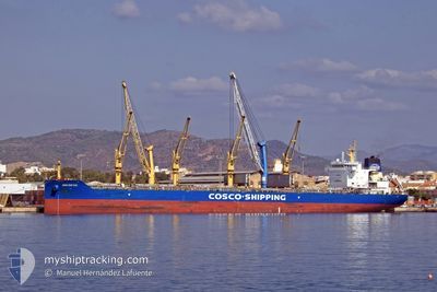
JIAN GUO HAI
Cargo
Current Trip
| Time Travelled | 1 day |
|---|---|
| Remaining Time | 15 mins |
| Distance Travelled | 160.01 nm |
| Remaining Distance | 5.73 nm |
| AVG Speed | 9.6 Knots |
| MAX Speed | 13.4 Knots |
| AVG Wind | 4.7 knots |
| MAX Wind | 8.8 knots |
| MIN Temp | 10.9°C / 51.62°F |
| MAX Temp | 21.7°C / 71.06°F |
| Draught | 10.4 m |
| Position Received | 1 m ago |
Current Position
| Longitude | -58.34691° |
|---|---|
| Latitude | -34.51880° |
| Status | Under way using engine |
| Speed | 9.3 Knots |
| Course | 134.8° |
| Area | Rio de La Plata |
| Station | T-AIS |
| Position Received | 1 m ago |
Info
Information
The current position of JIAN GUO HAI is in Rio de La Plata with coordinates -34.51880° / -58.34691° as reported on 2024-06-02 07:52 by AIS to our vessel tracker app. The vessel's current speed is 9.3 Knots and is heading at the port of BUENOS AIRES. The estimated time of arrival as calculated by vessel tracking app is 2024-06-02 08:08 LT
The vessel JIAN GUO HAI (IMO: 9751286, MMSI: 477913100) is a Cargo It's sailing under the flag of [HK] Hong Kong.
In this page you can find informations about the vessels current position, last detected port calls, and current voyage information. If the vessels is not in coverage by AIS you will find the latest position.
The current position of JIAN GUO HAI is detected by our AIS receivers and we are not responsible for the reliability of the data. The last position was recorded while the vessel was in Coverage by the Ais receivers of our vessel tracking app.
The current draught of JIAN GUO HAI as reported by AIS is 10.4 meters
Weather
| Temperature | 14.6°C / 58.28°F |
|---|---|
| Wind Speed | 7 knots |
| Direction | 163° SSE |
| Pressure | 1013.5 hPa |
| Humidity | 78.9 % |
| Cloud Coverage | 55 % |
Featured Company
Events
| Time | Event | Details | Position / Dest | Info |
|---|---|---|---|---|
| 2024-06-02 05:29 | START Moving | 3.09 nm, East of ESCOBAR |
-34.26049 / -58.66954
ZONA COMUN
|
Speed: 3.1 kn Course: 101° |
| 2024-06-02 05:02 | Status Changed | Under way using engine At anchor |
-34.26063 / -58.67315
ZONA COMUN
|
Speed: Course: 284° |
| 2024-06-02 04:07 | ETA Changed | 2024/06/02 11:00 2024/06/01 20:00 |
-34.26056 / -58.67313
ZONA COMUN
|
Speed: Course: 281° |
| 2024-06-02 03:04 | Status Changed | At anchor Default |
-34.26061 / -58.67314
ZONA COMUN
|
Speed: Course: 280° |
| 2024-06-02 02:52 | Status Changed | Default At anchor |
-34.26057 / -58.67314
ZONA COMUN
|
Speed: Course: 280° |
| 2024-06-02 02:43 | Status Changed | At anchor Default |
-34.26058 / -58.67319
ZONA COMUN
|
Speed: Course: 280° |
| 2024-06-02 02:19 | Status Changed | Default At anchor |
-34.26059 / -58.67313
ZONA COMUN
|
Speed: Course: 280° |
| 2024-06-02 02:04 | Status Changed | At anchor Default |
-34.26059 / -58.67314
ZONA COMUN
|
Speed: Course: 280° |
| 2024-06-02 02:01 | Status Changed | Default At anchor |
-34.26060 / -58.67312
ZONA COMUN
|
Speed: Course: 280° |
| 2024-06-02 01:40 | Status Changed | At anchor Default |
-34.26058 / -58.67319
ZONA COMUN
|
Speed: Course: 280° |