
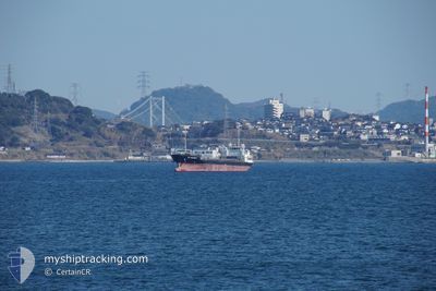
JING RUN
Cargo
Current Trip
JP OIT OFF
| Time Travelled | 1 day |
|---|---|
| Remaining Time | --- |
| Distance Travelled | 225.39 nm |
| Remaining Distance | --- |
| AVG Speed | 8.4 Knots |
| MAX Speed | 11.6 Knots |
| AVG Wind | 7.6 knots |
| MAX Wind | 14.5 knots |
| MIN Temp | 28.5°C / 83.3°F |
| MAX Temp | 32.7°C / 90.86°F |
| Draught | 5 m |
| Position Received | 1 m ago |
Current Position
| Longitude | 121.64590° |
|---|---|
| Latitude | 25.50855° |
| Status | Under way using engine |
| Speed | 8.6 Knots |
| Course | 66.4° |
| Area | South China Sea |
| Station | T-AIS |
| Position Received | 1 m ago |
Info
Information
The current position of JING RUN is in South China Sea with coordinates 25.50855° / 121.64590° as reported on 2024-06-27 07:53 by AIS to our vessel tracker app. The vessel's current speed is 8.6 Knots
The vessel JING RUN (IMO: 9154622, MMSI: 312200000) is a Cargo It's sailing under the flag of [BZ] Belize.
In this page you can find informations about the vessels current position, last detected port calls, and current voyage information. If the vessels is not in coverage by AIS you will find the latest position.
The current position of JING RUN is detected by our AIS receivers and we are not responsible for the reliability of the data. The last position was recorded while the vessel was in Coverage by the Ais receivers of our vessel tracking app.
The current draught of JING RUN as reported by AIS is 5 meters
Weather
| Temperature | 30.2°C / 86.36°F |
|---|---|
| Wind Speed | 8 knots |
| Direction | 113° ESE |
| Pressure | 1010 hPa |
| Humidity | 72.7 % |
| Cloud Coverage | 100 % |
Featured Company
Last Port Calls
| Port | Arrival | Departure | Time In Port |
|---|---|---|---|
| 2024-06-24 07:41 | 2024-06-26 04:08 | 1 d | |
| 2024-06-17 11:32 | 2024-06-18 09:17 | 21 h | |
| 2024-06-13 22:20 | 2024-06-16 03:10 | 2 d | |
| 2024-06-07 23:13 | 2024-06-09 06:20 | 1 d | |
| 2024-06-02 06:54 | 2024-06-03 20:39 | 1 d | |
| 2024-05-31 06:34 | 2024-06-02 06:02 | 1 d | |
| 2024-05-23 06:53 | 2024-05-25 07:15 | 2 d | |
| 2024-05-12 21:34 | 2024-05-13 04:16 | 6 h | |
| 2024-05-10 22:40 | 2024-05-11 22:37 | 23 h | |
| 2024-05-09 02:04 | 2024-05-09 10:52 | 8 h |
Last Trips
| Origin | Departure | Destination | Arrival | Distance | |
|---|---|---|---|---|---|
| 2024-06-18 17:17 | 2024-06-24 15:41 | 83.40 nm | |||
| 2024-06-16 11:10 | 2024-06-17 19:32 | 237.88 nm | |||
| 2024-06-09 15:20 | 2024-06-14 06:20 | 851.36 nm | |||
| 2024-06-04 05:39 | 2024-06-08 08:13 | 29.59 nm | |||
| 2024-06-02 15:02 | 2024-06-02 15:54 | 6.39 nm | |||
| 2024-05-25 15:15 | 2024-05-31 15:34 | 1060.30 nm | |||
| 2024-05-13 13:16 | 2024-05-23 14:53 | 1702.06 nm | |||
| 2024-05-12 07:37 | 2024-05-13 06:34 | 129.28 nm | |||
| 2024-05-09 19:52 | 2024-05-11 07:40 | 187.95 nm | |||
| 2024-05-07 10:07 | 2024-05-09 11:04 | 65.32 nm |
Events
| Time | Event | Details | Position / Dest | Info |
|---|---|---|---|---|
| 2024-06-27 07:37 | Change Sea Area | Taiwanese part of the Eastern China Sea Taiwanese part of the South China Sea |
25.49193 / 121.60519
Eastern China Sea
JP OIT OFF
|
Speed: 8.9 kn Course: 65.9° |
| 2024-06-27 07:36 | Status Changed | Under way using engine Default |
25.49085 / 121.60272
JP OIT OFF
|
Speed: 8 kn Course: 67° |
| 2024-06-27 07:19 | IN Coverage |
25.49193 / 121.60519
Eastern China Sea
JP OIT OFF
|
Speed: 8.9 kn Course: 65.9° |
|
| 2024-06-26 06:31 | START Moving | 10.04 nm, South West of YUNG AN |
22.69413 / 120.06893
JP OIT OFF
|
Speed: 7.9 kn Course: 303° |
| 2024-06-26 06:01 | STOP Moving | 9.87 nm, South West of YUNG AN |
22.68854 / 120.08003
JP OIT OFF
|
Speed: 0.2 kn Course: 186° |
| 2024-06-26 05:45 | Status Changed | Default Not under command |
22.69121 / 120.08157
JP OIT OFF
|
Speed: 2.4 kn Course: 208° |
| 2024-06-26 05:44 | Status Changed | Not under command Default |
22.69185 / 120.08221
JP OIT OFF
|
Speed: 7.7 kn Course: 238° |
| 2024-06-26 05:44 | OUT of Coverage |
22.69185 / 120.08221
South China Sea
JP OIT OFF
|
Speed: 2.4 kn Course: 225.8° |
|
| 2024-06-26 05:17 | Status Changed | Default Under way using engine |
22.72188 / 120.12525
JP OIT OFF
|
Speed: 8.1 kn Course: 320.8° |
| 2024-06-26 05:03 | Status Changed | Under way using engine Default |
22.69920 / 120.14615
JP OIT OFF
|
Speed: 8 kn Course: 312° |