
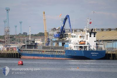
JOHN PAUL K
General Cargo
Current Trip
| Time Travelled | 2 days |
|---|---|
| Remaining Time | 3 h, 22 mins |
| Distance Travelled | 613.05 nm |
| Remaining Distance | 25.41 nm |
| AVG Speed | 9.8 Knots |
| MAX Speed | 13.6 Knots |
| AVG Wind | 8.8 knots |
| MAX Wind | 19 knots |
| MIN Temp | 13.4°C / 56.12°F |
| MAX Temp | 19.1°C / 66.38°F |
| Draught | 5.1 m |
| Position Received | Now |
Current Position
| Longitude | -5.68528° |
|---|---|
| Latitude | 53.13834° |
| Status | Under way using engine |
| Speed | 7.3 Knots |
| Course | 320.8° |
| Area | Irish Sea and St. George's Channel |
| Station | T-AIS |
| Position Received | Now |
Info
Information
The current position of JOHN PAUL K is in Irish Sea and St. George's Channel with coordinates 53.13834° / -5.68528° as reported on 2024-06-27 03:07 by AIS to our vessel tracker app. The vessel's current speed is 7.3 Knots and is heading at the port of DUBLIN. The estimated time of arrival as calculated by vessel tracking app is 2024-06-27 06:30 LT
The vessel JOHN PAUL K (IMO: 9198642, MMSI: 245181000) is a General Cargo that was built in 2002 ( 22 years old ). It's sailing under the flag of [NL] Netherlands.
In this page you can find informations about the vessels current position, last detected port calls, and current voyage information. If the vessels is not in coverage by AIS you will find the latest position.
The current position of JOHN PAUL K is detected by our AIS receivers and we are not responsible for the reliability of the data. The last position was recorded while the vessel was in Coverage by the Ais receivers of our vessel tracking app.
The current draught of JOHN PAUL K as reported by AIS is 5.1 meters
Weather
| Temperature | 13.7°C / 56.66°F |
|---|---|
| Wind Speed | 13 knots |
| Direction | 212° SSW |
| Pressure | 1004.9 hPa |
| Humidity | 87.1 % |
| Cloud Coverage | 23 % |
Featured Company
Last Port Calls
| Port | Arrival | Departure | Time In Port |
|---|---|---|---|
| 2024-06-23 14:06 | 2024-06-24 14:30 | 1 d | |
| 2024-06-08 17:37 | 2024-06-13 21:29 | 5 d | |
| 2024-06-05 17:45 | 2024-06-06 22:33 | 1 d | |
| 2024-06-04 20:48 | 2024-06-05 16:34 | 19 h | |
| 2024-05-29 12:14 | 2024-05-31 08:13 | 1 d | |
| 2024-05-26 15:31 | 2024-05-27 22:09 | 1 d | |
| 2024-05-24 19:18 | 2024-05-25 19:13 | 23 h | |
| 2024-05-17 06:36 | 2024-05-22 16:38 | 5 d | |
| 2024-05-07 21:31 | 2024-05-09 17:10 | 1 d | |
| 2024-05-04 20:26 | 2024-05-07 09:01 | 2 d |
Last Trips
| Origin | Departure | Destination | Arrival | Distance | |
|---|---|---|---|---|---|
| 2024-06-13 23:29 | 2024-06-23 16:06 | 378.32 nm | |||
| 2024-06-07 00:33 | 2024-06-08 19:37 | 361.68 nm | |||
| 2024-06-05 18:34 | 2024-06-05 19:45 | 14.50 nm | |||
| 2024-05-31 09:13 | 2024-06-04 22:48 | 316.42 nm | |||
| 2024-05-28 00:09 | 2024-05-29 13:14 | 290.14 nm | |||
| 2024-05-25 20:13 | 2024-05-26 17:31 | 198.84 nm | |||
| 2024-05-22 18:38 | 2024-05-24 20:18 | 222.93 nm | |||
| 2024-05-09 18:10 | 2024-05-17 08:36 | 185.96 nm | |||
| 2024-05-07 11:01 | 2024-05-07 22:31 | 117.28 nm | |||
| 2024-04-26 20:38 | 2024-05-04 22:26 | 563.82 nm |
Events
| Time | Event | Details | Position / Dest | Info |
|---|---|---|---|---|
| 2024-06-27 01:27 | ETA Changed | 2024/06/27 06:00 2024/06/27 05:00 |
52.94069 / -5.61709
IEDUB
|
Speed: 8.2 kn Course: 2.4° |
| 2024-06-27 00:13 | Status Changed | Under way using engine Default |
52.73379 / -5.64049
IEDUB
|
Speed: 11.4 kn Course: 4° |
| 2024-06-27 00:07 | Status Changed | Default Under way using engine |
52.71626 / -5.64280
IEDUB
|
Speed: 11.4 kn Course: 4.4° |
| 2024-06-27 00:01 | Status Changed | Under way using engine Default |
52.69563 / -5.64537
IEDUB
|
Speed: 11.4 kn Course: 4° |
| 2024-06-27 00:00 | IN Coverage |
52.69563 / -5.64537
Irish Sea and St. George's Channel
IEDUB
|
Speed: 11.4 kn Course: 4.4° |
|
| 2024-06-26 22:48 | Status Changed | Default Under way using engine |
52.45956 / -5.67839
IEDUB
|
Speed: 11.7 kn Course: 5° |
| 2024-06-26 22:47 | Status Changed | Under way using engine Default |
52.45908 / -5.67845
IEDUB
|
Speed: 11.7 kn Course: 5° |
| 2024-06-26 22:47 | OUT of Coverage |
52.45908 / -5.67845
Irish Sea and St. George's Channel
IEDUB
|
Speed: 11.7 kn Course: 5° |
|
| 2024-06-26 22:32 | Status Changed | Default Under way using engine |
52.40784 / -5.68557
IEDUB
|
Speed: 11.6 kn Course: 6.7° |
| 2024-06-26 21:23 | Change Sea Area | Irish part of the Irish Sea and St. George's Channel United Kingdom part of the Irish Sea and St. George's Channel |
52.19124 / -5.72689
Irish Sea and St. George's Channel
IEDUB
|
Speed: 11 kn Course: 6° |