
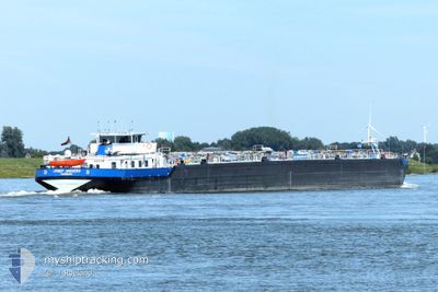
JOSEF JAEGERS
Tanker
Current Trip
| Time Travelled | 11 h, 58 mins |
|---|---|
| Remaining Time | --- |
| Distance Travelled | 73.61 nm |
| Remaining Distance | --- |
| AVG Speed | 10.1 Knots |
| MAX Speed | 11.3 Knots |
| AVG Wind | 6.3 knots |
| MAX Wind | 10.1 knots |
| MIN Temp | 10.5°C / 50.9°F |
| MAX Temp | 14.1°C / 57.38°F |
| Draught | 3 m |
| Position Received | 3 h, 47 m ago |
Current Position
| Longitude | 7.98949° |
|---|---|
| Latitude | 49.98584° |
| Status | Under way using engine |
| Speed | 10.9 Knots |
| Course | 244.7° |
| Area | North Sea |
| Station | T-AIS |
| Position Received | 3 h, 47 m ago |
Info
Information
The current position of JOSEF JAEGERS is in North Sea with coordinates 49.98584° / 7.98949° as reported on 2024-05-18 10:11 by AIS to our vessel tracker app. The vessel's current speed is 10.9 Knots and is heading at the port of ROTTERDAM. The estimated time of arrival as calculated by vessel tracking app is 2024-05-19 20:00 LT
The vessel JOSEF JAEGERS (MMSI: 211500430) is a Tanker It's sailing under the flag of [DE] Germany.
In this page you can find informations about the vessels current position, last detected port calls, and current voyage information. If the vessels is not in coverage by AIS you will find the latest position.
The current position of JOSEF JAEGERS is detected by our AIS receivers and we are not responsible for the reliability of the data. The last position was recorded while the vessel was in Coverage by the Ais receivers of our vessel tracking app.
The current draught of JOSEF JAEGERS as reported by AIS is 3 meters
Weather
| Temperature | 13.3°C / 55.94°F |
|---|---|
| Wind Speed | 4 knots |
| Direction | 240° WSW |
| Pressure | 1011 hPa |
| Humidity | 92.1 % |
| Cloud Coverage | 100 % |
Featured Company
Last Port Calls
| Port | Arrival | Departure | Time In Port |
|---|---|---|---|
| 2024-05-14 13:25 | 2024-05-18 02:00 | 3 d | |
| 2024-05-11 23:19 | 2024-05-12 00:34 | 1 h | |
| 2024-05-11 01:13 | 2024-05-11 11:03 | 9 h | |
| 2024-05-11 00:08 | 2024-05-11 00:25 | 17 m | |
| 2024-05-10 09:41 | 2024-05-10 23:45 | 14 h | |
| 2024-05-09 04:09 | |||
| 2024-05-04 11:38 | 2024-05-04 12:34 | 56 m | |
| 2024-05-04 00:42 | 2024-05-04 02:17 | 1 h | |
| 2024-05-03 02:10 | 2024-05-03 12:13 | 10 h | |
| 2024-05-02 08:30 | 2024-05-03 01:37 | 17 h |
Most Visited Ports (Last year)
| Port | Arrivals | |
|---|---|---|
| 42 | ||
| 31 | ||
| 27 | ||
| 23 | ||
| 20 | ||
| 19 |
Last Trips
| Origin | Departure | Destination | Arrival | Distance | |
|---|---|---|---|---|---|
| 2024-05-12 02:34 | 2024-05-14 15:25 | 239.60 nm | |||
| 2024-05-11 13:03 | 2024-05-12 01:19 | 75.60 nm | |||
| 2024-05-11 02:25 | 2024-05-11 03:13 | 7.05 nm | |||
| 2024-05-11 01:45 | 2024-05-11 02:08 | 4.27 nm | |||
| 2024-05-09 06:09 | 2024-05-10 11:41 | 310.81 nm | |||
| 2024-05-04 04:17 | 2024-05-04 13:38 | 37.74 nm | |||
| 2024-05-03 14:13 | 2024-05-04 02:42 | 74.91 nm | |||
| 2024-05-03 03:37 | 2024-05-03 04:10 | 2.24 nm | |||
| 2024-05-02 08:20 | 2024-05-02 10:30 | 16.74 nm | |||
| 2024-04-28 06:10 | 2024-04-28 11:46 | 57.40 nm |
Events
| Time | Event | Details | Position / Dest | Info |
|---|---|---|---|---|
| 2024-05-18 10:11 | OUT of Coverage |
49.98584 / 7.98949
North Sea
EUROPOORT
|
Speed: 10.9 kn Course: 244.7° |
|
| 2024-05-18 08:39 | IN Coverage |
49.96177 / 8.33551
North Sea
EUROPOORT
|
Speed: 10.8 kn Course: 330.8° |
|
| 2024-05-18 07:12 | OUT of Coverage |
49.76712 / 8.45291
North Sea
EUROPOORT
|
Speed: 9.6 kn Course: 251.8° |
|
| 2024-05-18 06:53 | IN Coverage |
49.74577 / 8.45912
North Sea
EUROPOORT
|
Speed: 9.7 kn Course: 40.9° |
|
| 2024-05-18 04:41 | OUT of Coverage |
49.44605 / 8.44684
North Sea
EUROPOORT
|
Speed: 9.9 kn Course: 308.3° |
|
| 2024-05-18 03:53 | IN Coverage |
49.34903 / 8.48404
North Sea
EUROPOORT
|
Speed: 10.1 kn Course: 35.1° |
|
| 2024-05-18 02:48 | OUT of Coverage |
49.21865 / 8.38515
North Sea
EUROPOORT
|
Speed: 10.7 kn Course: 348.4° |
|
| 2024-05-18 02:00 | PORT DEPARTURE |
|
49.08355 / 8.34479
EUROPOORT
|
Speed: 10.6 kn Course: 33° |
| 2024-05-18 01:54 | START Moving |
49.07158 / 8.33981
[DE] KARLSRUHE
|
Speed: 3.3 kn Course: 10.6° |
|
| 2024-05-18 00:51 | Destination Changed | EUROPOORT KARLSRUHE |
49.06996 / 8.33839
[DE] KARLSRUHE
|
Speed: Course: 511° |