
JOSEF JAEGERS
Other Type
Current Trip
| Time Travelled | 2 days |
|---|---|
| Remaining Time | 6 h, 51 mins |
| Distance Travelled | 195.93 nm |
| Remaining Distance | 47.83 nm |
| AVG Speed | 4.5 Knots |
| MAX Speed | 6.1 Knots |
| AVG Wind | 6.2 knots |
| MAX Wind | 10 knots |
| MIN Temp | 11°C / 51.8°F |
| MAX Temp | 25.9°C / 78.62°F |
| Draught | 3.1 m |
| Position Received | 2 h, 46 m ago |
Current Position
| Longitude | 8.45163° |
|---|---|
| Latitude | 49.73758° |
| Status | Under way using engine |
| Speed | 4.9 Knots |
| Course | 201.2° |
| Area | North Sea |
| Station | T-AIS |
| Position Received | 2 h, 46 m ago |
Info
Information
The current position of JOSEF JAEGERS is in North Sea with coordinates 49.73758° / 8.45163° as reported on 2024-05-14 01:21 by AIS to our vessel tracker app. The vessel's current speed is 4.9 Knots and is heading at the port of KARLSRUHE. The estimated time of arrival as calculated by vessel tracking app is 2024-05-14 10:58 LT
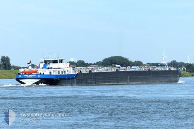
The vessel JOSEF JAEGERS (MMSI: 211500430) is a Other Type It's sailing under the flag of [DE] Germany.
In this page you can find informations about the vessels current position, last detected port calls, and current voyage information. If the vessels is not in coverage by AIS you will find the latest position.
The current position of JOSEF JAEGERS is detected by our AIS receivers and we are not responsible for the reliability of the data. The last position was recorded while the vessel was in Coverage by the Ais receivers of our vessel tracking app.
The current draught of JOSEF JAEGERS as reported by AIS is 3.1 meters
Weather
| Temperature | 14.8°C / 58.64°F |
|---|---|
| Wind Speed | 2 knots |
| Direction | 64° ENE |
| Pressure | 1008 hPa |
| Humidity | 84.3 % |
| Cloud Coverage | --- |
Featured Company
Last Port Calls
| Port | Arrival | Departure | Time In Port |
|---|---|---|---|
| 2024-05-11 23:19 | 2024-05-12 00:34 | 1 h | |
| 2024-05-11 01:13 | 2024-05-11 11:03 | 9 h | |
| 2024-05-11 00:08 | 2024-05-11 00:25 | 17 m | |
| 2024-05-10 09:41 | 2024-05-10 23:45 | 14 h | |
| 2024-05-09 04:09 | |||
| 2024-05-04 11:38 | 2024-05-04 12:34 | 56 m | |
| 2024-05-04 00:42 | 2024-05-04 02:17 | 1 h | |
| 2024-05-03 02:10 | 2024-05-03 12:13 | 10 h | |
| 2024-05-02 08:30 | 2024-05-03 01:37 | 17 h | |
| 2024-04-28 09:46 | 2024-05-02 06:20 | 3 d |
Most Visited Ports (Last year)
| Port | Arrivals | |
|---|---|---|
| 43 | ||
| 31 | ||
| 26 | ||
| 24 | ||
| 20 | ||
| 19 |
Last Trips
| Origin | Departure | Destination | Arrival | Distance | |
|---|---|---|---|---|---|
| 2024-05-11 13:03 | 2024-05-12 01:19 | 75.60 nm | |||
| 2024-05-11 02:25 | 2024-05-11 03:13 | 7.05 nm | |||
| 2024-05-11 01:45 | 2024-05-11 02:08 | 4.27 nm | |||
| 2024-05-09 06:09 | 2024-05-10 11:41 | 310.81 nm | |||
| 2024-05-04 04:17 | 2024-05-04 13:38 | 37.74 nm | |||
| 2024-05-03 14:13 | 2024-05-04 02:42 | 74.91 nm | |||
| 2024-05-03 03:37 | 2024-05-03 04:10 | 2.24 nm | |||
| 2024-05-02 08:20 | 2024-05-02 10:30 | 16.74 nm | |||
| 2024-04-28 06:10 | 2024-04-28 11:46 | 57.40 nm | |||
| 2024-04-27 15:01 | 2024-04-27 19:20 | 35.78 nm |
Events
| Time | Event | Details | Position / Dest | Info |
|---|---|---|---|---|
| 2024-05-14 01:21 | OUT of Coverage |
49.73758 / 8.45163
North Sea
KARLSRUHE
|
Speed: 4.9 kn Course: 201.2° |
|
| 2024-05-14 00:29 | IN Coverage |
49.76636 / 8.42628
North Sea
KARLSRUHE
|
Speed: 5 kn Course: 112.4° |
|
| 2024-05-13 21:57 | Status Changed | Default Under way using engine |
49.95500 / 8.33833
KARLSRUHE
|
Speed: 5 kn Course: 152.4° |
| 2024-05-13 21:50 | OUT of Coverage |
49.96297 / 8.33335
North Sea
KARLSRUHE
|
Speed: 5 kn Course: 152.4° |
|
| 2024-05-13 19:35 | Draught Changed | 3.1 3 |
50.01699 / 8.09459
KARLSRUHE
|
Speed: 5 kn Course: 75.5° |
| 2024-05-13 18:31 | IN Coverage |
49.98718 / 7.99491
North Sea
KARLSRUHE
|
Speed: 4.8 kn Course: 67.1° |
|
| 2024-05-13 05:15 | OUT of Coverage |
50.49905 / 7.31696
North Sea
KARLSRUHE
|
Speed: 4.9 kn Course: 126.8° |
|
| 2024-05-12 07:52 | Status Changed | Under way using engine Default |
51.54353 / 6.67515
KARLSRUHE
|
Speed: 4 kn Course: -1° |
| 2024-05-12 07:52 | IN Coverage |
51.54353 / 6.67515
North Sea
KARLSRUHE
|
Speed: 3.7 kn Course: 186.2° |
|
| 2024-05-12 01:22 | OUT of Coverage |
51.83820 / 6.17164
North Sea
KARLSRUHE
|
Speed: 5.2 kn Course: 119.7° |