
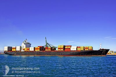
JPO LIBRA
Container Ship
Current Trip
| Time Travelled | 3 days |
|---|---|
| Remaining Time | --- |
| Distance Travelled | 730.69 nm |
| Remaining Distance | --- |
| AVG Speed | 12 Knots |
| MAX Speed | 16.8 Knots |
| AVG Wind | 11.1 knots |
| MAX Wind | 19.8 knots |
| MIN Temp | 13.8°C / 56.84°F |
| MAX Temp | 24.9°C / 76.82°F |
| Draught | 9.4 m |
| Position Received | 54 m ago |
Current Position
| Longitude | -73.64557° |
|---|---|
| Latitude | 40.48132° |
| Status | At anchor |
| Speed | |
| Course | 77° |
| Area | North Atlantic Ocean |
| Station | T-AIS |
| Position Received | 54 m ago |
Info
Information
The current position of JPO LIBRA is in North Atlantic Ocean with coordinates 40.48132° / -73.64557° as reported on 2024-05-09 09:48 by AIS to our vessel tracker app. The vessel's current speed is 0 Knots
The vessel JPO LIBRA (IMO: 9297840, MMSI: 636090862) is a Container Ship that was built in 2005 ( 19 years old ). It's sailing under the flag of [LR] Liberia.
In this page you can find informations about the vessels current position, last detected port calls, and current voyage information. If the vessels is not in coverage by AIS you will find the latest position.
The current position of JPO LIBRA is detected by our AIS receivers and we are not responsible for the reliability of the data. The last position was recorded while the vessel was in Coverage by the Ais receivers of our vessel tracking app.
The current draught of JPO LIBRA as reported by AIS is 9.4 meters
Weather
| Temperature | 16.1°C / 60.98°F |
|---|---|
| Wind Speed | 12 knots |
| Direction | 311° NW |
| Pressure | 1006.6 hPa |
| Humidity | 72.3 % |
| Cloud Coverage | 100 % |
Featured Company
Last Port Calls
| Port | Arrival | Departure | Time In Port |
|---|---|---|---|
| 2024-05-04 14:42 | 2024-05-05 12:54 | 22 h | |
| 2024-04-30 12:22 | 2024-05-01 05:48 | 17 h | |
| 2024-04-27 19:22 | 2024-04-28 09:10 | 13 h | |
| 2024-04-17 01:41 | 2024-04-17 19:59 | 18 h | |
| 2024-04-14 06:18 | 2024-04-16 07:52 | 2 d | |
| 2024-04-11 19:20 | 2024-04-12 21:34 | 1 d | |
| 2024-04-01 06:12 | 2024-04-02 07:02 | 1 d | |
| 2024-03-26 20:06 | 2024-03-28 04:15 | 1 d | |
| 2024-03-24 08:50 | 2024-03-24 23:41 | 14 h | |
| 2024-03-22 05:46 | 2024-03-23 06:48 | 1 d |
Last Trips
| Origin | Departure | Destination | Arrival | Distance | |
|---|---|---|---|---|---|
| 2024-05-01 01:48 | 2024-05-04 10:42 | 515.15 nm | |||
| 2024-04-28 05:10 | 2024-04-30 08:22 | 323.02 nm | |||
| 2024-04-17 21:59 | 2024-04-27 15:22 | 3356.20 nm | |||
| 2024-04-16 09:52 | 2024-04-17 03:41 | 268.54 nm | |||
| 2024-04-12 23:34 | 2024-04-14 08:18 | 351.56 nm | |||
| 2024-04-02 03:02 | 2024-04-11 21:20 | 3691.58 nm | |||
| 2024-03-28 00:15 | 2024-04-01 02:12 | 764.44 nm | |||
| 2024-03-24 19:41 | 2024-03-26 16:06 | 497.10 nm | |||
| 2024-03-23 02:48 | 2024-03-24 04:50 | 204.64 nm | |||
| 2024-03-18 02:54 | 2024-03-22 01:46 | 445.37 nm |
Events
| Time | Event | Details | Position / Dest | Info |
|---|---|---|---|---|
| 2024-05-09 10:00 | Status Changed | Default At anchor |
40.48110 / -73.64572
USNWK
|
Speed: Course: 77° |
| 2024-05-09 09:18 | Status Changed | At anchor Default |
40.48122 / -73.64562
USNWK
|
Speed: Course: -1° |
| 2024-05-09 09:08 | Status Changed | Default At anchor |
40.48000 / -73.64500
USNWK
|
Speed: 0.3 kn Course: 59° |
| 2024-05-09 09:00 | Status Changed | At anchor Default |
40.48074 / -73.64535
USNWK
|
Speed: Course: -1° |
| 2024-05-09 08:53 | Status Changed | Default At anchor |
40.48000 / -73.64500
USNWK
|
Speed: Course: 41° |
| 2024-05-09 08:48 | Status Changed | At anchor Default |
40.48035 / -73.64516
USNWK
|
Speed: Course: -1° |
| 2024-05-09 08:39 | Status Changed | Default At anchor |
40.47987 / -73.64475
USNWK
|
Speed: 0.3 kn Course: 19° |
| 2024-05-09 07:42 | Status Changed | At anchor Under way using engine |
40.47975 / -73.64201
USNWK
|
Speed: 0.3 kn Course: 337° |
| 2024-05-09 07:39 | STOP Moving | 16.28 nm, East of TWIN LIGHTS |
40.47990 / -73.64206
USNWK
|
Speed: 0.3 kn Course: 336° |
| 2024-05-09 06:55 | ETA Changed | 2024/05/10 07:00 2024/05/09 07:00 |
40.42507 / -73.71345
USNWK
|
Speed: 8.8 kn Course: 43.8° |