
JUICE
Pleasure Craft
Current Trip
| Time Travelled | 6 days |
|---|---|
| Remaining Time | 5 h, 7 mins |
| Distance Travelled | 189.58 nm |
| Remaining Distance | 71.40 nm |
| AVG Speed | 12.8 Knots |
| MAX Speed | 14.6 Knots |
| AVG Wind | 7.6 knots |
| MAX Wind | 18.9 knots |
| MIN Temp | 17.6°C / 63.68°F |
| MAX Temp | 22.6°C / 72.68°F |
| Draught | 3.7 m |
| Position Received | Now |
Current Position
| Longitude | 8.86484° |
|---|---|
| Latitude | 44.17182° |
| Status | Under way using engine |
| Speed | 13.6 Knots |
| Course | 238.2° |
| Area | Ligurian Sea |
| Station | T-AIS |
| Position Received | Now |
Info
Information
The current position of JUICE is in Ligurian Sea with coordinates 44.17182° / 8.86484° as reported on 2024-06-27 23:55 by AIS to our vessel tracker app. The vessel's current speed is 13.6 Knots and is heading at the port of MONACO. The estimated time of arrival as calculated by vessel tracking app is 2024-06-28 05:02 LT
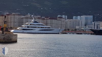
The vessel JUICE (IMO: 9868857, MMSI: 319218500) is a Pleasure Craft It's sailing under the flag of [KY] Cayman Is.
In this page you can find informations about the vessels current position, last detected port calls, and current voyage information. If the vessels is not in coverage by AIS you will find the latest position.
The current position of JUICE is detected by our AIS receivers and we are not responsible for the reliability of the data. The last position was recorded while the vessel was in Coverage by the Ais receivers of our vessel tracking app.
The current draught of JUICE as reported by AIS is 3.7 meters
Weather
| Temperature | 21°C / 69.8°F |
|---|---|
| Wind Speed | 9 knots |
| Direction | 69° ENE |
| Pressure | 1014.6 hPa |
| Humidity | 84.3 % |
| Cloud Coverage | 6 % |
Featured Company
Last Port Calls
Most Visited Ports (Last year)
| Port | Arrivals | |
|---|---|---|
| 4 | ||
| 3 | ||
| 2 | ||
| 2 | ||
| 2 | ||
| 1 |
Events
| Time | Event | Details | Position / Dest | Info |
|---|---|---|---|---|
| 2024-06-27 22:29 | START Moving | 4.74 nm, South East of RECCO |
44.30631 / 9.22193
MC MON
|
Speed: 5.5 kn Course: 130.7° |
| 2024-06-27 22:29 | Destination Changed | MC MON IT PTF |
44.30663 / 9.22141
MC MON
|
Speed: 5 kn Course: 131° |
| 2024-06-27 22:29 | ETA Changed | 2024/06/28 07:30 2024/06/22 15:30 |
44.30663 / 9.22141
MC MON
|
Speed: 5 kn Course: 131° |
| 2024-06-27 22:22 | Status Changed | Under way using engine At anchor |
44.30814 / 9.21959
IT PTF
|
Speed: Course: 345° |
| 2024-06-25 19:22 | IN Coverage |
44.30753 / 9.22006
Ligurian Sea
|
Speed: Course: 66.7° |
|
| 2024-06-25 18:01 | OUT of Coverage |
44.30732 / 9.21967
Ligurian Sea
|
Speed: Course: 254.6° |
|
| 2024-06-24 13:10 | IN Coverage |
44.30722 / 9.21989
Ligurian Sea
|
Speed: 0.4 kn Course: 101.8° |
|
| 2024-06-24 11:16 | OUT of Coverage |
44.30749 / 9.22035
Ligurian Sea
|
Speed: Course: 209.7° |
|
| 2024-06-24 10:58 | IN Coverage |
44.30753 / 9.22041
Ligurian Sea
|
Speed: Course: 63.5° |
|
| 2024-06-24 09:31 | OUT of Coverage |
44.30737 / 9.22013
Ligurian Sea
|
Speed: 0.1 kn Course: 57.4° |