
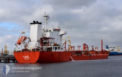
K INSET
Oil/Chemical Tanker
Current Trip
| Time Travelled | 23 h, 50 mins |
|---|---|
| Remaining Time | --- |
| Distance Travelled | 291.68 nm |
| Remaining Distance | --- |
| AVG Speed | 11.8 Knots |
| MAX Speed | 13.4 Knots |
| AVG Wind | 13.8 knots |
| MAX Wind | 24.3 knots |
| MIN Temp | 20.5°C / 68.9°F |
| MAX Temp | 25.5°C / 77.9°F |
| Draught | 5.4 m |
| Position Received | 6 h, 42 m ago |
Current Position
| Longitude | 7.08155° |
|---|---|
| Latitude | 40.29396° |
| Status | Under way using engine |
| Speed | 11.5 Knots |
| Course | 146° |
| Area | Mediterranean Sea - Western Basin |
| Station | T-AIS |
| Position Received | 6 h, 42 m ago |
Info
Information
The current position of K INSET is in Mediterranean Sea - Western Basin with coordinates 40.29396° / 7.08155° as reported on 2024-06-20 05:19 by AIS to our vessel tracker app. The vessel's current speed is 11.5 Knots and is heading at the port of AUGUSTA. The estimated time of arrival as calculated by vessel tracking app is 2024-06-23 05:00 LT
The vessel K INSET (IMO: 9311634, MMSI: 636022086) is a Oil/Chemical Tanker that was built in 2005 ( 19 years old ). It's sailing under the flag of [LR] Liberia.
In this page you can find informations about the vessels current position, last detected port calls, and current voyage information. If the vessels is not in coverage by AIS you will find the latest position.
The current position of K INSET is detected by our AIS receivers and we are not responsible for the reliability of the data. The last position was recorded while the vessel was in Coverage by the Ais receivers of our vessel tracking app.
The current draught of K INSET as reported by AIS is 5.4 meters
Weather
| Temperature | 22.2°C / 71.96°F |
|---|---|
| Wind Speed | 13 knots |
| Direction | 167° SSE |
| Pressure | 1015.7 hPa |
| Humidity | 87.7 % |
| Cloud Coverage | 28 % |
Featured Company
Last Port Calls
| Port | Arrival | Departure | Time In Port |
|---|---|---|---|
| 2024-06-17 19:04 | 2024-06-19 12:11 | 1 d | |
| 2024-06-16 12:13 | 2024-06-16 21:52 | 9 h | |
| 2024-06-13 16:07 | 2024-06-13 21:39 | 5 h | |
| 2024-06-04 13:41 | 2024-06-08 15:08 | 4 d | |
| 2024-05-30 22:37 | 2024-06-01 23:44 | 2 d | |
| 2024-05-27 02:21 | 2024-05-27 11:08 | 8 h | |
| 2024-05-23 22:30 | 2024-05-25 23:00 | 2 d | |
| 2024-05-11 08:07 | 2024-05-13 11:23 | 2 d | |
| 2024-05-09 00:09 | |||
| 2024-04-30 15:05 | 2024-05-02 17:33 | 2 d |
Last Trips
| Origin | Departure | Destination | Arrival | Distance | |
|---|---|---|---|---|---|
| 2024-06-16 23:52 | 2024-06-17 21:04 | 7.63 nm | |||
| 2024-06-13 23:39 | 2024-06-16 14:13 | 700.36 nm | |||
| 2024-06-08 17:08 | 2024-06-13 18:07 | 1446.81 nm | |||
| 2024-06-02 01:44 | 2024-06-04 15:41 | 789.17 nm | |||
| 2024-05-27 13:08 | 2024-05-31 00:37 | 928.79 nm | |||
| 2024-05-26 01:00 | 2024-05-27 04:21 | 286.07 nm | |||
| 2024-05-13 14:23 | 2024-05-24 00:30 | 1852.20 nm | |||
| 2024-05-02 18:33 | 2024-05-09 03:09 | 1578.76 nm | |||
| 2024-04-24 13:34 | 2024-04-30 16:05 | 1248.63 nm | |||
| 2024-04-13 04:12 | 2024-04-18 06:54 | 1126.94 nm |
Events
| Time | Event | Details | Position / Dest | Info |
|---|---|---|---|---|
| 2024-06-20 05:19 | OUT of Coverage |
40.29396 / 7.08155
Mediterranean Sea - Western Basin
FRLAV>IITAUG
|
Speed: 11.5 kn Course: 146° |
|
| 2024-06-20 04:37 | Detected in Sea | Italian part of the Mediterranean Sea - Western Basin |
40.41072 / 6.99415
Mediterranean Sea - Western Basin
FRLAV>IITAUG
|
Speed: 12.1 kn Course: 150° |
| 2024-06-20 04:37 | Status Changed | Under way using engine Default |
40.41072 / 6.99415
FRLAV>IITAUG
|
Speed: 12.1 kn Course: 151° |
| 2024-06-20 04:37 | IN Coverage |
40.41072 / 6.99415
Mediterranean Sea - Western Basin
FRLAV>IITAUG
|
Speed: 12.1 kn Course: 150° |
|
| 2024-06-19 19:21 | Status Changed | Default Under way using engine |
42.12447 / 5.78438
FRLAV>IITAUG
|
Speed: 12.7 kn Course: 150° |
| 2024-06-19 19:18 | Status Changed | Under way using engine Default |
42.13177 / 5.77903
FRLAV>IITAUG
|
Speed: 12.7 kn Course: 151° |
| 2024-06-19 19:18 | OUT of Coverage |
42.13177 / 5.77903
Mediterranean Sea - Western Basin
FRLAV>IITAUG
|
Speed: 12.7 kn Course: 150° |
|
| 2024-06-19 19:00 | IN Coverage |
42.13177 / 5.77903
Mediterranean Sea - Western Basin
FRLAV>IITAUG
|
Speed: 12.7 kn Course: 150° |
|
| 2024-06-19 15:20 | Status Changed | Default Under way using engine |
42.86485 / 5.25445
FRLAV>IITAUG
|
Speed: 11.7 kn Course: 151° |
| 2024-06-19 15:18 | OUT of Coverage |
42.86957 / 5.25082
Mediterranean Sea - Western Basin
FRLAV>IITAUG
|
Speed: 11.7 kn Course: 151° |