
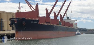
KAIFONG
Cargo
Current Trip
| Time Travelled | 12 days |
|---|---|
| Remaining Time | 2 days |
| Distance Travelled | 3246.44 nm |
| Remaining Distance | 850.03 nm |
| AVG Speed | 9.7 Knots |
| MAX Speed | 13.2 Knots |
| AVG Wind | 18.5 knots |
| MAX Wind | 34.3 knots |
| MIN Temp | 7.9°C / 46.22°F |
| MAX Temp | 28.3°C / 82.94°F |
| Draught | 10.3 m |
| Position Received | 7 d ago |
Current Position
| Longitude | 116.87344° |
|---|---|
| Latitude | -35.46041° |
| Status | Under way using engine |
| Speed | 5.2 Knots |
| Course | 260.3° |
| Area | Indian Ocean |
| Station | T-AIS |
| Position Received | 7 d ago |
Info
Information
The current position of KAIFONG is in Indian Ocean with coordinates -35.46041° / 116.87344° as reported on 2024-05-29 07:57 by AIS to our vessel tracker app. The vessel's current speed is 5.2 Knots and is heading at the port of SINGAPORE. The estimated time of arrival as calculated by vessel tracking app is 2024-06-07 19:55 LT
The vessel KAIFONG (IMO: 9860269, MMSI: 563115200) is a Cargo It's sailing under the flag of [SG] Singapore.
In this page you can find informations about the vessels current position, last detected port calls, and current voyage information. If the vessels is not in coverage by AIS you will find the latest position.
The current position of KAIFONG is detected by our AIS receivers and we are not responsible for the reliability of the data. The last position was recorded while the vessel was in Coverage by the Ais receivers of our vessel tracking app.
The current draught of KAIFONG as reported by AIS is 10.3 meters
Weather
| Temperature | 28.3°C / 82.94°F |
|---|---|
| Wind Speed | 15 knots |
| Direction | 122° ESE |
| Pressure | 1010.8 hPa |
| Humidity | 73.2 % |
| Cloud Coverage | 48 % |
Featured Company
Last Port Calls
| Port | Arrival | Departure | Time In Port |
|---|---|---|---|
| 2024-05-18 10:04 | 2024-05-23 13:26 | 5 d | |
| 2024-04-30 22:19 | 2024-05-14 21:19 | 13 d | |
| 2024-04-11 00:42 | 2024-04-14 07:42 | 3 d | |
| 2024-04-04 00:22 | 2024-04-07 22:05 | 3 d |
Most Visited Ports (Last year)
| Port | Arrivals | |
|---|---|---|
| 2 | ||
| 2 | ||
| 1 | ||
| 1 | ||
| 1 | ||
| 1 |
Last Trips
| Origin | Departure | Destination | Arrival | Distance | |
|---|---|---|---|---|---|
| 2024-05-15 07:19 | 2024-05-18 20:04 | 673.93 nm | |||
| 2024-04-14 16:42 | 2024-05-01 08:19 | 4474.39 nm | |||
| 2024-04-08 07:05 | 2024-04-11 09:42 | 7.75 nm | |||
| 2024-03-13 06:53 | 2024-04-04 09:22 | 2576.11 nm |
Events
| Time | Event | Details | Position / Dest | Info |
|---|---|---|---|---|
| 2024-05-29 08:05 | Status Changed | Default Under way using engine |
-35.46203 / 116.86073
SGSIN
|
Speed: 5.2 kn Course: 260.3° |
| 2024-05-29 07:57 | Status Changed | Under way using engine Default |
-35.46041 / 116.87344
SGSIN
|
Speed: 5.9 kn Course: 271° |
| 2024-05-29 07:57 | OUT of Coverage |
-35.46041 / 116.87344
Indian Ocean
SGSIN
|
Speed: 5.2 kn Course: 260.3° |
|
| 2024-05-29 07:21 | Status Changed | Default Under way using engine |
-35.45823 / 116.93722
SGSIN
|
Speed: 5.4 kn Course: 263.8° |
| 2024-05-29 07:14 | Status Changed | Under way using engine Default |
-35.45792 / 116.94948
SGSIN
|
Speed: 5.3 kn Course: 278° |
| 2024-05-29 07:13 | Status Changed | Default Under way using engine |
-35.45787 / 116.95222
SGSIN
|
Speed: 5.4 kn Course: 264.5° |
| 2024-05-29 07:03 | Status Changed | Under way using engine Default |
-35.45776 / 116.97079
SGSIN
|
Speed: 5.8 kn Course: 268° |
| 2024-05-29 07:00 | Status Changed | Default Under way using engine |
-35.45776 / 116.97505
SGSIN
|
Speed: 5.2 kn Course: 263.1° |
| 2024-05-29 06:54 | Status Changed | Under way using engine Default |
-35.45716 / 116.98640
SGSIN
|
Speed: 5.1 kn Course: 270° |
| 2024-05-29 06:52 | Status Changed | Default Under way using engine |
-35.45699 / 116.98994
SGSIN
|
Speed: 4.8 kn Course: 266° |