
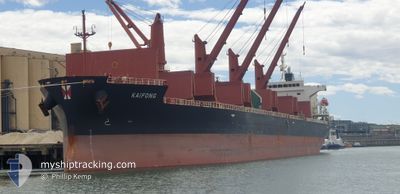
KAIFONG
Cargo
Current Trip
| Trip Time | 21 days |
|---|---|
| Trip Distance | 5331.86 nm |
| AVG Speed | 9.6 Knots |
| MAX Speed | 15.5 Knots |
| Draught | 10.5 m |
| AVG Wind | 14.7 knots |
| MAX Wind | 34.3 knots |
| MIN Temp | 7.9°C / 46.22°F |
| MAX Temp | 30.6°C / 87.08°F |
| Position Received | 7 d ago |
Current Position
| Longitude | 104.33524° |
|---|---|
| Latitude | 1.29464° |
| Status | Under way using engine |
| Speed | 14.3 Knots |
| Course | 56.5° |
| Area | Singapore Strait |
| Station | T-AIS |
| Position Received | 7 d ago |
Info
Information
The current position of KAIFONG is in Singapore Strait with coordinates 1.29464° / 104.33524° as reported on 2024-06-08 19:04 by AIS to our vessel tracker app. The vessel's current speed is 14.3 Knots and is currently inside the port of NAGA.
The vessel KAIFONG (IMO: 9860269, MMSI: 563115200) is a Cargo It's sailing under the flag of [SG] Singapore.
In this page you can find informations about the vessels current position, last detected port calls, and current voyage information. If the vessels is not in coverage by AIS you will find the latest position.
The current position of KAIFONG is detected by our AIS receivers and we are not responsible for the reliability of the data. The last position was recorded while the vessel was in Coverage by the Ais receivers of our vessel tracking app.
The current draught of KAIFONG as reported by AIS is 10.5 meters
Weather
| Temperature | 31°C / 87.8°F |
|---|---|
| Wind Speed | 4 knots |
| Direction | 158° SSE |
| Pressure | 1009.8 hPa |
| Humidity | 61.7 % |
| Cloud Coverage | 96 % |
Featured Company
Most Visited Ports (Last year)
| Port | Arrivals | |
|---|---|---|
| 2 | ||
| 2 | ||
| 1 | ||
| 1 | ||
| 1 | ||
| 1 |
Last Trips
| Origin | Departure | Destination | Arrival | Distance | |
|---|---|---|---|---|---|
| 2024-05-23 23:26 | 2024-06-14 16:43 | 5331.86 nm | |||
| 2024-05-15 07:19 | 2024-05-18 20:04 | 673.93 nm | |||
| 2024-04-14 16:42 | 2024-05-01 08:19 | 4474.39 nm | |||
| 2024-04-08 07:05 | 2024-04-11 09:42 | 7.75 nm | |||
| 2024-03-13 06:53 | 2024-04-04 09:22 | 2576.11 nm |
Events
| Time | Event | Details | Position / Dest | Info |
|---|---|---|---|---|
| 2024-06-14 08:43 | PORT ARRIVAL |
|
10.20106 / 123.76195
[PH] NAGA
|
Speed: 1 kn Course: 317° |
| 2024-06-13 08:10 | STOP Moving | 0.88 nm, South of NAGA |
10.19048 / 123.76801
PHNGA
|
Speed: Course: 192° |
| 2024-06-08 19:09 | Status Changed | Default Under way using engine |
1.30874 / 104.35250
PHNGA
|
Speed: 14.3 kn Course: 56.5° |
| 2024-06-08 19:04 | Status Changed | Under way using engine Default |
1.29464 / 104.33524
PHNGA
|
Speed: 14.1 kn Course: 78° |
| 2024-06-08 19:04 | OUT of Coverage |
1.29464 / 104.33524
Singapore Strait
PHNGA
|
Speed: 14.3 kn Course: 56.5° |
|
| 2024-06-08 18:57 | Status Changed | Default Under way using engine |
1.28801 / 104.31095
PHNGA
|
Speed: 13.6 kn Course: 80.7° |
| 2024-06-08 18:09 | Change Sea Area | Malaysian part of the Singapore Strait Indonesian part of the Singapore Strait |
1.26307 / 104.13904
Singapore Strait
PHNGA
|
Speed: 12.4 kn Course: 83.6° |
| 2024-06-08 17:25 | Change Sea Area | Indonesian part of the Singapore Strait Singaporean part of the Singapore Strait |
1.26543 / 104.02765
Singapore Strait
PHNGA
|
Speed: 5.5 kn Course: 169° |
| 2024-06-08 17:05 | START Moving | 1.34 nm, South of TANAH MERAH |
1.29028 / 104.01371
PHNGA
|
Speed: 3.1 kn Course: 139° |
| 2024-06-08 16:56 | Status Changed | Under way using engine At anchor |
1.29282 / 104.01470
PHNGA
|
Speed: 0.2 kn Course: 283° |