
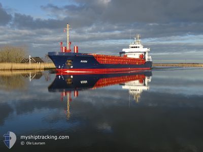
KAISA
General Cargo
Current Trip
EEROO
| Time Travelled | 13 h, 44 mins |
|---|---|
| Remaining Time | --- |
| Distance Travelled | 136.67 nm |
| Remaining Distance | --- |
| AVG Speed | 10.5 Knots |
| MAX Speed | 11.6 Knots |
| AVG Wind | 5.5 knots |
| MAX Wind | 9 knots |
| MIN Temp | 13.1°C / 55.58°F |
| MAX Temp | 24.2°C / 75.56°F |
| Draught | 3.7 m |
| Position Received | Now |
Current Position
| Longitude | 21.48131° |
|---|---|
| Latitude | 58.51957° |
| Status | Under way using engine |
| Speed | 10.4 Knots |
| Course | 16.4° |
| Area | Baltic Sea |
| Station | T-AIS |
| Position Received | Now |
Info
Information
The current position of KAISA is in Baltic Sea with coordinates 58.51957° / 21.48131° as reported on 2024-05-28 22:48 by AIS to our vessel tracker app. The vessel's current speed is 10.4 Knots
The vessel KAISA (IMO: 9333462, MMSI: 249399000) is a General Cargo that was built in 2005 ( 19 years old ). It's sailing under the flag of [MT] Malta.
In this page you can find informations about the vessels current position, last detected port calls, and current voyage information. If the vessels is not in coverage by AIS you will find the latest position.
The current position of KAISA is detected by our AIS receivers and we are not responsible for the reliability of the data. The last position was recorded while the vessel was in Coverage by the Ais receivers of our vessel tracking app.
The current draught of KAISA as reported by AIS is 3.7 meters
Weather
| Temperature | 13.6°C / 56.48°F |
|---|---|
| Wind Speed | 9 knots |
| Direction | 128° SE |
| Pressure | 1015.9 hPa |
| Humidity | 76.7 % |
| Cloud Coverage | 29 % |
Featured Company
Last Port Calls
| Port | Arrival | Departure | Time In Port |
|---|---|---|---|
| 2024-05-27 09:21 | 2024-05-28 09:05 | 23 h | |
| 2024-05-26 14:25 | 2024-05-27 05:11 | 14 h | |
| 2024-05-26 08:28 | |||
| 2024-05-22 02:47 | 2024-05-24 18:23 | 2 d | |
| 2024-05-21 23:43 | 2024-05-22 02:41 | 2 h | |
| 2024-05-21 23:31 | 2024-05-21 23:41 | 10 m | |
| 2024-05-21 17:01 | 2024-05-21 23:22 | 6 h | |
| 2024-05-15 07:42 | 2024-05-17 15:33 | 2 d | |
| 2024-05-13 14:31 | 2024-05-14 16:38 | 1 d | |
| 2024-05-09 08:16 | 2024-05-10 18:00 | 1 d |
Most Visited Ports (Last year)
| Port | Arrivals | |
|---|---|---|
| 5 | ||
| 5 | ||
| 4 | ||
| 4 | ||
| 3 | ||
| 3 |
Last Trips
| Origin | Departure | Destination | Arrival | Distance | |
|---|---|---|---|---|---|
| 2024-05-27 08:11 | 2024-05-27 12:21 | 38.92 nm | |||
| 2024-05-26 11:28 | 2024-05-26 17:25 | 57.75 nm | |||
| 2024-05-22 05:41 | 2024-05-22 05:47 | 1.20 nm | |||
| 2024-05-22 02:41 | 2024-05-22 02:43 | 1.22 nm | |||
| 2024-05-22 02:22 | 2024-05-22 02:31 | 1.88 nm | |||
| 2024-05-17 17:33 | 2024-05-21 20:01 | 846.33 nm | |||
| 2024-05-14 18:38 | 2024-05-15 09:42 | 141.31 nm | |||
| 2024-05-10 21:00 | 2024-05-13 16:31 | 644.57 nm | |||
| 2024-04-30 17:10 | 2024-05-09 11:16 | 1482.73 nm | |||
| 2024-04-27 12:08 | 2024-04-29 05:50 | 476.70 nm |
Events
| Time | Event | Details | Position / Dest | Info |
|---|---|---|---|---|
| 2024-05-28 22:23 | Change Sea Area | Estonian part of the Baltic Sea Latvian part of the Gulf of Riga |
58.44788 / 21.44253
Baltic Sea
|
Speed: 10.6 kn Course: 14.5° |
| 2024-05-28 22:21 | Status Changed | Under way using engine Default |
58.44221 / 21.43963
EEROO
|
Speed: 10.7 kn Course: 9° |
| 2024-05-28 22:18 | IN Coverage |
58.44788 / 21.44253
Baltic Sea
|
Speed: 10.6 kn Course: 14.5° |
|
| 2024-05-28 09:05 | PORT DEPARTURE |
|
56.99117 / 24.09212
EEROO
|
Speed: 4.1 kn Course: 308° |
| 2024-05-28 09:02 | START Moving |
56.98582 / 24.09664
[LV] RIGA
|
Speed: 4.1 kn Course: 308° |
|
| 2024-05-27 09:21 | STOP Moving |
56.98280 / 24.09880
[LV] RIGA
|
Speed: 0.2 kn Course: 188° |
|
| 2024-05-27 09:21 | PORT ARRIVAL |
|
56.98280 / 24.09880
[LV] RIGA
|
Speed: 0.8 kn Course: 182° |
| 2024-05-27 05:20 | START Moving | 0.73 nm, East of MERSRAGS |
57.33534 / 23.15855
EEROO
|
Speed: 4.8 kn Course: 88° |
| 2024-05-27 05:11 | PORT DEPARTURE |
|
57.33534 / 23.15855
EEROO
|
Speed: 0.2 kn Course: 157° |
| 2024-05-26 14:44 | STOP Moving |
57.33419 / 23.13567
[LV] MERSRAGS
|
Speed: Course: 151° |