
KALEY
Cargo
Current Trip
| Time Travelled | 12 days |
|---|---|
| Remaining Time | --- |
| Distance Travelled | 3093.19 nm |
| Remaining Distance | --- |
| AVG Speed | 10.3 Knots |
| MAX Speed | 14.7 Knots |
| AVG Wind | 12 knots |
| MAX Wind | 25.4 knots |
| MIN Temp | 8.2°C / 46.76°F |
| MAX Temp | 20.6°C / 69.08°F |
| Draught | 13.3 m |
| Position Received | 1 m ago |
Current Position
| Longitude | -14.79692° |
|---|---|
| Latitude | 29.19342° |
| Status | Under way using engine |
| Speed | 10.6 Knots |
| Course | 197.6° |
| Area | North Atlantic Ocean |
| Station | T-AIS |
| Position Received | 1 m ago |
Info
Information
The current position of KALEY is in North Atlantic Ocean with coordinates 29.19342° / -14.79692° as reported on 2024-06-01 14:44 by AIS to our vessel tracker app. The vessel's current speed is 10.6 Knots and is heading at the port of TUTICORIN. The estimated time of arrival as calculated by vessel tracking app is 2024-07-05 09:00 LT
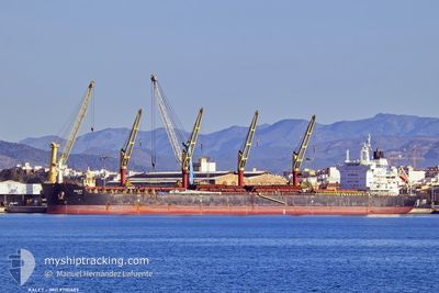
The vessel KALEY (IMO: 9700689, MMSI: 538006289) is a Cargo It's sailing under the flag of [MH] Marshall Is.
In this page you can find informations about the vessels current position, last detected port calls, and current voyage information. If the vessels is not in coverage by AIS you will find the latest position.
The current position of KALEY is detected by our AIS receivers and we are not responsible for the reliability of the data. The last position was recorded while the vessel was in Coverage by the Ais receivers of our vessel tracking app.
The current draught of KALEY as reported by AIS is 13.3 meters
Weather
| Temperature | 20.6°C / 69.08°F |
|---|---|
| Wind Speed | 16 knots |
| Direction | 348° NNW |
| Pressure | 1016 hPa |
| Humidity | 79.6 % |
| Cloud Coverage | 100 % |
Featured Company
Most Visited Ports (Last year)
| Port | Arrivals | |
|---|---|---|
| 2 | ||
| 1 | ||
| 1 | ||
| 1 | ||
| 1 | ||
| 1 |
Last Trips
Events
| Time | Event | Details | Position / Dest | Info |
|---|---|---|---|---|
| 2024-06-01 14:37 | Status Changed | Under way using engine Default |
29.21404 / -14.78956
IN TUT
|
Speed: 10 kn Course: 197° |
| 2024-06-01 14:35 | Status Changed | Default Under way using engine |
29.21833 / -14.78667
IN TUT
|
Speed: 10.5 kn Course: 197° |
| 2024-06-01 14:30 | Status Changed | Under way using engine Default |
29.23380 / -14.78260
IN TUT
|
Speed: 10 kn Course: 196° |
| 2024-06-01 14:26 | Status Changed | Default Under way using engine |
29.24333 / -14.77833
IN TUT
|
Speed: 10.4 kn Course: 197.1° |
| 2024-06-01 14:20 | Status Changed | Under way using engine Default |
29.25987 / -14.77336
IN TUT
|
Speed: 10.4 kn Course: 198° |
| 2024-06-01 14:05 | Status Changed | Default Under way using engine |
29.30167 / -14.75667
IN TUT
|
Speed: 10.3 kn Course: 198.9° |
| 2024-06-01 13:50 | Status Changed | Under way using engine Default |
29.34285 / -14.74175
IN TUT
|
Speed: 10 kn Course: 199° |
| 2024-06-01 13:47 | Status Changed | Default Under way using engine |
29.35167 / -14.73667
IN TUT
|
Speed: 10.3 kn Course: 198.6° |
| 2024-06-01 13:34 | Status Changed | Under way using engine Default |
29.38673 / -14.72451
IN TUT
|
Speed: 10.2 kn Course: 199° |
| 2024-06-01 12:53 | Status Changed | Default Under way using engine |
29.49833 / -14.68167
IN TUT
|
Speed: 10.1 kn Course: 196.4° |