
KALLISTI GS
Bulk Carrier
Current Trip
ALGERIA
| Time Travelled | --- |
|---|---|
| Remaining Time | --- |
| Distance Travelled | --- |
| Remaining Distance | --- |
| AVG Speed | --- |
| MAX Speed | --- |
| AVG Wind | --- |
| MAX Wind | --- |
| MIN Temp | --- |
| MAX Temp | --- |
| Draught | 9.6 m |
| Position Received | 1 h, 28 m ago |
Current Position
| Longitude | 18.37355° |
|---|---|
| Latitude | 36.23585° |
| Status | Under way using engine |
| Speed | 11.3 Knots |
| Course | 265.3° |
| Area | Mediterranean Sea - Eastern Basin |
| Station | T-AIS |
| Position Received | 1 h, 28 m ago |
Info
Information
The current position of KALLISTI GS is in Mediterranean Sea - Eastern Basin with coordinates 36.23585° / 18.37355° as reported on 2024-06-10 16:26 by AIS to our vessel tracker app. The vessel's current speed is 11.3 Knots
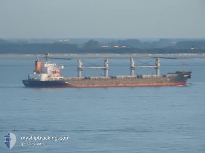
The vessel KALLISTI GS (IMO: 9494814, MMSI: 538008362) is a Bulk Carrier that was built in 2010 ( 14 years old ). It's sailing under the flag of [MH] Marshall Is.
In this page you can find informations about the vessels current position, last detected port calls, and current voyage information. If the vessels is not in coverage by AIS you will find the latest position.
The current position of KALLISTI GS is detected by our AIS receivers and we are not responsible for the reliability of the data. The last position was recorded while the vessel was in Coverage by the Ais receivers of our vessel tracking app.
The current draught of KALLISTI GS as reported by AIS is 9.6 meters
Weather
| Temperature | 24.3°C / 75.74°F |
|---|---|
| Wind Speed | 12 knots |
| Direction | 162° SSE |
| Pressure | 1010.7 hPa |
| Humidity | 73.3 % |
| Cloud Coverage | 11 % |
Featured Company
Most Visited Ports (Last year)
| Port | Arrivals | |
|---|---|---|
| 2 | ||
| 2 | ||
| 2 | ||
| 1 | ||
| 1 | ||
| 1 |
Last Trips
| Origin | Departure | Destination | Arrival | Distance | |
|---|---|---|---|---|---|
| 2024-05-09 14:50 | 2024-05-14 22:58 | 1293.37 nm | |||
| 2024-02-15 22:47 | 2024-04-09 11:59 | 5262.51 nm |
Events
| Time | Event | Details | Position / Dest | Info |
|---|---|---|---|---|
| 2024-06-10 16:33 | Status Changed | Default Under way using engine |
36.23425 / 18.34618
ALGERIA
|
Speed: 11.3 kn Course: 265.3° |
| 2024-06-10 16:26 | OUT of Coverage |
36.23585 / 18.37355
Mediterranean Sea - Eastern Basin
ALGERIA
|
Speed: 11.3 kn Course: 265.3° |
|
| 2024-06-10 16:26 | Status Changed | Under way using engine Default |
36.23595 / 18.37491
ALGERIA
|
Speed: 11.3 kn Course: 266° |
| 2024-06-10 16:21 | Status Changed | Default Under way using engine |
36.23696 / 18.39376
ALGERIA
|
Speed: 11.3 kn Course: 266.6° |
| 2024-06-10 16:00 | Status Changed | Under way using engine Default |
36.24106 / 18.47686
ALGERIA
|
Speed: 11.5 kn Course: 266° |
| 2024-06-10 15:53 | Status Changed | Default Under way using engine |
36.24264 / 18.50391
ALGERIA
|
Speed: 11.6 kn Course: 268° |
| 2024-06-10 15:48 | Status Changed | Under way using engine Default |
36.24366 / 18.52521
ALGERIA
|
Speed: 11.7 kn Course: 267° |
| 2024-06-10 15:41 | Status Changed | Default Under way using engine |
36.24457 / 18.55143
ALGERIA
|
Speed: 11.6 kn Course: 268.2° |
| 2024-06-10 15:24 | Status Changed | Under way using engine Default |
36.24591 / 18.62023
ALGERIA
|
Speed: 11.6 kn Course: 270° |
| 2024-06-10 15:21 | Status Changed | Default Under way using engine |
36.24604 / 18.63155
ALGERIA
|
Speed: 11.6 kn Course: 269.3° |