
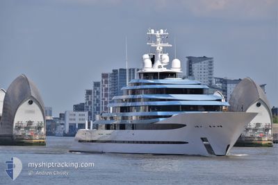
KAOS
Pleasure Craft
Current Trip
| Time Travelled | 3 days |
|---|---|
| Remaining Time | 14 h, 52 mins |
| Distance Travelled | 1432.48 nm |
| Remaining Distance | 270.61 nm |
| AVG Speed | 16.6 Knots |
| MAX Speed | 19.6 Knots |
| AVG Wind | 11.5 knots |
| MAX Wind | 24 knots |
| MIN Temp | 12.4°C / 54.32°F |
| MAX Temp | 21.2°C / 70.16°F |
| Draught | 4.1 m |
| Position Received | 1 m ago |
Current Position
| Longitude | -9.77610° |
|---|---|
| Latitude | 37.46742° |
| Status | Under way using engine |
| Speed | 18.2 Knots |
| Course | 167.1° |
| Area | North Atlantic Ocean |
| Station | T-AIS |
| Position Received | 1 m ago |
Info
Information
The current position of KAOS is in North Atlantic Ocean with coordinates 37.46742° / -9.77610° as reported on 2024-06-04 20:01 by AIS to our vessel tracker app. The vessel's current speed is 18.2 Knots and is heading at the port of GIBRALTAR. The estimated time of arrival as calculated by vessel tracking app is 2024-06-05 10:55 LT
The vessel KAOS (IMO: 1012610, MMSI: 339302000) is a Pleasure Craft It's sailing under the flag of [JM] Jamaica.
In this page you can find informations about the vessels current position, last detected port calls, and current voyage information. If the vessels is not in coverage by AIS you will find the latest position.
The current position of KAOS is detected by our AIS receivers and we are not responsible for the reliability of the data. The last position was recorded while the vessel was in Coverage by the Ais receivers of our vessel tracking app.
The current draught of KAOS as reported by AIS is 4.1 meters
Weather
| Temperature | 18.6°C / 65.48°F |
|---|---|
| Wind Speed | 12 knots |
| Direction | 324° NW |
| Pressure | 1015 hPa |
| Humidity | 89.5 % |
| Cloud Coverage | --- |
Featured Company
Events
| Time | Event | Details | Position / Dest | Info |
|---|---|---|---|---|
| 2024-06-04 16:55 | ETA Changed | 2024/06/05 15:30 2024/06/05 15:34 |
38.36039 / -10.03080
GIBRALTAR
|
Speed: 17.7 kn Course: 167.6° |
| 2024-06-04 05:29 | Change Sea Area | Portuguese part of the North Atlantic Ocean Spanish part of the North Atlantic Ocean |
41.74888 / -10.12131
North Atlantic Ocean
GIBRALTAR
|
Speed: 18.2 kn Course: 181.7° |
| 2024-06-04 02:37 | Change Sea Area | Spanish part of the North Atlantic Ocean French part of the Celtic Sea |
42.59616 / -10.11049
North Atlantic Ocean
GIBRALTAR
|
Speed: 17.3 kn Course: 181.6° |
| 2024-06-04 02:37 | IN Coverage |
42.59616 / -10.11049
North Atlantic Ocean
GIBRALTAR
|
Speed: 17.3 kn Course: 181.6° |
|
| 2024-06-03 08:33 | OUT of Coverage |
47.36772 / -7.01169
Celtic Sea
GIBRALTAR
|
Speed: 18 kn Course: 208.1° |
|
| 2024-06-03 00:55 | ETA Changed | 2024/06/05 15:34 2024/06/05 22:00 |
49.18595 / -5.10435
GIBRALTAR
|
Speed: 16.3 kn Course: 233.8° |
| 2024-06-03 00:44 | Change Sea Area | French part of the Celtic Sea French part of the English Channel |
49.21552 / -5.04030
Celtic Sea
GIBRALTAR
|
Speed: 16.4 kn Course: 235.6° |
| 2024-06-03 00:02 | Change Sea Area | French part of the English Channel United Kingdom part of the English Channel |
49.32294 / -4.79678
English Channel
GIBRALTAR
|
Speed: 16.6 kn Course: 235.5° |
| 2024-06-02 19:37 | Change Sea Area | United Kingdom part of the English Channel Guernsey part of the English Channel |
49.94816 / -3.04449
English Channel
GIBRALTAR
|
Speed: 17.5 kn Course: 256.1° |
| 2024-06-02 17:10 | Detected in Sea | Guernsey part of the English Channel |
50.11603 / -2.04258
English Channel
GIBRALTAR
|
Speed: 14.8 kn Course: 257.6° |