
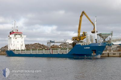
KARION
General Cargo
Current Trip
| Time Travelled | 2 days |
|---|---|
| Remaining Time | --- |
| Distance Travelled | 284.87 nm |
| Remaining Distance | --- |
| AVG Speed | 9 Knots |
| MAX Speed | 9.7 Knots |
| AVG Wind | 6.4 knots |
| MAX Wind | 10.1 knots |
| MIN Temp | 6.2°C / 43.16°F |
| MAX Temp | 11.1°C / 51.98°F |
| Draught | 4.2 m |
| Position Received | 1 d ago |
Current Position
| Longitude | 22.83896° |
|---|---|
| Latitude | 57.72099° |
| Status | Under way using engine |
| Speed | 9.1 Knots |
| Course | 137.5° |
| Area | Gulf of Riga |
| Station | T-AIS |
| Position Received | 1 d ago |
Info
Information
The current position of KARION is in Gulf of Riga with coordinates 57.72099° / 22.83896° as reported on 2024-05-12 08:29 by AIS to our vessel tracker app. The vessel's current speed is 9.1 Knots
The vessel KARION (IMO: 9155884, MMSI: 305476000) is a General Cargo that was built in 1997 ( 27 years old ). It's sailing under the flag of [AG] Antigua Barbuda.
In this page you can find informations about the vessels current position, last detected port calls, and current voyage information. If the vessels is not in coverage by AIS you will find the latest position.
The current position of KARION is detected by our AIS receivers and we are not responsible for the reliability of the data. The last position was recorded while the vessel was in Coverage by the Ais receivers of our vessel tracking app.
The current draught of KARION as reported by AIS is 4.2 meters
Weather
| Temperature | 11.5°C / 52.7°F |
|---|---|
| Wind Speed | 3 knots |
| Direction | 1° N |
| Pressure | 1021.5 hPa |
| Humidity | 60.9 % |
| Cloud Coverage | 92 % |
Featured Company
Last Port Calls
| Port | Arrival | Departure | Time In Port |
|---|---|---|---|
| 2024-05-10 08:30 | 2024-05-11 07:25 | 22 h | |
| 2024-05-05 11:11 | 2024-05-06 17:39 | 1 d | |
| 2024-05-02 05:05 | 2024-05-03 21:06 | 1 d | |
| 2024-04-30 03:59 | 2024-04-30 20:48 | 16 h | |
| 2024-04-26 20:22 | 2024-04-27 23:55 | 1 d | |
| 2024-04-25 11:59 | 2024-04-25 21:51 | 9 h | |
| 2024-04-21 08:48 | 2024-04-23 17:12 | 2 d | |
| 2024-04-19 05:28 | 2024-04-19 15:10 | 9 h | |
| 2024-04-17 17:13 | 2024-04-18 10:18 | 17 h | |
| 2024-04-16 11:55 | 2024-04-16 21:39 | 9 h |
Last Trips
| Origin | Departure | Destination | Arrival | Distance | |
|---|---|---|---|---|---|
| 2024-05-06 19:39 | 2024-05-10 10:30 | 620.54 nm | |||
| 2024-05-04 00:06 | 2024-05-05 13:11 | 363.10 nm | |||
| 2024-04-30 22:48 | 2024-05-02 08:05 | 291.82 nm | |||
| 2024-04-28 01:55 | 2024-04-30 05:59 | 239.32 nm | |||
| 2024-04-25 23:51 | 2024-04-26 22:22 | 217.52 nm | |||
| 2024-04-23 20:12 | 2024-04-25 13:59 | 286.13 nm | |||
| 2024-04-19 17:10 | 2024-04-21 11:48 | 284.27 nm | |||
| 2024-04-18 13:18 | 2024-04-19 07:28 | 167.99 nm | |||
| 2024-04-16 23:39 | 2024-04-17 20:13 | 185.15 nm | |||
| 2024-04-13 21:57 | 2024-04-16 13:55 | 287.28 nm |
Events
| Time | Event | Details | Position / Dest | Info |
|---|---|---|---|---|
| 2024-05-12 15:01 | STOP Moving | 6.48 nm, North of RIGA |
57.04906 / 24.02677
LVRIX
|
Speed: 0.1 kn Course: 160° |
| 2024-05-12 08:41 | Status Changed | Default Under way using engine |
57.69832 / 22.87773
LVRIX
|
Speed: 9.1 kn Course: 137.5° |
| 2024-05-12 08:29 | OUT of Coverage |
57.72099 / 22.83896
Gulf of Riga
LVRIX
|
Speed: 9.1 kn Course: 137.5° |
|
| 2024-05-12 08:23 | Status Changed | Under way using engine Default |
57.73313 / 22.81793
LVRIX
|
Speed: 9 kn Course: 137° |
| 2024-05-12 07:56 | Status Changed | Default Under way using engine |
57.78180 / 22.73122
LVRIX
|
Speed: 9.1 kn Course: 135.5° |
| 2024-05-12 07:44 | Change Sea Area | Latvian part of the Gulf of Riga Latvian part of the Baltic Sea |
57.80452 / 22.68962
Gulf of Riga
LVRIX
|
Speed: 9.1 kn Course: 135.5° |
| 2024-05-12 07:44 | Status Changed | Under way using engine Default |
57.80452 / 22.68962
LVRIX
|
Speed: 9.2 kn Course: 122° |
| 2024-05-12 07:32 | IN Coverage |
57.80452 / 22.68962
Gulf of Riga
LVRIX
|
Speed: 9.1 kn Course: 135.5° |
|
| 2024-05-11 23:09 | Status Changed | Default Under way using engine |
57.94647 / 20.46871
LVRIX
|
Speed: 8.8 kn Course: 104.4° |
| 2024-05-11 23:01 | OUT of Coverage |
57.95142 / 20.43334
Baltic Sea
LVRIX
|
Speed: 8.8 kn Course: 104.4° |