
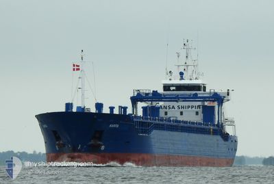
KARITA
General Cargo
Aktuelle Reise
| Bisherige Reisezeit | 20 h, 3 Minuten |
|---|---|
| Verbleibende Reisezeit | 2 Tage |
| Zurückgelegte Distanz | 162.96 nm |
| Verbleibende Distanz | 503.14 nm |
| Durchschnittliche Geschwindigkeit | 9.1 Knoten |
| Maximale Geschwindigkeit | 13.7 Knoten |
| Durchschnittliche Windgeschwindigkeit | 19.4 Knoten |
| Maximale Windgeschwindigkeit | 25.3 Knoten |
| Minimale Temperatur | 14.4°C / 57.92°F |
| Maximale Temperatur | 18.9°C / 66.02°F |
| Tiefgang | 5.1 m |
| Position erhalten | 2 m alt |
Aktuelle Position
| Länge | 23.60720° |
|---|---|
| Breite | 59.66685° |
| Zustand | Under way using engine |
| Geschwindigkeit | 8 Knoten |
| Kurs | 254° |
| Gebiet | Gulf of Finland |
| Station | T-AIS |
| Position erhalten | 2 m alt |
Schiffsdetails
Information
Die KARITA befindet sich derzeit in Gulf of Finland mit den Koordinaten 59.66685° / 23.60720°, Diese Position wurde am 2024-09-26 04:51 von unserer Schiffsverfolgungs-App über AIS erfasst. Das Schiff fährt momentan mit einer Geschwindigkeit von 8 Knoten und fahrt in den Hafen von SZCZECIN. Die geschatzte Ankunftszeit, berechnet von der -App zur Schiffsverfolgung, ist 2024-09-28 22:51 LT
Das Schiff KARITA (IMO: 9436783, MMSI: 229137000) ist General Cargo das wurde im Jahr 2013 ( 11 Jahre alt ) gebaut. und fährt unter der Flagge von [MT] Malta.
Auf dieser Seite erhalten Sie Informationen zur aktuellen Position des Schiffes, zu den letzten bekannten Hafenanläufen und zu den aktuellen Reiseinformationen. Sollte das Schiff nicht durch AIS abgedeckt sein, wird die zuletzt erfasste Position angezeigt.
Die KARITA wird durch unsere AIS-Empfänger ermittelt. Wir übernehmen keine Gewähr für die Richtigkeit der Daten. Die letzte Position wurde von unseren AIS-Empfängern aufgezeichnet, während das Schiff in Reichweite war.
Der aktuelle Entwurf von KARITA, wie von AIS gemeldet, betragt 5.1 meter
Wetter
| Temperatur | 14.8°C / 58.64°F |
|---|---|
| Windgeschwindigkeit | 23 Knoten |
| Windrichtung | 197° SSW |
| Luftdruck | 1001 hPa |
| Luftfeuchtigkeit | 86.2 % |
| Wolken | 100 % |
Featured Company
Letzte Hafenanläufe
| Hafen | Ankunft | Abfahrt | Time In Port |
|---|---|---|---|
| 2024-09-24 10:44 | 2024-09-25 08:51 | 22 h | |
| 2024-09-17 13:09 | 2024-09-19 19:17 | 2 d | |
| 2024-09-11 13:41 | 2024-09-13 18:51 | 2 d | |
| 2024-08-31 15:09 | 2024-09-06 15:05 | 5 d | |
| 2024-08-23 07:14 | 2024-08-26 19:18 | 3 d | |
| 2024-08-15 02:53 | 2024-08-17 19:03 | 2 d | |
| 2024-08-08 05:46 | 2024-08-08 05:49 | 3 m | |
| 2024-08-04 12:11 | 2024-08-07 16:13 | 3 d | |
| 2024-07-30 08:47 | 2024-08-02 15:33 | 3 d | |
| 2024-07-23 03:26 | 2024-07-25 09:11 | 2 d |
Meistbesuchte Häfen (Letztes Jahr)
| Hafen | Ankünfte | |
|---|---|---|
| 29 | ||
| 23 | ||
| 8 | ||
| 3 | ||
| 3 | ||
| 2 |
Letzte Reisen
| Herkunft | Abfahrt | Ziel | Ankunft | Distanz | |
|---|---|---|---|---|---|
| 2024-09-19 21:17 | 2024-09-24 13:44 | 680.69 nm | |||
| 2024-09-13 20:51 | 2024-09-17 15:09 | 866.05 nm | |||
| 2024-09-06 17:05 | 2024-09-11 15:41 | 1164.31 nm | |||
| 2024-08-26 21:18 | 2024-08-31 17:09 | 753.73 nm | |||
| 2024-08-17 22:03 | 2024-08-23 09:14 | 1159.94 nm | |||
| 2024-08-08 07:49 | 2024-08-15 05:53 | 832.29 nm | |||
| 2024-08-07 18:13 | 2024-08-08 07:46 | 88.86 nm | |||
| 2024-08-02 17:33 | 2024-08-04 14:11 | 343.47 nm | |||
| 2024-07-25 12:11 | 2024-07-30 10:47 | 1157.51 nm | |||
| 2024-07-19 15:40 | 2024-07-23 06:26 | 840.90 nm |
Events
| Zeit | Ereignis | Details | Position / Ziel | Information |
|---|---|---|---|---|
| 2024-09-26 03:43 | geänderter Status | Under way using engine Default |
59.70862 / 23.87322
PL SZZ
|
Geschwindigkeit: 7.2 kn Kurs: 258° |
| 2024-09-26 03:39 | geänderter Status | Default Under way using engine |
59.71043 / 23.88725
PL SZZ
|
Geschwindigkeit: 6.9 kn Kurs: 257.3° |
| 2024-09-26 00:46 | geänderter Status | Under way using engine Default |
59.79970 / 24.58217
PL SZZ
|
Geschwindigkeit: 7.9 kn Kurs: 258° |
| 2024-09-26 00:45 | geänderter Status | Default Under way using engine |
59.80010 / 24.58573
PL SZZ
|
Geschwindigkeit: 7.8 kn Kurs: 258.7° |
| 2024-09-26 00:35 | geänderter Status | Under way using engine Default |
59.80515 / 24.63102
PL SZZ
|
Geschwindigkeit: 8.1 kn Kurs: 258° |
| 2024-09-26 00:33 | geänderter Status | Default Under way using engine |
59.80593 / 24.63838
PL SZZ
|
Geschwindigkeit: 7.9 kn Kurs: 257.4° |
| 2024-09-26 00:32 | geänderter Status | Under way using engine Default |
59.80657 / 24.64405
PL SZZ
|
Geschwindigkeit: 8.3 kn Kurs: 259° |
| 2024-09-26 00:29 | geänderter Status | Default Under way using engine |
59.80785 / 24.65580
PL SZZ
|
Geschwindigkeit: 8.1 kn Kurs: 256.6° |
| 2024-09-26 00:23 | geänderter Status | Under way using engine Default |
59.81108 / 24.68340
PL SZZ
|
Geschwindigkeit: 7.8 kn Kurs: 255° |
| 2024-09-26 00:21 | geänderter Status | Default Under way using engine |
59.81177 / 24.68925
PL SZZ
|
Geschwindigkeit: 8 kn Kurs: 258.9° |