
KARL-HEIN
Cargo
Current Trip
| Time Travelled | 23 h, 19 mins |
|---|---|
| Remaining Time | 10 h, 15 mins |
| Distance Travelled | 78.78 nm |
| Remaining Distance | 55.85 nm |
| AVG Speed | 4.6 Knots |
| MAX Speed | 6.2 Knots |
| AVG Wind | 4.3 knots |
| MAX Wind | 10.9 knots |
| MIN Temp | 9.2°C / 48.56°F |
| MAX Temp | 19.8°C / 67.64°F |
| Draught | 3.7 m |
| Position Received | 4 m ago |
Current Position
| Longitude | 8.02820° |
|---|---|
| Latitude | 49.99986° |
| Status | Under way using engine |
| Speed | 5.8 Knots |
| Course | 46.1° |
| Area | North Sea |
| Station | T-AIS |
| Position Received | 4 m ago |
Info
Information
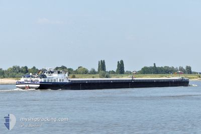
The current position of KARL-HEIN is in North Sea with coordinates 49.99986° / 8.02820° as reported on 2024-06-06 15:35 by AIS to our vessel tracker app. The vessel's current speed is 5.8 Knots and is heading at the port of RHEINAU. The estimated time of arrival as calculated by vessel tracking app is 2024-06-07 01:54 LT
The vessel KARL-HEIN (MMSI: 211267460) is a Cargo It's sailing under the flag of [DE] Germany.
In this page you can find informations about the vessels current position, last detected port calls, and current voyage information. If the vessels is not in coverage by AIS you will find the latest position.
The current position of KARL-HEIN is detected by our AIS receivers and we are not responsible for the reliability of the data. The last position was recorded while the vessel was in Coverage by the Ais receivers of our vessel tracking app.
The current draught of KARL-HEIN as reported by AIS is 3.7 meters
Weather
| Temperature | 19.6°C / 67.28°F |
|---|---|
| Wind Speed | 11 knots |
| Direction | 284° WNW |
| Pressure | 1015.6 hPa |
| Humidity | 55.7 % |
| Cloud Coverage | 77 % |
Featured Company
Last Port Calls
| Port | Arrival | Departure | Time In Port |
|---|---|---|---|
| 2024-06-04 14:47 | 2024-06-05 16:20 | 1 d | |
| 2024-06-03 16:36 | 2024-06-04 05:03 | 12 h | |
| 2024-06-03 07:34 | 2024-06-03 08:03 | 29 m | |
| 2024-06-02 19:59 | 2024-06-03 03:12 | 7 h | |
| 2024-06-02 12:53 | 2024-06-02 14:18 | 1 h | |
| 2024-06-01 16:50 | 2024-06-02 09:49 | 16 h | |
| 2024-05-25 07:38 | 2024-06-01 12:49 | 7 d | |
| 2024-05-18 09:15 | 2024-05-18 10:43 | 1 h | |
| 2024-05-18 02:09 | 2024-05-18 02:15 | 6 m | |
| 2024-05-17 16:26 | 2024-05-17 22:15 | 5 h |
Last Trips
| Origin | Departure | Destination | Arrival | Distance | |
|---|---|---|---|---|---|
| 2024-06-04 07:03 | 2024-06-04 16:47 | 40.51 nm | |||
| 2024-06-03 10:03 | 2024-06-03 18:36 | 37.05 nm | |||
| 2024-06-03 05:12 | 2024-06-03 09:34 | 24.30 nm | |||
| 2024-06-02 16:18 | 2024-06-02 21:59 | 33.69 nm | |||
| 2024-06-02 11:49 | 2024-06-02 14:53 | 26.73 nm | |||
| 2024-06-01 14:49 | 2024-06-01 18:50 | 38.90 nm | |||
| 2024-05-18 12:43 | 2024-05-25 09:38 | 65.71 nm | |||
| 2024-05-18 04:15 | 2024-05-18 11:15 | 42.96 nm | |||
| 2024-05-18 00:15 | 2024-05-18 04:09 | 27.43 nm | |||
| 2024-05-17 03:01 | 2024-05-17 18:26 | 90.89 nm |
Events
| Time | Event | Details | Position / Dest | Info |
|---|---|---|---|---|
| 2024-06-06 14:53 | IN Coverage |
49.97108 / 7.93013
North Sea
|
Speed: 5.9 kn Course: 93.8° |
|
| 2024-06-05 21:48 | OUT of Coverage |
50.68857 / 7.17613
North Sea
MHM RHEINAU
|
Speed: 4.5 kn Course: 160.8° |
|
| 2024-06-05 20:30 | IN Coverage |
50.76346 / 7.08151
North Sea
MHM RHEINAU
|
Speed: 3.3 kn Course: 131.5° |
|
| 2024-06-05 19:05 | OUT of Coverage |
50.82838 / 6.98708
North Sea
MHM RHEINAU
|
Speed: 4.1 kn Course: 127.4° |
|
| 2024-06-05 16:20 | PORT DEPARTURE |
|
50.96391 / 6.99461
MHM RHEINAU
|
Speed: 4.1 kn Course: 198.6° |
| 2024-06-05 15:37 | IN Coverage |
50.98352 / 6.96985
North Sea
[DE] NIEHL
|
Speed: 1.9 kn Course: 339.9° |
|
| 2024-06-05 12:04 | OUT of Coverage |
50.98266 / 6.97006
North Sea
[DE] NIEHL
|
Speed: Course: 170.6° |
|
| 2024-06-05 12:04 | IN Coverage |
50.98266 / 6.97006
North Sea
[DE] NIEHL
|
Speed: Course: 170.6° |
|
| 2024-06-05 09:52 | OUT of Coverage |
50.98265 / 6.97007
North Sea
[DE] NIEHL
|
Speed: Course: 170.6° |
|
| 2024-06-05 09:52 | IN Coverage |
50.98265 / 6.97007
North Sea
[DE] NIEHL
|
Speed: Course: 170.6° |