
KARLICA
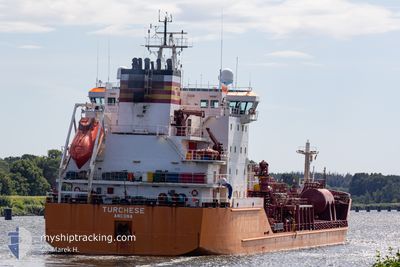
Oil/Chemical Tanker
Current Trip
| Time Travelled | 4 days |
|---|---|
| Remaining Time | --- |
| Distance Travelled | 354.78 nm |
| Remaining Distance | --- |
| AVG Speed | 6.7 Knots |
| MAX Speed | 11.7 Knots |
| AVG Wind | 9.7 knots |
| MAX Wind | 16 knots |
| MIN Temp | 17.8°C / 64.04°F |
| MAX Temp | 27.1°C / 80.78°F |
| Draught | 5.5 m |
| Position Received | 3 d ago |
Current Position
| Longitude | -9.64245° |
|---|---|
| Latitude | 32.78279° |
| Status | Under way using engine |
| Speed | 5.6 Knots |
| Course | 180.3° |
| Area | North Atlantic Ocean |
| Station | T-AIS |
| Position Received | 3 d ago |
Info
Information
The current position of KARLICA is in North Atlantic Ocean with coordinates 32.78279° / -9.64245° as reported on 2024-06-02 22:50 by AIS to our vessel tracker app. The vessel's current speed is 5.6 Knots
The vessel KARLICA (IMO: 9220354, MMSI: 271049308) is a Oil/Chemical Tanker that was built in 2000 ( 24 years old ). It's sailing under the flag of [TR] Turkey.
In this page you can find informations about the vessels current position, last detected port calls, and current voyage information. If the vessels is not in coverage by AIS you will find the latest position.
The current position of KARLICA is detected by our AIS receivers and we are not responsible for the reliability of the data. The last position was recorded while the vessel was in Coverage by the Ais receivers of our vessel tracking app.
The current draught of KARLICA as reported by AIS is 5.5 meters
Weather
| Temperature | 18°C / 64.4°F |
|---|---|
| Wind Speed | 7 knots |
| Direction | 27° NNE |
| Pressure | 1013.5 hPa |
| Humidity | 88.3 % |
| Cloud Coverage | 98 % |
Featured Company
Last Port Calls
| Port | Arrival | Departure | Time In Port |
|---|---|---|---|
| 2024-05-27 14:42 | 2024-06-01 13:04 | 4 d | |
| 2024-05-26 10:17 | 2024-05-26 15:39 | 5 h | |
| 2024-05-15 15:28 | 2024-05-16 20:08 | 1 d | |
| 2024-05-13 12:22 | 2024-05-15 05:16 | 1 d | |
| 2024-05-09 15:11 | 2024-05-10 20:31 | 1 d | |
| 2024-05-08 05:03 | 2024-05-09 13:08 | 1 d | |
| 2024-04-25 12:23 | 2024-04-28 20:25 | 3 d | |
| 2024-04-15 18:06 | 2024-04-18 03:58 | 2 d | |
| 2024-04-12 20:04 | 2024-04-13 21:49 | 1 d | |
| 2024-04-01 13:40 | 2024-04-02 17:32 | 1 d |
Last Trips
| Origin | Departure | Destination | Arrival | Distance | |
|---|---|---|---|---|---|
| 2024-05-26 17:39 | 2024-05-27 15:42 | 201.26 nm | |||
| 2024-05-16 23:08 | 2024-05-26 12:17 | 1974.25 nm | |||
| 2024-05-15 08:16 | 2024-05-15 18:28 | 87.20 nm | |||
| 2024-05-10 23:31 | 2024-05-13 15:22 | 339.28 nm | |||
| 2024-05-09 16:08 | 2024-05-09 18:11 | 13.25 nm | |||
| 2024-04-28 21:25 | 2024-05-08 08:03 | 2124.61 nm | |||
| 2024-04-18 05:58 | 2024-04-25 13:23 | 1473.72 nm | |||
| 2024-04-13 23:49 | 2024-04-15 20:06 | 444.24 nm | |||
| 2024-04-02 17:32 | 2024-04-12 22:04 | 1647.63 nm | |||
| 2024-03-18 20:16 | 2024-04-01 13:40 | 1131.07 nm |
Events
| Time | Event | Details | Position / Dest | Info |
|---|---|---|---|---|
| 2024-06-03 15:32 | STOP Moving | 2.69 nm, West of SAFI |
32.29833 / -9.30166
MASFI
|
Speed: Course: -1° |
| 2024-06-02 22:55 | Status Changed | Default Under way using engine |
32.77500 / -9.64167
MASFI
|
Speed: 5.6 kn Course: 180.3° |
| 2024-06-02 22:50 | Status Changed | Under way using engine Default |
32.78279 / -9.64245
MASFI
|
Speed: 5 kn Course: 185° |
| 2024-06-02 22:50 | OUT of Coverage |
32.78279 / -9.64245
North Atlantic Ocean
MASFI
|
Speed: 5.6 kn Course: 180.3° |
|
| 2024-06-02 22:34 | IN Coverage |
32.78279 / -9.64245
North Atlantic Ocean
MASFI
|
Speed: 5.6 kn Course: 180.3° |
|
| 2024-06-02 05:26 | Status Changed | Default Under way using engine |
34.02833 / -8.93167
MASFI
|
Speed: 8.6 kn Course: 274.2° |
| 2024-06-02 05:20 | Status Changed | Under way using engine Default |
34.02828 / -8.91718
MASFI
|
Speed: 8.5 kn Course: 276° |
| 2024-06-02 05:20 | OUT of Coverage |
34.02828 / -8.91718
North Atlantic Ocean
MASFI
|
Speed: 8.6 kn Course: 274.2° |
|
| 2024-06-02 05:02 | IN Coverage |
34.02828 / -8.91718
North Atlantic Ocean
MASFI
|
Speed: 8.6 kn Course: 274.2° |
|
| 2024-06-02 03:42 | OUT of Coverage |
33.98998 / -8.64011
North Atlantic Ocean
MASFI
|
Speed: 8.1 kn Course: 277.7° |