
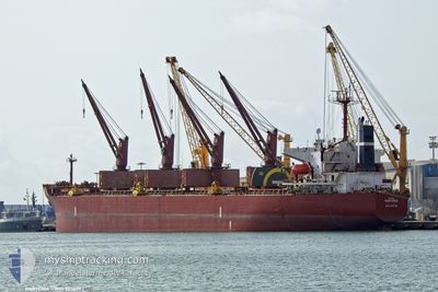
KARTERIA
Bulk Carrier
Current Trip
| Time Travelled | 2 days |
|---|---|
| Remaining Time | --- |
| Distance Travelled | 389.84 nm |
| Remaining Distance | --- |
| AVG Speed | 7.8 Knots |
| MAX Speed | 12.6 Knots |
| AVG Wind | 20.1 knots |
| MAX Wind | 26 knots |
| MIN Temp | 13.9°C / 57.02°F |
| MAX Temp | 18.5°C / 65.3°F |
| Draught | 7 m |
| Position Received | 55 m ago |
Current Position
| Longitude | -6.12685° |
|---|---|
| Latitude | 35.95370° |
| Status | Under way using engine |
| Speed | 12.1 Knots |
| Course | 271° |
| Area | North Atlantic Ocean |
| Station | T-AIS |
| Position Received | 55 m ago |
Info
Information
The current position of KARTERIA is in North Atlantic Ocean with coordinates 35.95370° / -6.12685° as reported on 2024-05-22 06:12 by AIS to our vessel tracker app. The vessel's current speed is 12.1 Knots and is heading at the port of SKAGEN. The estimated time of arrival as calculated by vessel tracking app is 2024-05-28 12:00 LT
The vessel KARTERIA (IMO: 9236092, MMSI: 249562000) is a Bulk Carrier that was built in 2001 ( 23 years old ). It's sailing under the flag of [MT] Malta.
In this page you can find informations about the vessels current position, last detected port calls, and current voyage information. If the vessels is not in coverage by AIS you will find the latest position.
The current position of KARTERIA is detected by our AIS receivers and we are not responsible for the reliability of the data. The last position was recorded while the vessel was in Coverage by the Ais receivers of our vessel tracking app.
The current draught of KARTERIA as reported by AIS is 7 meters
Weather
| Temperature | 16.2°C / 61.16°F |
|---|---|
| Wind Speed | 9 knots |
| Direction | 356° N |
| Pressure | 1019.5 hPa |
| Humidity | 71.5 % |
| Cloud Coverage | 2 % |
Featured Company
Last Port Calls
| Port | Arrival | Departure | Time In Port |
|---|---|---|---|
| 2024-05-16 17:34 | 2024-05-20 04:38 | 3 d | |
| 2024-04-18 00:47 | 2024-04-24 23:39 | 6 d | |
| 2024-03-27 13:43 | 2024-04-01 13:54 | 5 d | |
| 2024-03-21 07:52 | 2024-03-25 06:16 | 3 d | |
| 2024-03-03 10:34 | 2024-03-10 04:21 | 6 d |
Last Trips
| Origin | Departure | Destination | Arrival | Distance | |
|---|---|---|---|---|---|
| 2024-04-25 01:39 | 2024-05-16 18:34 | 4475.69 nm | |||
| 2024-04-01 16:54 | 2024-04-18 02:47 | 3498.88 nm | |||
| 2024-03-25 09:16 | 2024-03-27 16:43 | 5.30 nm | |||
| 2024-03-10 05:21 | 2024-03-21 10:52 | 3519.70 nm | |||
| 2024-02-23 18:44 | 2024-03-03 11:34 | 392.84 nm |
Events
| Time | Event | Details | Position / Dest | Info |
|---|---|---|---|---|
| 2024-05-22 06:17 | Status Changed | Default Under way using engine |
35.95334 / -6.14833
SKAW DENMARK
|
Speed: 12.1 kn Course: 271° |
| 2024-05-22 06:10 | Change Sea Area | Spanish part of the North Atlantic Ocean Moroccan part of the North Atlantic Ocean |
35.95361 / -6.11922
North Atlantic Ocean
SKAW DENMARK
|
Speed: 12.1 kn Course: 270.7° |
| 2024-05-22 06:08 | Status Changed | Under way using engine Default |
35.95353 / -6.11090
SKAW DENMARK
|
Speed: 12.3 kn Course: 270° |
| 2024-05-22 06:00 | Status Changed | Default Under way using engine |
35.95306 / -6.07812
SKAW DENMARK
|
Speed: 12.2 kn Course: 267.6° |
| 2024-05-22 05:58 | Status Changed | Under way using engine Default |
35.95324 / -6.06832
SKAW DENMARK
|
Speed: 12 kn Course: 268° |
| 2024-05-22 05:47 | Status Changed | Default Under way using engine |
35.95476 / -6.02241
SKAW DENMARK
|
Speed: 11.9 kn Course: 271.4° |
| 2024-05-22 05:35 | Change Sea Area | Moroccan part of the North Atlantic Ocean Moroccan part of the Strait of Gibraltar |
35.95467 / -5.97477
North Atlantic Ocean
SKAW DENMARK
|
Speed: 11.8 kn Course: 272.3° |
| 2024-05-22 05:26 | Change Sea Area | Moroccan part of the Strait of Gibraltar Spanish part of the Strait of Gibraltar |
35.95447 / -5.93839
Strait of Gibraltar
SKAW DENMARK
|
Speed: 11.7 kn Course: 266.5° |
| 2024-05-22 05:13 | Status Changed | Under way using engine Default |
35.95722 / -5.88541
SKAW DENMARK
|
Speed: 11.7 kn Course: 266° |
| 2024-05-22 04:58 | Status Changed | Default Under way using engine |
35.95929 / -5.82801
SKAW DENMARK
|
Speed: 11.3 kn Course: 271.6° |