
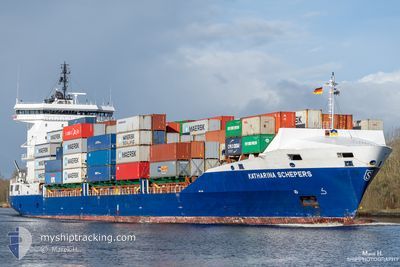
KATHARINA SCHEPERS
Container Ship
Current Trip
| Time Travelled | 5 h, 49 mins |
|---|---|
| Remaining Time | 1 day |
| Distance Travelled | 89.47 nm |
| Remaining Distance | 367.27 nm |
| AVG Speed | 14.9 Knots |
| MAX Speed | 17 Knots |
| AVG Wind | 15.3 knots |
| MAX Wind | 17.8 knots |
| MIN Temp | 10.1°C / 50.18°F |
| MAX Temp | 13.8°C / 56.84°F |
| Draught | 7.2 m |
| Position Received | 1 m ago |
Current Position
| Longitude | 12.32808° |
|---|---|
| Latitude | 54.59142° |
| Status | Under way using engine |
| Speed | 15.7 Knots |
| Course | 56.2° |
| Area | Baltic Sea |
| Station | T-AIS |
| Position Received | 1 m ago |
Info
Information
The current position of KATHARINA SCHEPERS is in Baltic Sea with coordinates 54.59142° / 12.32808° as reported on 2024-06-03 03:59 by AIS to our vessel tracker app. The vessel's current speed is 15.7 Knots and is heading at the port of NORRKOPING. The estimated time of arrival as calculated by vessel tracking app is 2024-06-04 04:26 LT
The vessel KATHARINA SCHEPERS (IMO: 9584865, MMSI: 255806525) is a Container Ship that was built in 2012 ( 12 years old ). It's sailing under the flag of [PT] Portugal.
In this page you can find informations about the vessels current position, last detected port calls, and current voyage information. If the vessels is not in coverage by AIS you will find the latest position.
The current position of KATHARINA SCHEPERS is detected by our AIS receivers and we are not responsible for the reliability of the data. The last position was recorded while the vessel was in Coverage by the Ais receivers of our vessel tracking app.
The current draught of KATHARINA SCHEPERS as reported by AIS is 7.2 meters
Weather
| Temperature | 13.6°C / 56.48°F |
|---|---|
| Wind Speed | 16 knots |
| Direction | 284° WNW |
| Pressure | 1013.9 hPa |
| Humidity | 85.7 % |
| Cloud Coverage | 7 % |
Featured Company
Last Port Calls
| Port | Arrival | Departure | Time In Port |
|---|---|---|---|
| 2024-06-02 22:07 | 2024-06-02 22:11 | 4 m | |
| 2024-05-30 16:56 | 2024-06-02 05:19 | 2 d | |
| 2024-05-28 14:10 | 2024-05-29 18:09 | 1 d | |
| 2024-05-27 04:29 | 2024-05-28 04:21 | 23 h | |
| 2024-05-26 20:24 | 2024-05-27 02:59 | 6 h | |
| 2024-05-22 08:26 | 2024-05-22 17:41 | 9 h | |
| 2024-05-21 02:14 | 2024-05-22 05:13 | 1 d | |
| 2024-05-19 07:12 | 2024-05-19 07:16 | 4 m | |
| 2024-05-16 23:10 | 2024-05-17 22:49 | 23 h | |
| 2024-05-15 23:12 | 2024-05-16 21:22 | 22 h |
Last Trips
| Origin | Departure | Destination | Arrival | Distance | |
|---|---|---|---|---|---|
| 2024-06-02 07:19 | 2024-06-03 00:07 | 88.89 nm | |||
| 2024-05-29 19:09 | 2024-05-30 18:56 | 365.56 nm | |||
| 2024-05-28 06:21 | 2024-05-28 15:10 | 116.15 nm | |||
| 2024-05-27 04:59 | 2024-05-27 06:29 | 15.40 nm | |||
| 2024-05-22 20:41 | 2024-05-26 22:24 | 1199.56 nm | |||
| 2024-05-22 08:13 | 2024-05-22 11:26 | 47.42 nm | |||
| 2024-05-19 09:16 | 2024-05-21 05:14 | 648.02 nm | |||
| 2024-05-18 00:49 | 2024-05-19 09:12 | 331.01 nm | |||
| 2024-05-16 23:22 | 2024-05-17 01:10 | 16.11 nm | |||
| 2024-05-15 23:59 | 2024-05-16 01:12 | 15.62 nm |
Events
| Time | Event | Details | Position / Dest | Info |
|---|---|---|---|---|
| 2024-06-03 03:53 | Change Sea Area | Danish part of the Baltic Sea German part of the Baltic Sea |
54.57217 / 12.30187
Baltic Sea
SENRK
|
Speed: 15.1 kn Course: 20° |
| 2024-06-03 03:02 | Change Sea Area | German part of the Baltic Sea Danish part of the Baltic Sea |
54.40754 / 12.10831
Baltic Sea
SENRK
|
Speed: 16.2 kn Course: 90.5° |
| 2024-06-03 01:29 | Change Sea Area | Danish part of the Baltic Sea German part of the Baltic Sea |
54.50909 / 11.43354
Baltic Sea
SENRK
|
Speed: 16.1 kn Course: 114.5° |
| 2024-06-03 00:05 | Change Sea Area | German part of the Baltic Sea Danish part of the Baltic Sea |
54.57163 / 10.80066
Baltic Sea
SENRK
|
Speed: 16.1 kn Course: 86.4° |
| 2024-06-02 23:38 | Change Sea Area | Danish part of the Baltic Sea German part of the Baltic Sea |
54.55929 / 10.59110
Baltic Sea
SENRK
|
Speed: 16.5 kn Course: 66.4° |
| 2024-06-02 22:44 | Change Sea Area | German part of the Baltic Sea German part of the North Sea |
54.46123 / 10.26319
Baltic Sea
SENRK
|
Speed: 12.7 kn Course: 28.9° |
| 2024-06-02 22:33 | ETA Changed | 2024/06/04 01:00 2024/06/04 05:30 |
54.42570 / 10.22184
SENRK
|
Speed: 15.2 kn Course: 29.2° |
| 2024-06-02 22:11 | PORT DEPARTURE |
|
54.36429 / 10.16825
SENRK
|
Speed: 9.7 kn Course: 53° |
| 2024-06-02 22:07 | PORT ARRIVAL |
|
54.36411 / 10.15058
[DE] KIEL
|
Speed: 7.3 kn Course: 106.6° |
| 2024-06-02 22:04 | START Moving | 1.38 nm, South West of STICKENHΟRN SPORT |
54.36536 / 10.14262
SENRK
|
Speed: 3.1 kn Course: 104° |