
KATHARINE
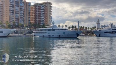
Yacht
Current Trip
| Trip Time | --- |
|---|---|
| Trip Distance | --- |
| AVG Speed | --- |
| MAX Speed | --- |
| Draught | --- |
| AVG Wind | --- |
| MAX Wind | --- |
| MIN Temp | --- |
| MAX Temp | --- |
| Position Received | Now |
Current Position
| Longitude | 14.47515° |
|---|---|
| Latitude | 40.69548° |
| Status | Moored |
| Speed | |
| Course | 214° |
| Area | Tyrrhenian Sea |
| Station | T-AIS |
| Position Received | Now |
Info
Information
The current position of KATHARINE is in Tyrrhenian Sea with coordinates 40.69548° / 14.47515° as reported on 2024-05-18 06:04 by AIS to our vessel tracker app. The vessel's current speed is 0 Knots and is currently inside the port of CASTELLAMMARE DI STA.
The vessel KATHARINE (IMO: 1005930, MMSI: 319457000) is a Yacht that was built in 2000 ( 24 years old ). It's sailing under the flag of [KY] Cayman Is.
In this page you can find informations about the vessels current position, last detected port calls, and current voyage information. If the vessels is not in coverage by AIS you will find the latest position.
The current position of KATHARINE is detected by our AIS receivers and we are not responsible for the reliability of the data. The last position was recorded while the vessel was in Coverage by the Ais receivers of our vessel tracking app.
The current draught of KATHARINE as reported by AIS is 3.5 meters
Weather
| Temperature | 21.1°C / 69.98°F |
|---|---|
| Wind Speed | 2 knots |
| Direction | 35° NE |
| Pressure | 1013 hPa |
| Humidity | 32.4 % |
| Cloud Coverage | 72 % |
Featured Company
Most Visited Ports (Last year)
| Port | Arrivals | |
|---|---|---|
| 3 | ||
| 2 | ||
| 2 | ||
| 2 | ||
| 1 | ||
| 1 |
Events
| Time | Event | Details | Position / Dest | Info |
|---|---|---|---|---|
| 2024-05-15 09:10 | IN Coverage |
40.69547 / 14.47514
Tyrrhenian Sea
[IT] CASTELLAMMARE DI STA
|
Speed: Course: 318.8° |
|
| 2024-05-12 15:31 | OUT of Coverage |
40.70780 / 14.43815
Tyrrhenian Sea
ITCAS
|
Speed: 8.9 kn Course: 67.5° |
|
| 2024-05-12 15:28 | START Moving | 2.13 nm, West of CASTELLAMMARE DI STA |
40.70654 / 14.42817
ITCAS
|
Speed: 6.1 kn Course: 91.6° |
| 2024-05-12 15:19 | STOP Moving | 2.3 nm, West of CASTELLAMMARE DI STA |
40.70760 / 14.42477
ITCAS
|
Speed: 0.3 kn Course: 216° |
| 2024-05-12 04:31 | IN Coverage |
41.36968 / 11.81520
Tyrrhenian Sea
ITCAS
|
Speed: 12.2 kn Course: 124.1° |
|
| 2024-05-12 03:23 | OUT of Coverage |
41.50227 / 11.56529
Tyrrhenian Sea
ITCAS
|
Speed: 12.1 kn Course: 122.5° |
|
| 2024-05-12 03:20 | IN Coverage |
41.50746 / 11.55444
Tyrrhenian Sea
ITCAS
|
Speed: 12.1 kn Course: 122.8° |
|
| 2024-05-12 01:53 | OUT of Coverage |
41.66715 / 11.22913
Tyrrhenian Sea
ITCAS
|
Speed: 12 kn Course: 122.6° |
|
| 2024-05-11 22:51 | IN Coverage |
42.00323 / 10.56795
Tyrrhenian Sea
ITCAS
|
Speed: 11.3 kn Course: 122.8° |
|
| 2024-05-11 21:26 | OUT of Coverage |
42.15516 / 10.26291
Tyrrhenian Sea
ITCAS
|
Speed: 11.8 kn Course: 123.3° |