
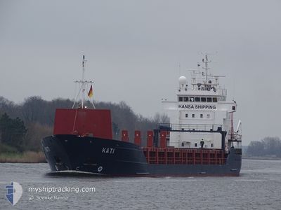
KATI
General Cargo
Current Trip
| Time Travelled | 20 h, 33 mins |
|---|---|
| Remaining Time | 1 day |
| Distance Travelled | 232.62 nm |
| Remaining Distance | 470.22 nm |
| AVG Speed | 11.2 Knots |
| MAX Speed | 12.4 Knots |
| AVG Wind | 8.7 knots |
| MAX Wind | 17 knots |
| MIN Temp | 14.9°C / 58.82°F |
| MAX Temp | 19°C / 66.2°F |
| Draught | 5.8 m |
| Position Received | 4 h, 42 m ago |
Current Position
| Longitude | -4.74877° |
|---|---|
| Latitude | 47.76617° |
| Status | Under way using engine |
| Speed | 11.8 Knots |
| Course | 308° |
| Area | Celtic Sea |
| Station | T-AIS |
| Position Received | 4 h, 42 m ago |
Info
Information
The current position of KATI is in Celtic Sea with coordinates 47.76617° / -4.74877° as reported on 2024-06-18 09:12 by AIS to our vessel tracker app. The vessel's current speed is 11.8 Knots and is heading at the port of GREAT YARMOUTH. The estimated time of arrival as calculated by vessel tracking app is 2024-06-20 02:49 LT
The vessel KATI (IMO: 9173214, MMSI: 305167000) is a General Cargo that was built in 1998 ( 26 years old ). It's sailing under the flag of [AG] Antigua Barbuda.
In this page you can find informations about the vessels current position, last detected port calls, and current voyage information. If the vessels is not in coverage by AIS you will find the latest position.
The current position of KATI is detected by our AIS receivers and we are not responsible for the reliability of the data. The last position was recorded while the vessel was in Coverage by the Ais receivers of our vessel tracking app.
The current draught of KATI as reported by AIS is 5.8 meters
Weather
| Temperature | 15.1°C / 59.18°F |
|---|---|
| Wind Speed | 16 knots |
| Direction | 30° NNE |
| Pressure | 1014.8 hPa |
| Humidity | 91 % |
| Cloud Coverage | 100 % |
Featured Company
Last Port Calls
| Port | Arrival | Departure | Time In Port |
|---|---|---|---|
| 2024-06-14 13:33 | 2024-06-17 17:22 | 3 d | |
| 2024-05-24 08:07 | 2024-06-05 22:17 | 12 d | |
| 2024-05-21 05:03 | 2024-05-21 18:56 | 13 h | |
| 2024-05-19 16:23 | 2024-05-21 04:57 | 1 d | |
| 2024-05-10 13:29 | 2024-05-14 11:54 | 3 d | |
| 2024-05-08 02:57 | 2024-05-08 22:26 | 19 h | |
| 2024-05-02 16:26 | 2024-05-06 18:31 | 4 d | |
| 2024-04-22 01:56 | 2024-04-25 02:39 | 3 d | |
| 2024-04-11 02:17 | 2024-04-12 02:52 | 1 d | |
| 2024-04-08 08:06 | 2024-04-08 08:12 | 5 m |
Last Trips
| Origin | Departure | Destination | Arrival | Distance | |
|---|---|---|---|---|---|
| 2024-06-06 00:17 | 2024-06-14 15:33 | 1355.01 nm | |||
| 2024-05-21 21:56 | 2024-05-24 10:07 | 708.85 nm | |||
| 2024-05-21 07:57 | 2024-05-21 08:03 | 3.65 nm | |||
| 2024-05-14 13:54 | 2024-05-19 19:23 | 862.94 nm | |||
| 2024-05-09 01:26 | 2024-05-10 15:29 | 430.63 nm | |||
| 2024-05-06 20:31 | 2024-05-08 05:57 | 335.09 nm | |||
| 2024-04-25 03:39 | 2024-05-02 18:26 | 1012.53 nm | |||
| 2024-04-12 04:52 | 2024-04-22 02:56 | 1719.64 nm | |||
| 2024-04-08 11:12 | 2024-04-11 04:17 | 532.86 nm | |||
| 2024-04-08 10:16 | 2024-04-08 11:06 | 6.15 nm |
Events
| Time | Event | Details | Position / Dest | Info |
|---|---|---|---|---|
| 2024-06-18 09:19 | Status Changed | Default Under way using engine |
47.77833 / -4.77333
GB GTY
|
Speed: 11.8 kn Course: 308° |
| 2024-06-18 09:12 | OUT of Coverage |
47.76617 / -4.74877
Celtic Sea
GB GTY
|
Speed: 11.8 kn Course: 308° |
|
| 2024-06-18 09:06 | Change Sea Area | French part of the Celtic Sea French part of the Bay of Biscay |
47.75327 / -4.72429
Celtic Sea
GB GTY
|
Speed: 12 kn Course: 309° |
| 2024-06-18 09:05 | Status Changed | Under way using engine Default |
47.75180 / -4.72159
GB GTY
|
Speed: 12 kn Course: 308° |
| 2024-06-18 09:05 | IN Coverage |
47.75327 / -4.72429
Celtic Sea
GB GTY
|
Speed: 12 kn Course: 309° |
|
| 2024-06-18 04:22 | Status Changed | Default Under way using engine |
47.18333 / -3.64500
GB GTY
|
Speed: 11.4 kn Course: 306° |
| 2024-06-18 04:17 | OUT of Coverage |
47.17584 / -3.62939
Bay of Biscay
GB GTY
|
Speed: 11.4 kn Course: 306° |
|
| 2024-06-18 04:11 | Status Changed | Under way using engine Default |
47.16416 / -3.60721
GB GTY
|
Speed: 11 kn Course: 309° |
| 2024-06-18 03:49 | Status Changed | Default Under way using engine |
47.11833 / -3.52500
GB GTY
|
Speed: 11.2 kn Course: 310° |
| 2024-06-18 03:44 | Status Changed | Under way using engine Default |
47.10790 / -3.50709
GB GTY
|
Speed: 11 kn Course: 310° |