
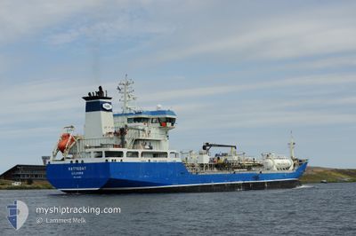
KATTEGAT
Oil/Chemical Tanker
Current Trip
SE GOT FO
| Time Travelled | 1 day |
|---|---|
| Remaining Time | --- |
| Distance Travelled | 83.87 nm |
| Remaining Distance | --- |
| AVG Speed | 8.8 Knots |
| MAX Speed | 10.3 Knots |
| AVG Wind | 21.4 knots |
| MAX Wind | 28.9 knots |
| MIN Temp | 10.7°C / 51.26°F |
| MAX Temp | 13.6°C / 56.48°F |
| Draught | 6 m |
| Position Received | 1 m ago |
Current Position
| Longitude | 11.67437° |
|---|---|
| Latitude | 57.54221° |
| Status | At anchor |
| Speed | 0.3 Knots |
| Course | 234° |
| Area | Kattegat |
| Station | T-AIS |
| Position Received | 1 m ago |
Info
Information
The current position of KATTEGAT is in Kattegat with coordinates 57.54221° / 11.67437° as reported on 2024-06-09 19:45 by AIS to our vessel tracker app. The vessel's current speed is 0.3 Knots
The vessel KATTEGAT (IMO: 9432866, MMSI: 219222000) is a Oil/Chemical Tanker that was built in 2008 ( 16 years old ). It's sailing under the flag of [DK] Denmark.
In this page you can find informations about the vessels current position, last detected port calls, and current voyage information. If the vessels is not in coverage by AIS you will find the latest position.
The current position of KATTEGAT is detected by our AIS receivers and we are not responsible for the reliability of the data. The last position was recorded while the vessel was in Coverage by the Ais receivers of our vessel tracking app.
The current draught of KATTEGAT as reported by AIS is 6 meters
Weather
| Temperature | 12.6°C / 54.68°F |
|---|---|
| Wind Speed | 27 knots |
| Direction | 247° WSW |
| Pressure | 995.8 hPa |
| Humidity | 71.5 % |
| Cloud Coverage | 100 % |
Featured Company
Last Port Calls
| Port | Arrival | Departure | Time In Port |
|---|---|---|---|
| 2024-06-07 02:31 | 2024-06-07 21:45 | 19 h | |
| 2024-06-05 17:03 | 2024-06-06 18:05 | 1 d | |
| 2024-06-04 08:38 | 2024-06-05 08:17 | 23 h | |
| 2024-06-02 21:09 | 2024-06-03 19:15 | 22 h | |
| 2024-06-02 20:50 | 2024-06-02 20:57 | 7 m | |
| 2024-05-30 12:33 | 2024-05-31 15:48 | 1 d | |
| 2024-05-24 08:00 | 2024-05-25 07:13 | 23 h | |
| 2024-05-20 11:16 | 2024-05-21 22:24 | 1 d | |
| 2024-05-08 19:03 | 2024-05-18 19:07 | 10 d | |
| 2024-04-23 09:43 | 2024-04-24 07:09 | 21 h |
Most Visited Ports (Last year)
| Port | Arrivals | |
|---|---|---|
| 6 | ||
| 5 | ||
| 5 | ||
| 3 | ||
| 3 | ||
| 3 |
Last Trips
| Origin | Departure | Destination | Arrival | Distance | |
|---|---|---|---|---|---|
| 2024-06-06 20:05 | 2024-06-07 04:31 | 90.40 nm | |||
| 2024-06-05 10:17 | 2024-06-05 19:03 | 106.86 nm | |||
| 2024-06-03 21:15 | 2024-06-04 10:38 | 140.56 nm | |||
| 2024-06-02 22:57 | 2024-06-02 23:09 | 0.29 nm | |||
| 2024-05-31 17:48 | 2024-06-02 22:50 | 640.37 nm | |||
| 2024-05-25 09:13 | 2024-05-30 14:33 | 858.43 nm | |||
| 2024-05-22 00:24 | 2024-05-24 10:00 | 531.97 nm | |||
| 2024-05-18 21:07 | 2024-05-20 13:16 | 385.79 nm | |||
| 2024-04-24 10:09 | 2024-05-08 21:03 | 3248.64 nm | |||
| 2024-04-14 00:42 | 2024-04-23 12:43 | 556.89 nm |
Events
| Time | Event | Details | Position / Dest | Info |
|---|---|---|---|---|
| 2024-06-08 06:45 | STOP Moving | 3.91 nm, South West of VRANGO |
57.54300 / 11.67198
SE GOT FO
|
Speed: 0.3 kn Course: 216° |
| 2024-06-08 06:27 | Status Changed | At anchor Under way using engine |
57.54161 / 11.66883
SE GOT FO
|
Speed: 1 kn Course: 133° |
| 2024-06-07 21:45 | PORT DEPARTURE |
|
56.64957 / 12.83479
SE GOT FO
|
Speed: 6.5 kn Course: 219° |
| 2024-06-07 21:41 | START Moving |
56.65302 / 12.84998
[SE] HALMSTAD
|
Speed: 7 kn Course: 244° |
|
| 2024-06-07 21:12 | Draught Changed | 6 8.3 |
56.65511 / 12.85623
[SE] HALMSTAD
|
Speed: Course: 229° |
| 2024-06-07 21:12 | Destination Changed | SE GOT FO SE HAD |
56.65511 / 12.85623
[SE] HALMSTAD
|
Speed: Course: 229° |
| 2024-06-07 21:12 | ETA Changed | 2024/06/08 06:00 2024/06/07 02:00 |
56.65511 / 12.85623
[SE] HALMSTAD
|
Speed: Course: 229° |
| 2024-06-07 21:12 | Status Changed | Under way using engine Default |
56.65511 / 12.85623
[SE] HALMSTAD
|
Speed: Course: 229° |
| 2024-06-07 20:57 | IN Coverage |
56.65510 / 12.85626
Kattegat
[SE] HALMSTAD
|
Speed: Course: 337.9° |
|
| 2024-06-07 19:27 | OUT of Coverage |
56.65510 / 12.85624
Kattegat
[SE] HALMSTAD
|
Speed: Course: 338.7° |