
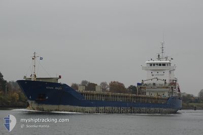
KENAN ATASOY
General Cargo
Current Trip
| Time Travelled | 3 days |
|---|---|
| Remaining Time | --- |
| Distance Travelled | 888.66 nm |
| Remaining Distance | --- |
| AVG Speed | 10.6 Knots |
| MAX Speed | 11.9 Knots |
| AVG Wind | 10.2 knots |
| MAX Wind | 18.9 knots |
| MIN Temp | 23.1°C / 73.58°F |
| MAX Temp | 27.5°C / 81.5°F |
| Draught | 6.8 m |
| Position Received | 6 m ago |
Current Position
| Longitude | 15.25623° |
|---|---|
| Latitude | 36.46111° |
| Status | Under way using engine |
| Speed | 10.7 Knots |
| Course | 290.9° |
| Area | Mediterranean Sea - Eastern Basin |
| Station | T-AIS |
| Position Received | 6 m ago |
Info
Information
The current position of KENAN ATASOY is in Mediterranean Sea - Eastern Basin with coordinates 36.46111° / 15.25623° as reported on 2024-06-18 06:23 by AIS to our vessel tracker app. The vessel's current speed is 10.7 Knots and is heading at the port of ROUEN. The estimated time of arrival as calculated by vessel tracking app is 2024-06-26 17:00 LT
The vessel KENAN ATASOY (IMO: 9215658, MMSI: 636021080) is a General Cargo that was built in 2000 ( 24 years old ). It's sailing under the flag of [LR] Liberia.
In this page you can find informations about the vessels current position, last detected port calls, and current voyage information. If the vessels is not in coverage by AIS you will find the latest position.
The current position of KENAN ATASOY is detected by our AIS receivers and we are not responsible for the reliability of the data. The last position was recorded while the vessel was in Coverage by the Ais receivers of our vessel tracking app.
The current draught of KENAN ATASOY as reported by AIS is 6.8 meters
Weather
| Temperature | 23.2°C / 73.76°F |
|---|---|
| Wind Speed | 12 knots |
| Direction | 48° NE |
| Pressure | 1017.1 hPa |
| Humidity | 79.9 % |
| Cloud Coverage | --- |
Featured Company
Last Port Calls
| Port | Arrival | Departure | Time In Port |
|---|---|---|---|
| 2024-06-13 20:13 | 2024-06-14 20:18 | 1 d | |
| 2024-05-30 20:15 | 2024-06-02 11:45 | 2 d | |
| 2024-05-23 22:22 | 2024-05-24 01:52 | 3 h | |
| 2024-05-18 11:30 | 2024-05-23 06:37 | 4 d | |
| 2024-05-12 07:42 | 2024-05-12 20:16 | 12 h | |
| 2024-05-09 19:43 | 2024-05-10 19:09 | 23 h | |
| 2024-04-25 17:24 | 2024-04-27 15:23 | 1 d | |
| 2024-04-13 03:19 | 2024-04-14 20:54 | 1 d |
Last Trips
| Origin | Departure | Destination | Arrival | Distance | |
|---|---|---|---|---|---|
| 2024-06-02 14:45 | 2024-06-13 22:13 | 836.69 nm | |||
| 2024-05-24 03:52 | 2024-05-30 23:15 | 1829.86 nm | |||
| 2024-05-23 08:37 | 2024-05-24 00:22 | 166.62 nm | |||
| 2024-05-12 22:16 | 2024-05-18 13:30 | 922.86 nm | |||
| 2024-05-10 21:09 | 2024-05-12 09:42 | 39.16 nm | |||
| 2024-04-27 18:23 | 2024-05-09 21:43 | 2834.31 nm | |||
| 2024-04-14 23:54 | 2024-04-25 20:24 | 462.18 nm | |||
| 2024-03-27 08:30 | 2024-04-13 06:19 | 3004.48 nm |
Events
| Time | Event | Details | Position / Dest | Info |
|---|---|---|---|---|
| 2024-06-18 06:14 | Status Changed | Under way using engine Default |
36.45117 / 15.28726
FRURO
|
Speed: 10.8 kn Course: 292° |
| 2024-06-18 06:13 | Status Changed | Default Under way using engine |
36.45007 / 15.29073
FRURO
|
Speed: 10.8 kn Course: 291.5° |
| 2024-06-18 06:08 | Status Changed | Under way using engine Default |
36.44357 / 15.31153
FRURO
|
Speed: 10.9 kn Course: 292° |
| 2024-06-18 06:01 | Status Changed | Default Under way using engine |
36.43641 / 15.33348
FRURO
|
Speed: 10.9 kn Course: 292.7° |
| 2024-06-18 00:56 | Status Changed | Under way using engine Default |
36.16739 / 16.42243
FRURO
|
Speed: 11 kn Course: 287° |
| 2024-06-18 00:05 | Status Changed | Default Under way using engine |
36.11951 / 16.61389
FRURO
|
Speed: 11.5 kn Course: 288.6° |
| 2024-06-17 23:46 | Status Changed | Under way using engine Default |
36.10093 / 16.68464
FRURO
|
Speed: 11.6 kn Course: 287° |
| 2024-06-17 23:40 | IN Coverage |
36.10093 / 16.68464
Mediterranean Sea - Eastern Basin
FRURO
|
Speed: 11.5 kn Course: 287.2° |
|
| 2024-06-17 21:30 | Status Changed | Default Under way using engine |
35.96823 / 17.20309
FRURO
|
Speed: 11.8 kn Course: 285.7° |
| 2024-06-17 21:22 | OUT of Coverage |
35.96036 / 17.23513
Mediterranean Sea - Eastern Basin
FRURO
|
Speed: 11.8 kn Course: 285.7° |