
KENORA
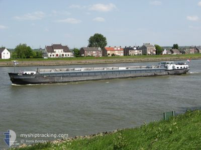
Tanker
Current Trip
| Time Travelled | 4 days |
|---|---|
| Remaining Time | --- |
| Distance Travelled | 54.20 nm |
| Remaining Distance | --- |
| AVG Speed | 9.8 Knots |
| MAX Speed | 11.4 Knots |
| AVG Wind | 12.1 knots |
| MAX Wind | 13.4 knots |
| MIN Temp | 15.7°C / 60.26°F |
| MAX Temp | 18.8°C / 65.84°F |
| Draught | 0 m |
| Position Received | 3 d ago |
Current Position
| Longitude | 7.26277° |
|---|---|
| Latitude | 52.77758° |
| Status | Under way using engine |
| Speed | 3.7 Knots |
| Course | 98° |
| Area | North Sea |
| Station | T-AIS |
| Position Received | 3 d ago |
Info
info
Information
The current position of KENORA is in North Sea with coordinates 52.77758° / 7.26277° as reported on 2024-05-30 11:20 by AIS to our vessel tracker app. The vessel's current speed is 3.7 Knots
The vessel KENORA (MMSI: 244660500) is a Tanker It's sailing under the flag of [NL] Netherlands.
In this page you can find informations about the vessels current position, last detected port calls, and current voyage information. If the vessels is not in coverage by AIS you will find the latest position.
The current position of KENORA is detected by our AIS receivers and we are not responsible for the reliability of the data. The last position was recorded while the vessel was in Coverage by the Ais receivers of our vessel tracking app.
Weather
| Temperature | 12°C / 53.6°F |
|---|---|
| Wind Speed | 9 knots |
| Direction | 317° NW |
| Pressure | 1019.9 hPa |
| Humidity | 70.3 % |
| Cloud Coverage | 93 % |
Featured Company
Limited time offer - Install a base station receiver to your area and list your company on Free forever!
Last Port Calls
| Port | Arrival | Departure | Time In Port |
|---|---|---|---|
| 2024-05-27 16:47 | 2024-05-29 08:38 | 1 d | |
| 2024-05-27 13:43 | 2024-05-27 14:44 | 1 h | |
| 2024-05-26 12:26 | 2024-05-26 13:03 | 36 m | |
| 2024-05-25 17:20 | 2024-05-26 07:33 | 14 h | |
| 2024-05-24 23:45 | 2024-05-25 09:59 | 10 h | |
| 2024-05-24 21:56 | 2024-05-24 22:29 | 33 m | |
| 2024-05-24 19:21 | 2024-05-24 20:53 | 1 h | |
| 2024-05-22 11:31 | 2024-05-23 20:09 | 1 d | |
| 2024-05-21 20:52 | 2024-05-22 05:00 | 8 h | |
| 2024-05-21 17:48 | 2024-05-21 18:02 | 14 m |
Most Visited Ports (Last year)
| Port | Arrivals | |
|---|---|---|
| 30 | ||
| 29 | ||
| 27 | ||
| 22 | ||
| 20 | ||
| 19 |
Last Trips
| Origin | Departure | Destination | Arrival | Distance | |
|---|---|---|---|---|---|
| 2024-05-27 16:44 | 2024-05-27 18:47 | 10.82 nm | |||
| 2024-05-26 15:03 | 2024-05-27 15:43 | 114.11 nm | |||
| 2024-05-26 09:33 | 2024-05-26 14:26 | 34.53 nm | |||
| 2024-05-25 11:59 | 2024-05-25 19:20 | 57.37 nm | |||
| 2024-05-25 00:29 | 2024-05-25 01:45 | 12.08 nm | |||
| 2024-05-24 22:53 | 2024-05-24 23:56 | 9.21 nm | |||
| 2024-05-23 22:09 | 2024-05-24 21:21 | 23.48 nm | |||
| 2024-05-22 07:00 | 2024-05-22 13:31 | 24.14 nm | |||
| 2024-05-21 20:02 | 2024-05-21 22:52 | 21.16 nm | |||
| 2024-05-21 11:55 | 2024-05-21 19:48 | 54.74 nm |
Events
| Time | Event | Details | Position / Dest | Info |
|---|---|---|---|---|
| 2024-05-30 11:45 | STOP Moving | 1.43 nm, South East of HAREN |
52.77500 / 7.27167
LINGEN
|
Speed: Course: -1° |
| 2024-05-30 11:30 | Status Changed | Default Under way using engine |
52.77667 / 7.27167
LINGEN
|
Speed: 3.7 kn Course: 98° |
| 2024-05-30 11:20 | OUT of Coverage |
52.77758 / 7.26277
North Sea
|
Speed: 3.7 kn Course: 100.6° |
|
| 2024-05-30 10:40 | Status Changed | Under way using engine Default |
52.80977 / 7.24064
LINGEN
|
Speed: 4 kn Course: -1° |
| 2024-05-30 10:30 | IN Coverage |
52.80977 / 7.24064
North Sea
|
Speed: 4 kn Course: 132.9° |
|
| 2024-05-29 17:00 | STOP Moving | 2.28 nm, South West of LATHEN |
52.83333 / 7.27833
LINGEN
|
Speed: Course: -1° |
| 2024-05-29 13:29 | START Moving | 0.66 nm, North of HERBRUM |
53.03395 / 7.31749
LINGEN
|
Speed: 5.4 kn Course: 181° |
| 2024-05-29 12:43 | STOP Moving | 1.05 nm, North of HERBRUM |
53.04055 / 7.31804
LINGEN
|
Speed: 0.3 kn Course: 185° |
| 2024-05-29 12:06 | Status Changed | Default Under way using engine |
53.09333 / 7.28667
LINGEN
|
Speed: 8.6 kn Course: 248.8° |
| 2024-05-29 11:56 | OUT of Coverage |
53.10395 / 7.31765
North Sea
|
Speed: 8.6 kn Course: 248.8° |