
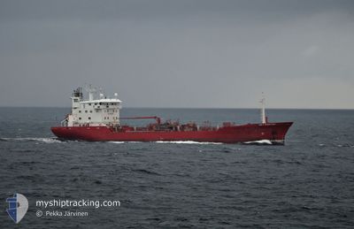
KEY FIGHTER
Oil/Chemical Tanker
Current Trip
| Time Travelled | 2 days |
|---|---|
| Remaining Time | 4 h, 59 mins |
| Distance Travelled | 640.14 nm |
| Remaining Distance | 72.97 nm |
| AVG Speed | 12.3 Knots |
| MAX Speed | 14.7 Knots |
| AVG Wind | 6.9 knots |
| MAX Wind | 18.7 knots |
| MIN Temp | 11.1°C / 51.98°F |
| MAX Temp | 16.9°C / 62.42°F |
| Draught | 6.5 m |
| Position Received | Now |
Current Position
| Longitude | 5.90321° |
|---|---|
| Latitude | 58.14018° |
| Status | Under way using engine |
| Speed | 13.4 Knots |
| Course | 309.6° |
| Area | North Sea |
| Station | T-AIS |
| Position Received | Now |
Info
Information
The current position of KEY FIGHTER is in North Sea with coordinates 58.14018° / 5.90321° as reported on 2024-05-28 19:48 by AIS to our vessel tracker app. The vessel's current speed is 13.4 Knots and is heading at the port of STAVANGER. The estimated time of arrival as calculated by vessel tracking app is 2024-05-29 00:48 LT
The vessel KEY FIGHTER (IMO: 8712166, MMSI: 215211000) is a Oil/Chemical Tanker that was built in 1989 ( 35 years old ). It's sailing under the flag of [MT] Malta.
In this page you can find informations about the vessels current position, last detected port calls, and current voyage information. If the vessels is not in coverage by AIS you will find the latest position.
The current position of KEY FIGHTER is detected by our AIS receivers and we are not responsible for the reliability of the data. The last position was recorded while the vessel was in Coverage by the Ais receivers of our vessel tracking app.
The current draught of KEY FIGHTER as reported by AIS is 6.5 meters
Weather
| Temperature | 11°C / 51.8°F |
|---|---|
| Wind Speed | 4 knots |
| Direction | 141° SE |
| Pressure | 1011 hPa |
| Humidity | 77.9 % |
| Cloud Coverage | 100 % |
Featured Company
Last Port Calls
| Port | Arrival | Departure | Time In Port |
|---|---|---|---|
| 2024-05-25 06:50 | 2024-05-26 16:59 | 1 d | |
| 2024-05-22 23:48 | 2024-05-23 15:16 | 15 h | |
| 2024-05-20 03:06 | 2024-05-21 06:00 | 1 d | |
| 2024-05-15 21:55 | 2024-05-16 09:32 | 11 h | |
| 2024-05-10 21:55 | 2024-05-11 23:02 | 1 d | |
| 2024-05-08 08:03 | 2024-05-09 08:13 | 1 d | |
| 2024-05-04 13:56 | 2024-05-05 18:19 | 1 d | |
| 2024-05-01 20:45 | 2024-05-02 12:20 | 15 h | |
| 2024-04-29 11:48 | 2024-04-30 08:12 | 20 h | |
| 2024-04-26 20:40 | 2024-04-27 03:42 | 7 h |
Last Trips
| Origin | Departure | Destination | Arrival | Distance | |
|---|---|---|---|---|---|
| 2024-05-23 17:16 | 2024-05-25 09:50 | 503.25 nm | |||
| 2024-05-21 08:00 | 2024-05-23 01:48 | 518.55 nm | |||
| 2024-05-16 11:32 | 2024-05-20 05:06 | 790.71 nm | |||
| 2024-05-12 02:02 | 2024-05-15 23:55 | 1073.49 nm | |||
| 2024-05-09 10:13 | 2024-05-11 00:55 | 500.00 nm | |||
| 2024-05-05 20:19 | 2024-05-08 10:03 | 648.32 nm | |||
| 2024-05-02 14:20 | 2024-05-04 15:56 | 625.12 nm | |||
| 2024-04-30 11:12 | 2024-05-01 22:45 | 480.13 nm | |||
| 2024-04-27 05:42 | 2024-04-29 14:48 | 726.59 nm | |||
| 2024-04-24 00:23 | 2024-04-26 22:40 | 719.46 nm |
Events
| Time | Event | Details | Position / Dest | Info |
|---|---|---|---|---|
| 2024-05-28 15:51 | Change Sea Area | Norwegian part of the North Sea Norwegian part of the Skaggerak |
57.78664 / 7.37073
North Sea
NO SVG
|
Speed: 13.8 kn Course: 273.7° |
| 2024-05-28 13:30 | ETA Changed | 2024/05/29 02:00 2024/05/29 23:00 |
57.78733 / 8.33474
NO SVG
|
Speed: 12.7 kn Course: 266° |
| 2024-05-28 13:23 | ETA Changed | 2024/05/29 23:00 2024/05/28 23:00 |
57.78881 / 8.37504
NO SVG
|
Speed: 12.6 kn Course: 265.8° |
| 2024-05-28 11:38 | Change Sea Area | Norwegian part of the Skaggerak Danish part of the Skaggerak |
57.81549 / 9.06842
Skaggerak
NO SVG
|
Speed: 12.5 kn Course: 266.2° |
| 2024-05-28 06:50 | Change Sea Area | Danish part of the Skaggerak Danish part of the Kattegat |
57.80539 / 10.92529
Skaggerak
NO SVG
|
Speed: 12.7 kn Course: 315° |
| 2024-05-28 05:35 | Change Sea Area | Danish part of the Kattegat Swedish part of the Kattegat |
57.60735 / 11.24868
Kattegat
NO SVG
|
Speed: 12.8 kn Course: 316.7° |
| 2024-05-27 21:44 | Change Sea Area | Swedish part of the Kattegat Danish part of the Kattegat |
56.12626 / 12.53073
Kattegat
NO SVG
|
Speed: 13.3 kn Course: 315° |
| 2024-05-27 21:38 | Change Sea Area | Danish part of the Kattegat Swedish part of the Kattegat |
56.11073 / 12.55884
Kattegat
NO SVG
|
Speed: 13.3 kn Course: 314.9° |
| 2024-05-27 17:47 | Change Sea Area | Swedish part of the Kattegat Danish part of the Kattegat |
55.50216 / 12.71886
Kattegat
NO SVG
|
Speed: 8.7 kn Course: 37.5° |
| 2024-05-27 17:41 | Change Sea Area | Danish part of the Kattegat Swedish part of the Kattegat |
55.48934 / 12.70893
Kattegat
NO SVG
|
Speed: 10.3 kn Course: 7.4° |