
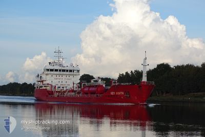
KEY SOUTH
Oil/Chemical Tanker
Current Trip
| Time Travelled | 6 days |
|---|---|
| Remaining Time | 1 day |
| Distance Travelled | 1379.11 nm |
| Remaining Distance | 422.08 nm |
| AVG Speed | 11.2 Knots |
| MAX Speed | 14.2 Knots |
| AVG Wind | 16.4 knots |
| MAX Wind | 34 knots |
| MIN Temp | 7.7°C / 45.86°F |
| MAX Temp | 14.2°C / 57.56°F |
| Draught | 5 m |
| Position Received | 1 m ago |
Current Position
| Longitude | 11.59914° |
|---|---|
| Latitude | 57.17783° |
| Status | Under way using engine |
| Speed | 12.5 Knots |
| Course | 167.3° |
| Area | Kattegat |
| Station | T-AIS |
| Position Received | 1 m ago |
Info
Information
The current position of KEY SOUTH is in Kattegat with coordinates 57.17783° / 11.59914° as reported on 2024-06-11 01:29 by AIS to our vessel tracker app. The vessel's current speed is 12.5 Knots and is heading at the port of KLAIPEDA. The estimated time of arrival as calculated by vessel tracking app is 2024-06-12 13:07 LT
The vessel KEY SOUTH (IMO: 9479802, MMSI: 248221000) is a Oil/Chemical Tanker that was built in 2010 ( 14 years old ). It's sailing under the flag of [MT] Malta.
In this page you can find informations about the vessels current position, last detected port calls, and current voyage information. If the vessels is not in coverage by AIS you will find the latest position.
The current position of KEY SOUTH is detected by our AIS receivers and we are not responsible for the reliability of the data. The last position was recorded while the vessel was in Coverage by the Ais receivers of our vessel tracking app.
The current draught of KEY SOUTH as reported by AIS is 5 meters
Weather
| Temperature | 12.3°C / 54.14°F |
|---|---|
| Wind Speed | 13 knots |
| Direction | 214° SW |
| Pressure | 1001.1 hPa |
| Humidity | 79.2 % |
| Cloud Coverage | 100 % |
Featured Company
Last Port Calls
| Port | Arrival | Departure | Time In Port |
|---|---|---|---|
| 2024-06-03 09:43 | 2024-06-05 01:02 | 1 d | |
| 2024-05-28 08:28 | 2024-05-28 20:46 | 12 h | |
| 2024-05-27 05:52 | 2024-05-27 18:11 | 12 h | |
| 2024-05-23 12:18 | 2024-05-23 21:12 | 8 h | |
| 2024-05-18 21:22 | 2024-05-19 13:38 | 16 h | |
| 2024-05-15 13:57 | 2024-05-16 09:31 | 19 h | |
| 2024-05-15 13:37 | 2024-05-15 13:49 | 12 m | |
| 2024-05-11 00:04 | 2024-05-12 22:27 | 1 d | |
| 2024-05-10 17:03 | 2024-05-10 21:45 | 4 h | |
| 2024-05-07 08:59 | 2024-05-08 10:23 | 1 d |
Most Visited Ports (Last year)
| Port | Arrivals | |
|---|---|---|
| 9 | ||
| 9 | ||
| 8 | ||
| 7 | ||
| 5 | ||
| 4 |
Last Trips
| Origin | Departure | Destination | Arrival | Distance | |
|---|---|---|---|---|---|
| 2024-05-28 22:46 | 2024-06-03 12:43 | 1548.61 nm | |||
| 2024-05-27 20:11 | 2024-05-28 10:28 | 126.76 nm | |||
| 2024-05-23 23:12 | 2024-05-27 07:52 | 769.53 nm | |||
| 2024-05-19 15:38 | 2024-05-23 14:18 | 724.33 nm | |||
| 2024-05-16 11:31 | 2024-05-18 23:22 | 633.51 nm | |||
| 2024-05-15 15:49 | 2024-05-15 15:57 | 0.80 nm | |||
| 2024-05-12 23:27 | 2024-05-15 15:37 | 586.04 nm | |||
| 2024-05-08 12:23 | 2024-05-11 01:04 | 632.31 nm | |||
| 2024-05-08 12:23 | 2024-05-10 18:03 | 613.33 nm | |||
| 2024-05-06 18:27 | 2024-05-07 10:59 | 181.85 nm |
Events
| Time | Event | Details | Position / Dest | Info |
|---|---|---|---|---|
| 2024-06-11 01:10 | Detected in Sea | Danish part of the Kattegat |
57.23907 / 11.56605
Kattegat
LTKLJ
|
Speed: 11.6 kn Course: 159.5° |
| 2024-06-10 23:47 | Change Sea Area | Swedish part of the Kattegat Danish part of the Kattegat |
57.48429 / 11.36655
Kattegat
LTKLJ
|
Speed: 11.6 kn Course: 138.2° |
| 2024-06-10 21:41 | Change Sea Area | Danish part of the Kattegat Danish part of the Skaggerak |
57.77931 / 10.87243
Kattegat
LTKLJ
|
Speed: 10.6 kn Course: 136.2° |
| 2024-06-10 16:53 | Detected in Sea | Danish part of the Skaggerak |
57.73648 / 8.96003
Skaggerak
LTKLJ
|
Speed: 13.3 kn Course: 85.3° |
| 2024-06-10 13:16 | Detected in Sea | Norwegian part of the Skaggerak |
57.69436 / 7.57662
Skaggerak
LTKLJ
|
Speed: 12.3 kn Course: 93.7° |
| 2024-06-10 05:07 | ETA Changed | 2024/06/12 22:00 2024/06/12 23:00 |
58.48291 / 4.94945
LTKLJ
|
Speed: 12.9 kn Course: 133.8° |
| 2024-06-09 15:55 | Change Sea Area | Norwegian part of the North Sea Norwegian part of the Norwegian Sea |
60.99516 / 4.01681
North Sea
LTKLJ
|
Speed: 12.9 kn Course: 180.4° |
| 2024-06-09 13:48 | ETA Changed | 2024/06/12 23:00 2024/06/13 03:00 |
61.41851 / 4.03174
LTKLJ
|
Speed: 11.5 kn Course: 183.7° |
| 2024-06-09 10:34 | ETA Changed | 2024/06/13 03:00 2024/06/12 11:00 |
61.60919 / 4.94763
LTKLJ
|
Speed: 11.8 kn Course: 312.6° |
| 2024-06-09 10:19 | START Moving | 1.41 nm, South West of FLORO |
61.58382 / 4.99920
LTKLJ
|
Speed: 5.5 kn Course: 290.1° |