
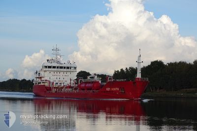
KEY SOUTH
Oil/Chemical Tanker
Current Trip
| Time Travelled | 2 days |
|---|---|
| Remaining Time | 2 days |
| Distance Travelled | 754.94 nm |
| Remaining Distance | 773.97 nm |
| AVG Speed | 11.9 Knots |
| MAX Speed | 13.6 Knots |
| AVG Wind | 9.8 knots |
| MAX Wind | 17.9 knots |
| MIN Temp | 7.7°C / 45.86°F |
| MAX Temp | 16.9°C / 62.42°F |
| Draught | 4.9 m |
| Position Received | 2 m ago |
Current Position
| Longitude | 4.02725° |
|---|---|
| Latitude | 60.14995° |
| Status | Under way using engine |
| Speed | 12.5 Knots |
| Course | 180.8° |
| Area | North Sea |
| Station | T-AIS |
| Position Received | 2 m ago |
Info
Information
The current position of KEY SOUTH is in North Sea with coordinates 60.14995° / 4.02725° as reported on 2024-05-31 12:55 by AIS to our vessel tracker app. The vessel's current speed is 12.5 Knots and is heading at the port of KLAIPEDA. The estimated time of arrival as calculated by vessel tracking app is 2024-06-03 02:54 LT
The vessel KEY SOUTH (IMO: 9479802, MMSI: 248221000) is a Oil/Chemical Tanker that was built in 2010 ( 14 years old ). It's sailing under the flag of [MT] Malta.
In this page you can find informations about the vessels current position, last detected port calls, and current voyage information. If the vessels is not in coverage by AIS you will find the latest position.
The current position of KEY SOUTH is detected by our AIS receivers and we are not responsible for the reliability of the data. The last position was recorded while the vessel was in Coverage by the Ais receivers of our vessel tracking app.
The current draught of KEY SOUTH as reported by AIS is 4.9 meters
Weather
| Temperature | 11.5°C / 52.7°F |
|---|---|
| Wind Speed | 17 knots |
| Direction | 340° NNW |
| Pressure | 1019.4 hPa |
| Humidity | 87.5 % |
| Cloud Coverage | 54 % |
Featured Company
Last Port Calls
| Port | Arrival | Departure | Time In Port |
|---|---|---|---|
| 2024-05-28 08:28 | 2024-05-28 20:46 | 12 h | |
| 2024-05-27 05:52 | 2024-05-27 18:11 | 12 h | |
| 2024-05-23 12:18 | 2024-05-23 21:12 | 8 h | |
| 2024-05-18 21:22 | 2024-05-19 13:38 | 16 h | |
| 2024-05-15 13:57 | 2024-05-16 09:31 | 19 h | |
| 2024-05-15 13:37 | 2024-05-15 13:49 | 12 m | |
| 2024-05-11 00:04 | 2024-05-12 22:27 | 1 d | |
| 2024-05-10 17:03 | 2024-05-10 21:45 | 4 h | |
| 2024-05-07 08:59 | 2024-05-08 10:23 | 1 d | |
| 2024-05-06 14:42 | 2024-05-06 16:27 | 1 h |
Most Visited Ports (Last year)
| Port | Arrivals | |
|---|---|---|
| 9 | ||
| 9 | ||
| 8 | ||
| 7 | ||
| 5 | ||
| 4 |
Last Trips
| Origin | Departure | Destination | Arrival | Distance | |
|---|---|---|---|---|---|
| 2024-05-27 20:11 | 2024-05-28 10:28 | 126.76 nm | |||
| 2024-05-23 23:12 | 2024-05-27 07:52 | 769.53 nm | |||
| 2024-05-19 15:38 | 2024-05-23 14:18 | 724.33 nm | |||
| 2024-05-16 11:31 | 2024-05-18 23:22 | 633.51 nm | |||
| 2024-05-15 15:49 | 2024-05-15 15:57 | 0.80 nm | |||
| 2024-05-12 23:27 | 2024-05-15 15:37 | 586.04 nm | |||
| 2024-05-08 12:23 | 2024-05-11 01:04 | 632.31 nm | |||
| 2024-05-08 12:23 | 2024-05-10 18:03 | 613.33 nm | |||
| 2024-05-06 18:27 | 2024-05-07 10:59 | 181.85 nm | |||
| 2024-05-06 15:17 | 2024-05-06 16:42 | 8.53 nm |
Events
| Time | Event | Details | Position / Dest | Info |
|---|---|---|---|---|
| 2024-05-31 08:50 | Detected in Sea | Norwegian part of the North Sea |
60.98673 / 4.01675
North Sea
LTKLJ
|
Speed: 11.5 kn Course: 180.6° |
| 2024-05-31 04:47 | ETA Changed | 2024/06/03 20:00 2024/06/03 22:00 |
61.79623 / 4.04222
LTKLJ
|
Speed: 12.3 kn Course: 181.4° |
| 2024-05-30 09:18 | Draught Changed | 4.9 5.2 |
64.82883 / 8.68777
LTKLJ
|
Speed: 11.3 kn Course: 203.2° |
| 2024-05-30 06:49 | IN Coverage |
65.27239 / 9.10139
Norwegian Sea
LTKLJ
|
Speed: 11.6 kn Course: 200.6° |
|
| 2024-05-30 05:46 | OUT of Coverage |
65.46475 / 9.28613
Norwegian Sea
LTKLJ
|
Speed: 11.5 kn Course: 202.8° |
|
| 2024-05-29 09:09 | ETA Changed | 2024/06/03 22:00 2024/06/04 12:00 |
69.05516 / 14.17730
LTKLJ
|
Speed: 11.3 kn Course: 225° |
| 2024-05-29 09:04 | Destination Changed | LTKLJ DKODE |
69.05516 / 14.17730
LTKLJ
|
Speed: 11.3 kn Course: 225° |
| 2024-05-29 09:04 | ETA Changed | 2024/06/04 12:00 2024/06/02 15:30 |
69.05516 / 14.17730
LTKLJ
|
Speed: 11.3 kn Course: 225° |
| 2024-05-29 00:24 | ETA Changed | 2024/06/02 15:30 2024/06/02 19:00 |
69.57685 / 17.94063
DKODE
|
Speed: 11.5 kn Course: 322.3° |
| 2024-05-29 00:09 | ETA Changed | 2024/06/02 19:00 2024/06/03 06:00 |
69.54251 / 18.02907
DKODE
|
Speed: 10.6 kn Course: 301.9° |