
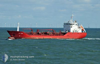
KEY SUND
Oil/Chemical Tanker
Current Trip
| Time Travelled | 1 day |
|---|---|
| Remaining Time | 1 day |
| Distance Travelled | 450.40 nm |
| Remaining Distance | 491.89 nm |
| AVG Speed | 12.5 Knots |
| MAX Speed | 14.4 Knots |
| AVG Wind | 11.9 knots |
| MAX Wind | 19.3 knots |
| MIN Temp | 10.3°C / 50.54°F |
| MAX Temp | 16.3°C / 61.34°F |
| Draught | 4.9 m |
| Position Received | 1 m ago |
Current Position
| Longitude | 10.64191° |
|---|---|
| Latitude | 57.68827° |
| Status | At anchor |
| Speed | |
| Course | 28° |
| Area | Kattegat |
| Station | T-AIS |
| Position Received | 1 m ago |
Info
Information
The current position of KEY SUND is in Kattegat with coordinates 57.68827° / 10.64191° as reported on 2024-06-01 06:24 by AIS to our vessel tracker app. The vessel's current speed is 0 Knots and is heading at the port of TERNEUZEN. The estimated time of arrival as calculated by vessel tracking app is 2024-06-02 13:29 LT
The vessel KEY SUND (IMO: 8920567, MMSI: 259360000) is a Oil/Chemical Tanker that was built in 1993 ( 31 years old ). It's sailing under the flag of [NO] Norway.
In this page you can find informations about the vessels current position, last detected port calls, and current voyage information. If the vessels is not in coverage by AIS you will find the latest position.
The current position of KEY SUND is detected by our AIS receivers and we are not responsible for the reliability of the data. The last position was recorded while the vessel was in Coverage by the Ais receivers of our vessel tracking app.
The current draught of KEY SUND as reported by AIS is 4.9 meters
Weather
| Temperature | 15.5°C / 59.9°F |
|---|---|
| Wind Speed | 10 knots |
| Direction | 34° NE |
| Pressure | 1015.4 hPa |
| Humidity | 87.9 % |
| Cloud Coverage | 100 % |
Featured Company
Last Port Calls
| Port | Arrival | Departure | Time In Port |
|---|---|---|---|
| 2024-05-30 10:25 | 2024-05-30 10:39 | 14 m | |
| 2024-05-28 12:50 | 2024-05-29 17:16 | 1 d | |
| 2024-05-24 02:12 | 2024-05-25 00:00 | 21 h | |
| 2024-05-21 22:18 | 2024-05-22 09:04 | 10 h | |
| 2024-05-21 04:04 | 2024-05-21 18:40 | 14 h | |
| 2024-05-17 21:50 | 2024-05-18 15:50 | 17 h | |
| 2024-05-15 21:30 | 2024-05-16 20:22 | 22 h | |
| 2024-05-15 20:36 | 2024-05-15 21:14 | 38 m | |
| 2024-05-10 20:29 | 2024-05-11 09:23 | 12 h | |
| 2024-05-08 18:20 | 2024-05-09 07:01 | 12 h |
Most Visited Ports (Last year)
| Port | Arrivals | |
|---|---|---|
| 7 | ||
| 7 | ||
| 7 | ||
| 6 | ||
| 6 | ||
| 4 |
Last Trips
| Origin | Departure | Destination | Arrival | Distance | |
|---|---|---|---|---|---|
| 2024-05-29 19:16 | 2024-05-30 12:25 | 194.77 nm | |||
| 2024-05-25 03:00 | 2024-05-28 14:50 | 1083.06 nm | |||
| 2024-05-22 11:04 | 2024-05-24 05:12 | 285.45 nm | |||
| 2024-05-21 20:40 | 2024-05-22 00:18 | 42.68 nm | |||
| 2024-05-18 17:50 | 2024-05-21 06:04 | 637.96 nm | |||
| 2024-05-16 21:22 | 2024-05-17 23:50 | 293.28 nm | |||
| 2024-05-15 22:14 | 2024-05-15 22:30 | 0.36 nm | |||
| 2024-05-11 11:23 | 2024-05-15 21:36 | 765.67 nm | |||
| 2024-05-09 09:01 | 2024-05-10 22:29 | 468.09 nm | |||
| 2024-05-08 19:33 | 2024-05-08 20:20 | 4.84 nm |
Events
| Time | Event | Details | Position / Dest | Info |
|---|---|---|---|---|
| 2024-06-01 00:03 | ETA Changed | 2025/05/31 21:30 2024/05/31 21:30 |
57.68883 / 10.64416
NO VAE>FOR ORDER
|
Speed: Course: 300° |
| 2024-05-31 22:06 | STOP Moving | 2.04 nm, South East of SKAGEN |
57.68930 / 10.64066
NO VAE>FOR ORDER
|
Speed: 0.2 kn Course: 94° |
| 2024-05-31 21:57 | Status Changed | At anchor Under way using engine |
57.68936 / 10.64262
NO VAE>FOR ORDER
|
Speed: 0.9 kn Course: 102° |
| 2024-05-31 21:28 | Change Sea Area | Danish part of the Kattegat Danish part of the Skaggerak |
57.75239 / 10.72497
Kattegat
NO VAE>FOR ORDER
|
Speed: 13 kn Course: 199.5° |
| 2024-05-31 17:07 | Change Sea Area | Danish part of the Skaggerak Norwegian part of the Skaggerak |
57.74800 / 8.97911
Skaggerak
NO VAE>FOR ORDER
|
Speed: 13.6 kn Course: 83° |
| 2024-05-31 13:30 | Detected in Sea | Norwegian part of the Skaggerak |
57.70117 / 7.55195
Skaggerak
NO VAE>FOR ORDER
|
Speed: 12.9 kn Course: 91.1° |
| 2024-05-31 10:09 | ETA Changed | 2024/05/31 21:30 2024/05/31 20:00 |
57.84413 / 6.27551
NO VAE>FOR ORDER
|
Speed: 13.3 kn Course: 130.7° |
| 2024-05-30 17:07 | Change Sea Area | Norwegian part of the North Sea Norwegian part of the Norwegian Sea |
60.99495 / 4.03539
North Sea
NO VAE>FOR ORDER
|
Speed: 11.4 kn Course: 184° |
| 2024-05-30 10:39 | PORT DEPARTURE |
|
61.92335 / 5.11836
NO VAE>FOR ORDER
|
Speed: 7.8 kn Course: 183° |
| 2024-05-30 10:37 | START Moving |
61.92894 / 5.12163
[NO] MALOY
|
Speed: 7.8 kn Course: 183° |