
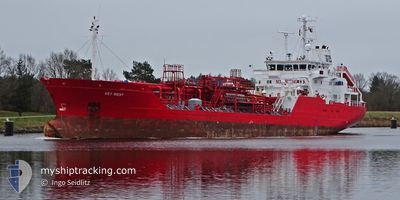
KEY WEST
Oil/Chemical Tanker
Current Trip
| Time Travelled | 1 day |
|---|---|
| Remaining Time | 1 day |
| Distance Travelled | 308.24 nm |
| Remaining Distance | 397.96 nm |
| AVG Speed | 9.1 Knots |
| MAX Speed | 15.4 Knots |
| AVG Wind | 10.5 knots |
| MAX Wind | 13 knots |
| MIN Temp | 11.7°C / 53.06°F |
| MAX Temp | 20.7°C / 69.26°F |
| Draught | 5.4 m |
| Position Received | Now |
Current Position
| Longitude | 10.29949° |
|---|---|
| Latitude | 54.48368° |
| Status | Under way using engine |
| Speed | 12.3 Knots |
| Course | 63.1° |
| Area | North Sea |
| Station | T-AIS |
| Position Received | Now |
Info
Information
The current position of KEY WEST is in North Sea with coordinates 54.48368° / 10.29949° as reported on 2024-05-18 20:20 by AIS to our vessel tracker app. The vessel's current speed is 12.3 Knots and is heading at the port of LIEPAJA. The estimated time of arrival as calculated by vessel tracking app is 2024-05-20 03:30 LT
The vessel KEY WEST (IMO: 9020429, MMSI: 236668000) is a Oil/Chemical Tanker that was built in 1992 ( 32 years old ). It's sailing under the flag of [GI] Gibraltar.
In this page you can find informations about the vessels current position, last detected port calls, and current voyage information. If the vessels is not in coverage by AIS you will find the latest position.
The current position of KEY WEST is detected by our AIS receivers and we are not responsible for the reliability of the data. The last position was recorded while the vessel was in Coverage by the Ais receivers of our vessel tracking app.
The current draught of KEY WEST as reported by AIS is 5.4 meters
Weather
| Temperature | 13.9°C / 57.02°F |
|---|---|
| Wind Speed | 11 knots |
| Direction | 69° ENE |
| Pressure | 1011.6 hPa |
| Humidity | 82.3 % |
| Cloud Coverage | 6 % |
Featured Company
Events
| Time | Event | Details | Position / Dest | Info |
|---|---|---|---|---|
| 2024-05-18 20:20 | ETA Changed | 2024/05/20 03:00 2024/05/19 23:00 |
54.48420 / 10.30135
LV LPX
|
Speed: 12.3 kn Course: 64.1° |
| 2024-05-18 20:11 | Change Sea Area | German part of the Baltic Sea German part of the North Sea |
54.46638 / 10.27051
Baltic Sea
LV LPX
|
Speed: 13.1 kn Course: 32.7° |
| 2024-05-18 19:28 | START Moving | 1.29 nm, South West of STICKENHΟRN SPORT |
54.36567 / 10.14608
LV LPX
|
Speed: 5.3 kn Course: 100.6° |
| 2024-05-18 18:52 | STOP Moving | 1.34 nm, South West of STICKENHΟRN SPORT |
54.36604 / 10.14299
LV LPX
|
Speed: 0.3 kn Course: 104° |
| 2024-05-18 13:23 | Status Changed | Under way using engine Default |
54.16062 / 9.40116
LV LPX
|
Speed: 6.4 kn Course: 64° |
| 2024-05-18 13:15 | Status Changed | Default Under way using engine |
54.15473 / 9.37794
LV LPX
|
Speed: 5.9 kn Course: 52.6° |
| 2024-05-18 13:12 | Status Changed | Under way using engine Default |
54.15194 / 9.37010
LV LPX
|
Speed: 0.3 kn Course: 60° |
| 2024-05-18 13:12 | START Moving | 0.16 nm, West of FISCHERHUTTE |
54.15194 / 9.37010
LV LPX
|
Speed: 5.9 kn Course: 52.6° |
| 2024-05-18 13:03 | Status Changed | Default Under way using engine |
54.14980 / 9.36522
LV LPX
|
Speed: 4.7 kn Course: 54° |
| 2024-05-18 13:03 | STOP Moving | 0.37 nm, South West of FISCHERHUTTE |
54.14980 / 9.36522
LV LPX
|
Speed: 0.3 kn Course: 60° |