
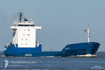
KHOLMOGORY
General Cargo
Current Trip
| Time Travelled | 1 day |
|---|---|
| Remaining Time | --- |
| Distance Travelled | 402.63 nm |
| Remaining Distance | --- |
| AVG Speed | 11.9 Knots |
| MAX Speed | 13.3 Knots |
| AVG Wind | 13.3 knots |
| MAX Wind | 17.5 knots |
| MIN Temp | 12.8°C / 55.04°F |
| MAX Temp | 15.5°C / 59.9°F |
| Draught | 5 m |
| Position Received | 8 h, 51 m ago |
Current Position
| Longitude | 21.45687° |
|---|---|
| Latitude | 58.77446° |
| Status | Under way using engine |
| Speed | 12.5 Knots |
| Course | 189.9° |
| Area | Baltic Sea |
| Station | T-AIS |
| Position Received | 8 h, 51 m ago |
Info
Information
The current position of KHOLMOGORY is in Baltic Sea with coordinates 58.77446° / 21.45687° as reported on 2024-06-19 21:28 by AIS to our vessel tracker app. The vessel's current speed is 12.5 Knots and is heading at the port of KALININGRAD. The estimated time of arrival as calculated by vessel tracking app is 2024-06-21 01:00 LT
The vessel KHOLMOGORY (IMO: 9109081, MMSI: 273342810) is a General Cargo that was built in 1995 ( 29 years old ). It's sailing under the flag of [RU] Russia.
In this page you can find informations about the vessels current position, last detected port calls, and current voyage information. If the vessels is not in coverage by AIS you will find the latest position.
The current position of KHOLMOGORY is detected by our AIS receivers and we are not responsible for the reliability of the data. The last position was recorded while the vessel was in Coverage by the Ais receivers of our vessel tracking app.
The current draught of KHOLMOGORY as reported by AIS is 5 meters
Weather
| Temperature | 14.5°C / 58.1°F |
|---|---|
| Wind Speed | 15 knots |
| Direction | 283° WNW |
| Pressure | 1014.2 hPa |
| Humidity | 87 % |
| Cloud Coverage | 6 % |
Featured Company
Last Port Calls
| Port | Arrival | Departure | Time In Port |
|---|---|---|---|
| 2024-06-18 09:45 | 2024-06-18 16:42 | 6 h | |
| 2024-06-11 15:25 | 2024-06-14 09:37 | 2 d | |
| 2024-06-08 04:50 | 2024-06-09 09:49 | 1 d | |
| 2024-06-02 16:26 | 2024-06-03 09:55 | 17 h | |
| 2024-05-30 14:22 | 2024-05-31 09:46 | 19 h | |
| 2024-05-27 14:33 | 2024-05-28 08:57 | 18 h | |
| 2024-05-23 15:24 | 2024-05-25 09:20 | 1 d | |
| 2024-05-19 13:48 | 2024-05-20 07:56 | 18 h | |
| 2024-05-15 14:36 | 2024-05-17 16:07 | 2 d | |
| 2024-05-12 15:48 | 2024-05-13 10:44 | 18 h |
Most Visited Ports (Last year)
| Port | Arrivals | |
|---|---|---|
| 31 | ||
| 21 | ||
| 3 |
Last Trips
| Origin | Departure | Destination | Arrival | Distance | |
|---|---|---|---|---|---|
| 2024-06-14 11:37 | 2024-06-18 12:45 | 580.46 nm | |||
| 2024-06-09 12:49 | 2024-06-11 17:25 | 564.57 nm | |||
| 2024-06-03 11:55 | 2024-06-08 07:50 | 574.75 nm | |||
| 2024-05-31 12:46 | 2024-06-02 18:26 | 566.22 nm | |||
| 2024-05-28 10:57 | 2024-05-30 17:22 | 558.16 nm | |||
| 2024-05-25 12:20 | 2024-05-27 16:33 | 565.84 nm | |||
| 2024-05-20 09:56 | 2024-05-23 18:24 | 561.82 nm | |||
| 2024-05-17 19:07 | 2024-05-19 15:48 | 562.78 nm | |||
| 2024-05-13 12:44 | 2024-05-15 17:36 | 558.69 nm | |||
| 2024-05-07 13:28 | 2024-05-12 17:48 | 575.13 nm |
Events
| Time | Event | Details | Position / Dest | Info |
|---|---|---|---|---|
| 2024-06-19 21:37 | Status Changed | Default Under way using engine |
58.74280 / 21.44587
RULEDRUKGD
|
Speed: 12.5 kn Course: 189.9° |
| 2024-06-19 21:28 | OUT of Coverage |
58.77446 / 21.45687
Baltic Sea
RULEDRUKGD
|
Speed: 12.5 kn Course: 189.9° |
|
| 2024-06-19 20:20 | Status Changed | Under way using engine Default |
59.01242 / 21.54343
RULEDRUKGD
|
Speed: 13 kn Course: 191° |
| 2024-06-19 20:08 | Status Changed | Default Under way using engine |
59.05456 / 21.55787
RULEDRUKGD
|
Speed: 12.5 kn Course: 214.6° |
| 2024-06-19 18:18 | Change Sea Area | Estonian part of the Baltic Sea Finnish part of the Baltic Sea |
59.30770 / 22.08510
Baltic Sea
RULEDRUKGD
|
Speed: 12 kn Course: 233.5° |
| 2024-06-19 18:18 | Status Changed | Under way using engine Default |
59.30770 / 22.08510
RULEDRUKGD
|
Speed: 12.2 kn Course: 231° |
| 2024-06-19 17:50 | Status Changed | Default Under way using engine |
59.36646 / 22.23463
RULEDRUKGD
|
Speed: 12.2 kn Course: 231.6° |
| 2024-06-19 17:35 | Status Changed | Under way using engine Default |
59.39670 / 22.31141
RULEDRUKGD
|
Speed: 12.1 kn Course: 231° |
| 2024-06-19 17:22 | Status Changed | Default Under way using engine |
59.42463 / 22.38037
RULEDRUKGD
|
Speed: 12.2 kn Course: 231.8° |
| 2024-06-19 16:32 | Status Changed | Under way using engine Default |
59.50820 / 22.65626
RULEDRUKGD
|
Speed: 11.8 kn Course: 252° |