
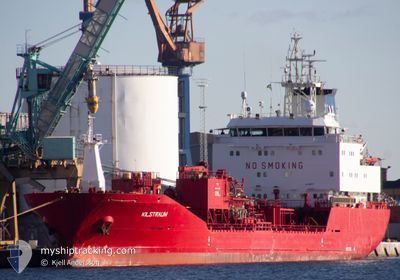
KILSTRAUM
Oil/Chemical Tanker
Current Trip
| Time Travelled | 1 day |
|---|---|
| Remaining Time | 2 days |
| Distance Travelled | 457.79 nm |
| Remaining Distance | 551.36 nm |
| AVG Speed | 10.6 Knots |
| MAX Speed | 14.3 Knots |
| AVG Wind | 19.5 knots |
| MAX Wind | 33 knots |
| MIN Temp | 11.7°C / 53.06°F |
| MAX Temp | 16.5°C / 61.7°F |
| Draught | 7.5 m |
| Position Received | 17 m ago |
Current Position
| Longitude | -0.78504° |
|---|---|
| Latitude | 50.36543° |
| Status | Under way using engine |
| Speed | 10.7 Knots |
| Course | 249° |
| Area | English Channel |
| Station | T-AIS |
| Position Received | 17 m ago |
Info
Information
The current position of KILSTRAUM is in English Channel with coordinates 50.36543° / -0.78504° as reported on 2024-06-16 04:32 by AIS to our vessel tracker app. The vessel's current speed is 10.7 Knots and is heading at the port of BILBAO. The estimated time of arrival as calculated by vessel tracking app is 2024-06-18 13:33 LT
The vessel KILSTRAUM (IMO: 9164732, MMSI: 257643000) is a Oil/Chemical Tanker that was built in 1999 ( 25 years old ). It's sailing under the flag of [NO] Norway.
In this page you can find informations about the vessels current position, last detected port calls, and current voyage information. If the vessels is not in coverage by AIS you will find the latest position.
The current position of KILSTRAUM is detected by our AIS receivers and we are not responsible for the reliability of the data. The last position was recorded while the vessel was in Coverage by the Ais receivers of our vessel tracking app.
The current draught of KILSTRAUM as reported by AIS is 7.5 meters
Weather
| Temperature | 13.6°C / 56.48°F |
|---|---|
| Wind Speed | 18 knots |
| Direction | 235° SW |
| Pressure | 1002.1 hPa |
| Humidity | 84.4 % |
| Cloud Coverage | 65 % |
Featured Company
Last Port Calls
| Port | Arrival | Departure | Time In Port |
|---|---|---|---|
| 2024-06-13 09:35 | 2024-06-14 10:34 | 1 d | |
| 2024-06-08 06:51 | 2024-06-09 11:36 | 1 d | |
| 2024-06-05 01:06 | 2024-06-06 09:59 | 1 d | |
| 2024-06-04 21:09 | 2024-06-04 22:24 | 1 h | |
| 2024-06-04 11:44 | 2024-06-04 12:38 | 53 m | |
| 2024-05-29 17:17 | 2024-05-29 18:08 | 50 m | |
| 2024-05-23 06:20 | 2024-05-29 09:38 | 6 d | |
| 2024-05-22 23:08 | 2024-05-22 23:48 | 40 m | |
| 2024-05-20 12:46 | 2024-05-21 12:20 | 23 h | |
| 2024-05-16 22:50 | 2024-05-18 03:18 | 1 d |
Last Trips
| Origin | Departure | Destination | Arrival | Distance | |
|---|---|---|---|---|---|
| 2024-06-09 13:36 | 2024-06-13 11:35 | 836.30 nm | |||
| 2024-06-06 11:59 | 2024-06-08 08:51 | 324.28 nm | |||
| 2024-06-05 00:24 | 2024-06-05 03:06 | 36.11 nm | |||
| 2024-06-04 14:38 | 2024-06-04 23:09 | 50.89 nm | |||
| 2024-05-29 20:08 | 2024-06-04 13:44 | 971.57 nm | |||
| 2024-05-29 11:38 | 2024-05-29 19:17 | 64.64 nm | |||
| 2024-05-23 01:48 | 2024-05-23 08:20 | 65.97 nm | |||
| 2024-05-21 14:20 | 2024-05-23 01:08 | 399.29 nm | |||
| 2024-05-18 05:18 | 2024-05-20 14:46 | 659.92 nm | |||
| 2024-05-12 14:08 | 2024-05-17 00:50 | 287.81 nm |
Events
| Time | Event | Details | Position / Dest | Info |
|---|---|---|---|---|
| 2024-06-16 04:39 | Status Changed | Default Under way using engine |
50.35968 / -.81491
ES BIO
|
Speed: 10.7 kn Course: 249° |
| 2024-06-15 23:11 | Status Changed | Under way using engine Default |
50.63975 / .62441
ES BIO
|
Speed: 11.2 kn Course: 231° |
| 2024-06-15 23:09 | IN Coverage |
50.63975 / .62441
English Channel
ES BIO
|
Speed: 12.9 kn Course: 229.2° |
|
| 2024-06-15 22:01 | Status Changed | Default Under way using engine |
50.78445 / .90817
ES BIO
|
Speed: 12 kn Course: 229.7° |
| 2024-06-15 21:54 | OUT of Coverage |
50.79923 / .93710
English Channel
ES BIO
|
Speed: 12 kn Course: 229.7° |
|
| 2024-06-15 19:17 | Change Sea Area | United Kingdom part of the English Channel United Kingdom part of the North Sea |
51.07586 / 1.47273
English Channel
ES BIO
|
Speed: 8.3 kn Course: 237.2° |
| 2024-06-15 12:16 | Change Sea Area | United Kingdom part of the North Sea Belgian part of the North Sea |
51.84165 / 2.51200
North Sea
ES BIO
|
Speed: 9.8 kn Course: 220.9° |
| 2024-06-15 12:07 | Change Sea Area | Belgian part of the North Sea Dutch part of the North Sea |
51.85963 / 2.54055
North Sea
ES BIO
|
Speed: 10.9 kn Course: 224.9° |
| 2024-06-15 11:52 | ETA Changed | 2024/06/17 21:00 2024/06/17 20:00 |
51.89401 / 2.58876
ES BIO
|
Speed: 10.4 kn Course: 217.4° |
| 2024-06-15 10:22 | Status Changed | Under way using engine Default |
52.08948 / 2.85428
ES BIO
|
Speed: 10.5 kn Course: 216° |