
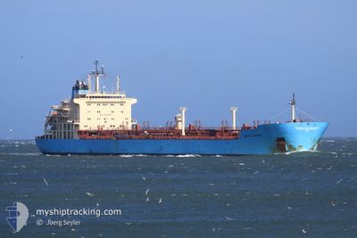
KIRSTEN MAERSK
Oil/Chemical Tanker
Current Trip
FOR ORDERS
| Time Travelled | 3 days |
|---|---|
| Remaining Time | --- |
| Distance Travelled | 394.35 nm |
| Remaining Distance | --- |
| AVG Speed | 7.5 Knots |
| MAX Speed | 16.6 Knots |
| AVG Wind | 17.4 knots |
| MAX Wind | 24 knots |
| MIN Temp | 17.2°C / 62.96°F |
| MAX Temp | 25.3°C / 77.54°F |
| Draught | 7.5 m |
| Position Received | 1 m ago |
Current Position
| Longitude | 24.73353° |
|---|---|
| Latitude | 38.36983° |
| Status | Under way using engine |
| Speed | 4.4 Knots |
| Course | 8° |
| Area | Aegean Sea |
| Station | T-AIS |
| Position Received | 1 m ago |
Info
Information
The current position of KIRSTEN MAERSK is in Aegean Sea with coordinates 38.36983° / 24.73353° as reported on 2024-06-27 07:52 by AIS to our vessel tracker app. The vessel's current speed is 4.4 Knots
The vessel KIRSTEN MAERSK (IMO: 9431264, MMSI: 220530000) is a Oil/Chemical Tanker that was built in 2010 ( 14 years old ). It's sailing under the flag of [DK] Denmark.
In this page you can find informations about the vessels current position, last detected port calls, and current voyage information. If the vessels is not in coverage by AIS you will find the latest position.
The current position of KIRSTEN MAERSK is detected by our AIS receivers and we are not responsible for the reliability of the data. The last position was recorded while the vessel was in Coverage by the Ais receivers of our vessel tracking app.
The current draught of KIRSTEN MAERSK as reported by AIS is 7.5 meters
Weather
| Temperature | 22.4°C / 72.32°F |
|---|---|
| Wind Speed | 17 knots |
| Direction | 327° NNW |
| Pressure | 1011.5 hPa |
| Humidity | 79.7 % |
| Cloud Coverage | --- |
Featured Company
Last Port Calls
| Port | Arrival | Departure | Time In Port |
|---|---|---|---|
| 2024-06-23 18:26 | 2024-06-23 19:36 | 1 h | |
| 2024-06-20 18:44 | 2024-06-22 13:49 | 1 d | |
| 2024-06-20 12:14 | |||
| 2024-06-20 10:12 | 2024-06-20 12:12 | 2 h | |
| 2024-06-15 09:24 | 2024-06-16 15:57 | 1 d | |
| 2024-06-11 12:55 | 2024-06-12 11:23 | 22 h | |
| 2024-06-09 06:44 | 2024-06-10 12:30 | 1 d | |
| 2024-06-04 11:25 | 2024-06-05 15:29 | 1 d | |
| 2024-05-28 03:09 | 2024-05-28 12:15 | 9 h | |
| 2024-05-23 20:34 | 2024-05-25 12:46 | 1 d |
Most Visited Ports (Last year)
| Port | Arrivals | |
|---|---|---|
| 5 | ||
| 4 | ||
| 4 | ||
| 4 | ||
| 3 | ||
| 3 |
Last Trips
| Origin | Departure | Destination | Arrival | Distance | |
|---|---|---|---|---|---|
| 2024-06-22 16:49 | 2024-06-23 21:26 | 198.92 nm | |||
| 2024-06-20 15:12 | 2024-06-20 15:14 | 5.07 nm | |||
| 2024-06-16 18:57 | 2024-06-20 13:12 | 603.80 nm | |||
| 2024-06-12 13:23 | 2024-06-15 12:24 | 705.24 nm | |||
| 2024-06-10 14:30 | 2024-06-11 14:55 | 291.98 nm | |||
| 2024-06-05 17:29 | 2024-06-09 08:44 | 699.02 nm | |||
| 2024-05-25 15:46 | 2024-06-04 13:25 | 1678.08 nm | |||
| 2024-05-25 15:46 | 2024-05-28 05:09 | 496.27 nm | |||
| 2024-05-07 07:04 | 2024-05-23 23:34 | 598.40 nm | |||
| 2024-04-19 01:48 | 2024-05-03 18:52 | 1338.15 nm |
Events
| Time | Event | Details | Position / Dest | Info |
|---|---|---|---|---|
| 2024-06-26 18:18 | START Moving |
38.32039 / 24.69809
FOR ORDERS
|
Speed: 3.1 kn Course: 282° |
|
| 2024-06-26 16:17 | STOP Moving |
38.37290 / 24.73355
FOR ORDERS
|
Speed: 0.3 kn Course: 341° |
|
| 2024-06-25 20:16 | START Moving |
38.31755 / 24.70888
FOR ORDERS
|
Speed: 3.1 kn Course: 338° |
|
| 2024-06-25 18:36 | STOP Moving |
38.36160 / 24.73664
FOR ORDERS
|
Speed: 0.3 kn Course: 340° |
|
| 2024-06-25 16:02 | START Moving |
38.34718 / 24.67533
FOR ORDERS
|
Speed: 3.1 kn Course: 61° |
|
| 2024-06-25 14:19 | STOP Moving | 21.18 nm, East of PETRIES |
38.36364 / 24.63952
FOR ORDERS
|
Speed: 0.3 kn Course: 353° |
| 2024-06-25 11:12 | Destination Changed | FOR ORDERS GELIBOLU PILOT |
38.27439 / 24.75158
FOR ORDERS
|
Speed: 8.7 kn Course: 345.1° |
| 2024-06-25 03:07 | Status Changed | Under way using engine Default |
39.82497 / 25.75795
GELIBOLU PILOT
|
Speed: 14.2 kn Course: 209° |
| 2024-06-25 02:50 | Status Changed | Default Under way using engine |
39.88242 / 25.79613
GELIBOLU PILOT
|
Speed: 14.6 kn Course: 210.4° |
| 2024-06-25 02:40 | Change Sea Area | Greek part of the Aegean Sea Turkish part of the Aegean Sea |
39.91461 / 25.82832
Aegean Sea
|
Speed: 15.5 kn Course: 225.8° |