
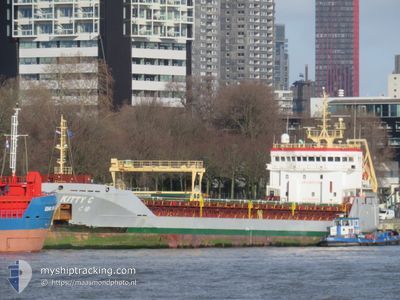
KITTY C
General Cargo
Current Trip
| Time Travelled | 3 days |
|---|---|
| Remaining Time | --- |
| Distance Travelled | 557.33 nm |
| Remaining Distance | --- |
| AVG Speed | 9.4 Knots |
| MAX Speed | 13.5 Knots |
| AVG Wind | 9.6 knots |
| MAX Wind | 15.8 knots |
| MIN Temp | 11.4°C / 52.52°F |
| MAX Temp | 18.5°C / 65.3°F |
| Draught | 6.3 m |
| Position Received | Now |
Current Position
| Longitude | 26.33367° |
|---|---|
| Latitude | 40.09950° |
| Status | Under way using engine |
| Speed | 12.7 Knots |
| Course | 225° |
| Area | Sea of Marmara |
| Station | T-AIS |
| Position Received | Now |
Info
Information
The current position of KITTY C is in Sea of Marmara with coordinates 40.09950° / 26.33367° as reported on 2024-05-20 19:57 by AIS to our vessel tracker app. The vessel's current speed is 12.7 Knots and is heading at the port of CEUTA. The estimated time of arrival as calculated by vessel tracking app is 2024-05-27 09:00 LT
The vessel KITTY C (IMO: 9558048, MMSI: 255806510) is a General Cargo that was built in 2011 ( 13 years old ). It's sailing under the flag of [PT] Portugal.
In this page you can find informations about the vessels current position, last detected port calls, and current voyage information. If the vessels is not in coverage by AIS you will find the latest position.
The current position of KITTY C is detected by our AIS receivers and we are not responsible for the reliability of the data. The last position was recorded while the vessel was in Coverage by the Ais receivers of our vessel tracking app.
The current draught of KITTY C as reported by AIS is 6.3 meters
Weather
| Temperature | 18.3°C / 64.94°F |
|---|---|
| Wind Speed | 7 knots |
| Direction | 58° ENE |
| Pressure | 1013.7 hPa |
| Humidity | 62 % |
| Cloud Coverage | 100 % |
Featured Company
Last Port Calls
| Port | Arrival | Departure | Time In Port |
|---|---|---|---|
| 2024-05-15 10:12 | 2024-05-17 11:04 | 2 d | |
| 2024-05-08 17:53 | 2024-05-12 20:25 | 4 d | |
| 2024-04-27 16:09 | 2024-04-27 21:42 | 5 h | |
| 2024-04-19 12:45 | 2024-04-21 09:33 | 1 d | |
| 2024-04-16 07:46 | 2024-04-17 20:13 | 1 d | |
| 2024-03-20 17:45 | 2024-04-11 13:59 | 21 d | |
| 2024-03-03 11:03 |
Last Trips
| Origin | Departure | Destination | Arrival | Distance | |
|---|---|---|---|---|---|
| 2024-05-12 23:25 | 2024-05-15 13:12 | 497.48 nm | |||
| 2024-04-27 23:42 | 2024-05-08 20:53 | 1815.58 nm | |||
| 2024-04-21 11:33 | 2024-04-27 18:09 | 1422.17 nm | |||
| 2024-04-17 22:13 | 2024-04-19 14:45 | 126.02 nm | |||
| 2024-04-11 14:59 | 2024-04-16 09:46 | 115.66 nm | |||
| 2024-03-03 14:03 | 2024-03-20 17:45 | 3392.87 nm |
Events
| Time | Event | Details | Position / Dest | Info |
|---|---|---|---|---|
| 2024-05-20 18:09 | Status Changed | Under way using engine Default |
40.33179 / 26.61867
ESCEU
|
Speed: 11 kn Course: 213° |
| 2024-05-20 18:09 | IN Coverage |
40.31983 / 26.60167
Sea of Marmara
ESCEU
|
Speed: 11.3 kn Course: 228° |
|
| 2024-05-20 16:31 | START Moving | 9.19 nm, North West of KEMER |
40.50830 / 26.89043
ESCEU
|
Speed: 4.2 kn Course: 225° |
| 2024-05-20 07:11 | STOP Moving | 9.31 nm, North West of KEMER |
40.50917 / 26.88817
ESCEU
|
Speed: 0.2 kn Course: 71° |
| 2024-05-20 06:14 | Status Changed | Default Under way using engine |
40.54867 / 27.03050
ESCEU
|
Speed: 10.3 kn Course: 245° |
| 2024-05-20 05:56 | OUT of Coverage |
40.56450 / 27.09367
Sea of Marmara
ESCEU
|
Speed: 10.3 kn Course: 245° |
|
| 2024-05-20 05:25 | Status Changed | Under way using engine Default |
40.60333 / 27.19467
ESCEU
|
Speed: 10 kn Course: 243° |
| 2024-05-20 04:50 | Status Changed | Default Under way using engine |
40.64850 / 27.30867
ESCEU
|
Speed: 10 kn Course: 243° |
| 2024-05-20 00:10 | Status Changed | Under way using engine Default |
40.84783 / 28.26400
ESCEU
|
Speed: 9.3 kn Course: 265° |
| 2024-05-20 00:10 | IN Coverage |
40.84700 / 28.25600
Sea of Marmara
ESCEU
|
Speed: 9.4 kn Course: 262° |