
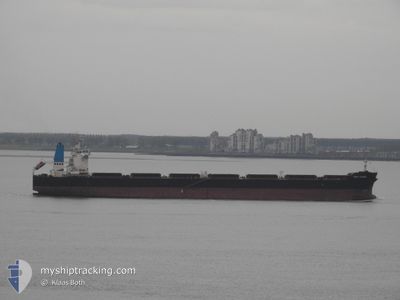
KMAX LEADER
Bulk Carrier
Current Trip
| Time Travelled | --- |
|---|---|
| Remaining Time | 1 day |
| Distance Travelled | --- |
| Remaining Distance | 473.72 nm |
| AVG Speed | --- |
| MAX Speed | --- |
| AVG Wind | --- |
| MAX Wind | --- |
| MIN Temp | --- |
| MAX Temp | --- |
| Draught | 7.2 m |
| Position Received | 1 m ago |
Current Position
| Longitude | 17.98265° |
|---|---|
| Latitude | 55.94710° |
| Status | Under way using engine |
| Speed | 12.7 Knots |
| Course | 80° |
| Area | Baltic Sea |
| Station | T-AIS |
| Position Received | 1 m ago |
Info
Information
The current position of KMAX LEADER is in Baltic Sea with coordinates 55.94710° / 17.98265° as reported on 2024-06-01 07:09 by AIS to our vessel tracker app. The vessel's current speed is 12.7 Knots and is heading at the port of UST-LUGA. The estimated time of arrival as calculated by vessel tracking app is 2024-06-02 20:05 LT
The vessel KMAX LEADER (IMO: 9477414, MMSI: 636022409) is a Bulk Carrier that was built in 2010 ( 14 years old ). It's sailing under the flag of [LR] Liberia.
In this page you can find informations about the vessels current position, last detected port calls, and current voyage information. If the vessels is not in coverage by AIS you will find the latest position.
The current position of KMAX LEADER is detected by our AIS receivers and we are not responsible for the reliability of the data. The last position was recorded while the vessel was in Coverage by the Ais receivers of our vessel tracking app.
The current draught of KMAX LEADER as reported by AIS is 7.2 meters
Weather
| Temperature | 12.8°C / 55.04°F |
|---|---|
| Wind Speed | 8 knots |
| Direction | 32° NNE |
| Pressure | 1012.6 hPa |
| Humidity | 95.4 % |
| Cloud Coverage | 100 % |
Featured Company
Last Port Calls
| Port | Arrival | Departure | Time In Port |
|---|---|---|---|
| 2024-05-17 05:19 | 2024-05-17 13:44 | 8 h |
Most Visited Ports (Last year)
| Port | Arrivals | |
|---|---|---|
| 1 | ||
| 1 | ||
| 1 | ||
| 1 |
Last Trips
| Origin | Departure | Destination | Arrival | Distance |
|---|
Events
| Time | Event | Details | Position / Dest | Info |
|---|---|---|---|---|
| 2024-06-01 04:27 | Status Changed | Under way using engine Default |
55.82940 / 17.04767
RU ULU
|
Speed: 12.5 kn Course: 77° |
| 2024-06-01 04:14 | Status Changed | Default Under way using engine |
55.81988 / 16.97340
RU ULU
|
Speed: 12.6 kn Course: 77° |
| 2024-05-31 23:43 | Change Sea Area | Swedish part of the Baltic Sea Danish part of the Kattegat |
55.60050 / 15.44548
Baltic Sea
RU ULU
|
Speed: 12.2 kn Course: 64° |
| 2024-05-31 19:40 | Detected in Sea | Danish part of the Kattegat |
55.17708 / 14.28522
Kattegat
RU ULU
|
Speed: 12.5 kn Course: 78° |
| 2024-05-31 14:43 | Change Sea Area | Swedish part of the Baltic Sea Danish part of the Baltic Sea |
55.29443 / 12.64962
Baltic Sea
RU ULU
|
Speed: 11.2 kn Course: 112° |
| 2024-05-31 14:34 | Change Sea Area | Danish part of the Baltic Sea Danish part of the Kattegat |
55.31432 / 12.62232
Baltic Sea
RU ULU
|
Speed: 12.5 kn Course: 179° |
| 2024-05-31 14:22 | Change Sea Area | Danish part of the Kattegat Swedish part of the Kattegat |
55.35415 / 12.63535
Kattegat
RU ULU
|
Speed: 13 kn Course: 197° |
| 2024-05-31 13:46 | Change Sea Area | Swedish part of the Kattegat Danish part of the Kattegat |
55.46967 / 12.68532
Kattegat
RU ULU
|
Speed: 11.7 kn Course: 192° |
| 2024-05-31 11:04 | Change Sea Area | Danish part of the Kattegat Swedish part of the Kattegat |
55.94087 / 12.65213
Kattegat
RU ULU
|
Speed: 12.3 kn Course: 194° |
| 2024-05-31 10:34 | Change Sea Area | Swedish part of the Kattegat Danish part of the Kattegat |
56.03775 / 12.65535
Kattegat
RU ULU
|
Speed: 12.6 kn Course: 161° |