
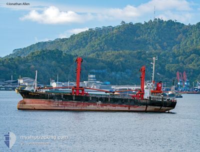
KM.SAHABATSEJATI 8
Cargo
Current Trip
JAKARTA
| Time Travelled | 27 days |
|---|---|
| Remaining Time | --- |
| Distance Travelled | 1185.87 nm |
| Remaining Distance | --- |
| AVG Speed | 7 Knots |
| MAX Speed | 9.4 Knots |
| AVG Wind | 8.7 knots |
| MAX Wind | 19 knots |
| MIN Temp | 20.4°C / 68.72°F |
| MAX Temp | 33.4°C / 92.12°F |
| Draught | 6.8 m |
| Position Received | 9 h, 13 m ago |
Current Position
| Longitude | 114.43493° |
|---|---|
| Latitude | -8.05350° |
| Status | At anchor |
| Speed | 0.5 Knots |
| Course | --- |
| Area | Bali Sea |
| Station | T-AIS |
| Position Received | 9 h, 13 m ago |
Info
Information
The current position of KM.SAHABATSEJATI 8 is in Bali Sea with coordinates -8.05350° / 114.43493° as reported on 2024-06-11 11:03 by AIS to our vessel tracker app. The vessel's current speed is 0.5 Knots
The vessel KM.SAHABATSEJATI 8 (IMO: 8403325, MMSI: 525015135) is a Cargo It's sailing under the flag of [ID] Indonesia.
In this page you can find informations about the vessels current position, last detected port calls, and current voyage information. If the vessels is not in coverage by AIS you will find the latest position.
The current position of KM.SAHABATSEJATI 8 is detected by our AIS receivers and we are not responsible for the reliability of the data. The last position was recorded while the vessel was in Coverage by the Ais receivers of our vessel tracking app.
The current draught of KM.SAHABATSEJATI 8 as reported by AIS is 6.8 meters
Weather
| Temperature | 25.4°C / 77.72°F |
|---|---|
| Wind Speed | 12 knots |
| Direction | 210° SSW |
| Pressure | 1012.2 hPa |
| Humidity | 86.8 % |
| Cloud Coverage | 12 % |
Featured Company
Last Port Calls
| Port | Arrival | Departure | Time In Port |
|---|---|---|---|
| 2024-05-06 22:14 | 2024-05-14 21:56 | 7 d | |
| 2024-04-27 00:51 | 2024-05-03 00:23 | 5 d | |
| 2024-04-25 02:06 | 2024-04-25 07:22 | 5 h | |
| 2024-04-11 02:59 | 2024-04-25 02:00 | 13 d | |
| 2024-04-04 05:37 | 2024-04-11 02:56 | 6 d |
Most Visited Ports (Last year)
| Port | Arrivals | |
|---|---|---|
| 3 | ||
| 1 | ||
| 1 |
Last Trips
| Origin | Departure | Destination | Arrival | Distance | |
|---|---|---|---|---|---|
| 2024-05-03 07:23 | 2024-05-07 06:14 | 195.89 nm | |||
| 2024-04-25 15:22 | 2024-04-27 07:51 | 45.28 nm | |||
| 2024-04-25 10:00 | 2024-04-25 10:06 | 0.10 nm | |||
| 2024-04-11 10:56 | 2024-04-11 10:59 | --- |
Events
| Time | Event | Details | Position / Dest | Info |
|---|---|---|---|---|
| 2024-06-11 11:07 | Status Changed | Default At anchor |
-8.05314 / 114.43489
JAKARTA
|
Speed: 0.5 kn Course: 511° |
| 2024-06-11 11:03 | Status Changed | At anchor Default |
-8.05350 / 114.43493
JAKARTA
|
Speed: 0.3 kn Course: -1° |
| 2024-06-11 11:03 | OUT of Coverage |
-8.05350 / 114.43493
Bali Sea
|
Speed: 0.5 kn Course: 230.7° |
|
| 2024-06-11 10:44 | IN Coverage |
-8.05350 / 114.43493
Bali Sea
|
Speed: 0.5 kn Course: 230.7° |
|
| 2024-06-11 03:42 | Status Changed | Default At anchor |
-8.05166 / 114.43500
JAKARTA
|
Speed: Course: 511° |
| 2024-06-11 03:34 | Status Changed | At anchor Default |
-8.05326 / 114.43560
JAKARTA
|
Speed: 0.1 kn Course: -1° |
| 2024-06-11 03:34 | OUT of Coverage |
-8.05326 / 114.43560
Bali Sea
|
Speed: Course: 56.4° |
|
| 2024-06-11 03:28 | IN Coverage |
-8.05326 / 114.43560
Bali Sea
|
Speed: Course: 56.4° |
|
| 2024-06-10 12:44 | Status Changed | Default At anchor |
-8.05316 / 114.43483
JAKARTA
|
Speed: 0.1 kn Course: 511° |
| 2024-06-10 12:38 | OUT of Coverage |
-8.05325 / 114.43502
Bali Sea
|
Speed: 0.1 kn Course: 296.7° |