
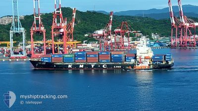
KMTC SINGAPORE
Container Ship
Current Trip
| Time Travelled | 7 h, 55 mins |
|---|---|
| Remaining Time | --- |
| Distance Travelled | 24.56 nm |
| Remaining Distance | --- |
| AVG Speed | 15.7 Knots |
| MAX Speed | 17.3 Knots |
| AVG Wind | 8.3 knots |
| MAX Wind | 9 knots |
| MIN Temp | 29.9°C / 85.82°F |
| MAX Temp | 30.8°C / 87.44°F |
| Draught | 6.8 m |
| Position Received | 3 m ago |
Current Position
| Longitude | 100.61022° |
|---|---|
| Latitude | 13.35293° |
| Status | At anchor |
| Speed | 0.1 Knots |
| Course | 218° |
| Area | Gulf of Thailand |
| Station | T-AIS |
| Position Received | 3 m ago |
Info
Information
The current position of KMTC SINGAPORE is in Gulf of Thailand with coordinates 13.35293° / 100.61022° as reported on 2024-05-17 06:05 by AIS to our vessel tracker app. The vessel's current speed is 0.1 Knots
The vessel KMTC SINGAPORE (IMO: 9217412, MMSI: 440493000) is a Container Ship that was built in 2001 ( 23 years old ). It's sailing under the flag of [KR] Korea.
In this page you can find informations about the vessels current position, last detected port calls, and current voyage information. If the vessels is not in coverage by AIS you will find the latest position.
The current position of KMTC SINGAPORE is detected by our AIS receivers and we are not responsible for the reliability of the data. The last position was recorded while the vessel was in Coverage by the Ais receivers of our vessel tracking app.
The current draught of KMTC SINGAPORE as reported by AIS is 6.8 meters
Weather
| Temperature | 30.8°C / 87.44°F |
|---|---|
| Wind Speed | 9 knots |
| Direction | 180° S |
| Pressure | 1008 hPa |
| Humidity | 69.9 % |
| Cloud Coverage | 100 % |
Featured Company
Last Port Calls
| Port | Arrival | Departure | Time In Port |
|---|---|---|---|
| 2024-05-16 09:12 | 2024-05-16 22:14 | 13 h | |
| 2024-05-07 11:19 | 2024-05-07 21:36 | 10 h | |
| 2024-05-06 01:47 | 2024-05-07 02:04 | 1 d | |
| 2024-05-02 10:34 | 2024-05-03 10:27 | 23 h | |
| 2024-05-01 00:09 | 2024-05-01 12:39 | 12 h | |
| 2024-04-26 13:36 | 2024-04-27 00:30 | 10 h | |
| 2024-04-24 21:32 | 2024-04-26 10:12 | 1 d | |
| 2024-04-23 16:48 | 2024-04-23 23:35 | 6 h | |
| 2024-04-14 20:25 | 2024-04-15 16:43 | 20 h | |
| 2024-04-13 13:02 | 2024-04-14 10:32 | 21 h |
Last Trips
| Origin | Departure | Destination | Arrival | Distance | |
|---|---|---|---|---|---|
| 2024-05-08 06:36 | 2024-05-16 16:12 | 2707.20 nm | |||
| 2024-05-07 11:04 | 2024-05-07 20:19 | 98.17 nm | |||
| 2024-05-03 18:27 | 2024-05-06 10:47 | 965.17 nm | |||
| 2024-05-01 20:39 | 2024-05-02 18:34 | 322.77 nm | |||
| 2024-04-27 07:30 | 2024-05-01 08:09 | 1537.93 nm | |||
| 2024-04-26 17:12 | 2024-04-26 20:36 | 39.49 nm | |||
| 2024-04-24 06:35 | 2024-04-25 04:32 | 43.34 nm | |||
| 2024-04-16 01:43 | 2024-04-23 23:48 | 2632.71 nm | |||
| 2024-04-14 19:32 | 2024-04-15 05:25 | 106.12 nm | |||
| 2024-04-11 15:15 | 2024-04-13 22:02 | 912.29 nm |
Events
| Time | Event | Details | Position / Dest | Info |
|---|---|---|---|---|
| 2024-05-17 05:06 | Draught Changed | 6.8 9 |
13.35287 / 100.61027
TH BKK
|
Speed: 0.1 kn Course: 218° |
| 2024-05-17 05:06 | Destination Changed | TH BKK TH LCH |
13.35287 / 100.61027
TH BKK
|
Speed: 0.1 kn Course: 218° |
| 2024-05-17 05:06 | ETA Changed | 2024/05/17 00:01 2024/05/16 01:00 |
13.35287 / 100.61027
TH BKK
|
Speed: 0.1 kn Course: 218° |
| 2024-05-17 05:02 | Detected in Sea | Thailand part of the Gulf of Thailand |
13.35288 / 100.61023
Gulf of Thailand
|
Speed: Course: 183° |
| 2024-05-17 05:02 | Status Changed | At anchor Default |
13.35288 / 100.61023
TH LCH
|
Speed: 0.1 kn Course: 214° |
| 2024-05-17 05:02 | IN Coverage |
13.35288 / 100.61023
Gulf of Thailand
|
Speed: Course: 183° |
|
| 2024-05-17 00:04 | STOP Moving | 11.43 nm, South of BANGKOK |
13.35322 / 100.60935
TH LCH
|
Speed: 0.2 kn Course: 165° |
| 2024-05-16 22:14 | PORT DEPARTURE |
|
13.06718 / 100.83013
TH LCH
|
Speed: 11.6 kn Course: 295° |
| 2024-05-16 21:51 | START Moving |
13.06503 / 100.89040
[TH] LAEM CHABANG
|
Speed: 5.3 kn Course: 242° |
|
| 2024-05-16 09:52 | STOP Moving |
13.06785 / 100.89788
[TH] LAEM CHABANG
|
Speed: 0.1 kn Course: 60° |