
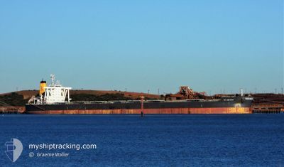
KN AMETHYST
Cargo
Current Trip
| Time Travelled | 12 days |
|---|---|
| Remaining Time | --- |
| Distance Travelled | 3279.16 nm |
| Remaining Distance | --- |
| AVG Speed | 12.8 Knots |
| MAX Speed | 16.5 Knots |
| AVG Wind | 8.8 knots |
| MAX Wind | 24 knots |
| MIN Temp | 20.9°C / 69.62°F |
| MAX Temp | 30.4°C / 86.72°F |
| Draught | 9.6 m |
| Position Received | 6 h, 56 m ago |
Current Position
| Longitude | 118.82678° |
|---|---|
| Latitude | -18.79760° |
| Status | Not under command |
| Speed | 1.3 Knots |
| Course | 168° |
| Area | Indian Ocean |
| Station | T-AIS |
| Position Received | 6 h, 56 m ago |
Info
Information
The current position of KN AMETHYST is in Indian Ocean with coordinates -18.79760° / 118.82678° as reported on 2024-06-19 12:48 by AIS to our vessel tracker app. The vessel's current speed is 1.3 Knots and is heading at the port of PORT HEDLAND. The estimated time of arrival as calculated by vessel tracking app is 2024-06-23 00:00 LT
The vessel KN AMETHYST (IMO: 9757905, MMSI: 563010400) is a Cargo It's sailing under the flag of [SG] Singapore.
In this page you can find informations about the vessels current position, last detected port calls, and current voyage information. If the vessels is not in coverage by AIS you will find the latest position.
The current position of KN AMETHYST is detected by our AIS receivers and we are not responsible for the reliability of the data. The last position was recorded while the vessel was in Coverage by the Ais receivers of our vessel tracking app.
The current draught of KN AMETHYST as reported by AIS is 9.6 meters
Weather
| Temperature | 24.8°C / 76.64°F |
|---|---|
| Wind Speed | 24 knots |
| Direction | 123° ESE |
| Pressure | 1013.7 hPa |
| Humidity | 68.2 % |
| Cloud Coverage | 100 % |
Featured Company
Most Visited Ports (Last year)
| Port | Arrivals | |
|---|---|---|
| 1 | ||
| 1 | ||
| 1 | ||
| 1 | ||
| 1 | ||
| 1 |
Events
| Time | Event | Details | Position / Dest | Info |
|---|---|---|---|---|
| 2024-06-19 12:56 | Status Changed | Default Not under command |
-18.79693 / 118.82904
AUPHE
|
Speed: 1.3 kn Course: 168° |
| 2024-06-19 12:48 | OUT of Coverage |
-18.79760 / 118.82678
Indian Ocean
AUPHE
|
Speed: 1.3 kn Course: 74.7° |
|
| 2024-06-19 12:42 | Status Changed | Not under command Default |
-18.79813 / 118.82502
AUPHE
|
Speed: 1.1 kn Course: 167° |
| 2024-06-19 12:12 | Status Changed | Default Not under command |
-18.80056 / 118.81617
AUPHE
|
Speed: 0.7 kn Course: 147° |
| 2024-06-19 12:05 | Status Changed | Not under command Default |
-18.80094 / 118.81411
AUPHE
|
Speed: 1.4 kn Course: 148° |
| 2024-06-19 12:04 | Status Changed | Default Not under command |
-18.80104 / 118.81383
AUPHE
|
Speed: 1.2 kn Course: 150° |
| 2024-06-19 07:57 | Status Changed | Not under command Default |
-18.80966 / 118.77231
AUPHE
|
Speed: 0.4 kn Course: 217° |
| 2024-06-19 07:36 | Status Changed | Default Not under command |
-18.81204 / 118.77189
AUPHE
|
Speed: 0.7 kn Course: 218° |
| 2024-06-19 06:27 | STOP Moving |
-18.81940 / 118.77291
AUPHE
|
Speed: 0.2 kn Course: 181° |
|
| 2024-06-19 06:00 | Status Changed | Not under command Default |
-18.81635 / 118.78019
AUPHE
|
Speed: 2.2 kn Course: 233° |