
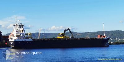
KNARRLAGSUND
General Cargo
Current Trip
| Time Travelled | 4 days |
|---|---|
| Remaining Time | 1 day |
| Distance Travelled | 866.14 nm |
| Remaining Distance | 245.19 nm |
| AVG Speed | 9.5 Knots |
| MAX Speed | 11.7 Knots |
| AVG Wind | 12.3 knots |
| MAX Wind | 27.8 knots |
| MIN Temp | 5.8°C / 42.44°F |
| MAX Temp | 14.6°C / 58.28°F |
| Draught | 5.8 m |
| Position Received | Now |
Current Position
| Longitude | 5.22268° |
|---|---|
| Latitude | 56.17198° |
| Status | Under way using engine |
| Speed | 9.6 Knots |
| Course | 177.2° |
| Area | North Sea |
| Station | T-AIS |
| Position Received | Now |
Info
Information
The current position of KNARRLAGSUND is in North Sea with coordinates 56.17198° / 5.22268° as reported on 2024-05-20 04:54 by AIS to our vessel tracker app. The vessel's current speed is 9.6 Knots and is heading at the port of AMSTERDAM. The estimated time of arrival as calculated by vessel tracking app is 2024-05-21 06:31 LT
The vessel KNARRLAGSUND (IMO: 9268849, MMSI: 257039490) is a General Cargo that was built in 2004 ( 20 years old ). It's sailing under the flag of [NO] Norway.
In this page you can find informations about the vessels current position, last detected port calls, and current voyage information. If the vessels is not in coverage by AIS you will find the latest position.
The current position of KNARRLAGSUND is detected by our AIS receivers and we are not responsible for the reliability of the data. The last position was recorded while the vessel was in Coverage by the Ais receivers of our vessel tracking app.
The current draught of KNARRLAGSUND as reported by AIS is 5.8 meters
Weather
| Temperature | 10.7°C / 51.26°F |
|---|---|
| Wind Speed | 13 knots |
| Direction | 350° N |
| Pressure | 1013.9 hPa |
| Humidity | 79.1 % |
| Cloud Coverage | 16 % |
Featured Company
Last Port Calls
| Port | Arrival | Departure | Time In Port |
|---|---|---|---|
| 2024-05-15 14:23 | 2024-05-15 16:55 | 2 h | |
| 2024-05-12 12:46 | 2024-05-14 09:43 | 1 d | |
| 2024-05-04 12:02 | 2024-05-06 13:15 | 2 d | |
| 2024-05-02 13:33 | 2024-05-03 13:30 | 23 h | |
| 2024-04-28 14:12 | 2024-04-29 05:56 | 15 h | |
| 2024-04-27 12:26 | 2024-04-28 01:07 | 12 h | |
| 2024-04-19 05:02 | 2024-04-20 13:47 | 1 d | |
| 2024-04-13 12:14 | 2024-04-16 12:51 | 3 d | |
| 2024-03-01 08:06 | 2024-04-12 13:12 |
Last Trips
| Origin | Departure | Destination | Arrival | Distance | |
|---|---|---|---|---|---|
| 2024-05-14 11:43 | 2024-05-15 16:23 | 301.97 nm | |||
| 2024-05-06 15:15 | 2024-05-12 14:46 | 1117.59 nm | |||
| 2024-05-03 15:30 | 2024-05-04 14:02 | 242.60 nm | |||
| 2024-04-29 07:56 | 2024-05-02 15:33 | 633.47 nm | |||
| 2024-04-28 03:07 | 2024-04-28 16:12 | 123.08 nm | |||
| 2024-04-20 15:47 | 2024-04-27 14:26 | 896.13 nm | |||
| 2024-04-16 15:51 | 2024-04-19 07:02 | 594.70 nm | |||
| 2024-04-12 16:12 | 2024-04-13 15:14 | 227.28 nm | |||
| 2024-02-27 23:20 | 2024-03-01 10:06 | 612.18 nm |
Events
| Time | Event | Details | Position / Dest | Info |
|---|---|---|---|---|
| 2024-05-20 01:58 | Detected in Sea | Danish part of the North Sea |
56.63510 / 5.17747
North Sea
NLAMS
|
Speed: 9.5 kn Course: 175.1° |
| 2024-05-20 00:45 | Status Changed | Under way using engine Default |
56.82833 / 5.15134
NLAMS
|
Speed: 9 kn Course: 177° |
| 2024-05-20 00:33 | Status Changed | Default Under way using engine |
56.86014 / 5.14865
NLAMS
|
Speed: 9.4 kn Course: 175.9° |
| 2024-05-19 23:35 | Status Changed | Under way using engine Default |
57.01465 / 5.13706
NLAMS
|
Speed: 9 kn Course: 178° |
| 2024-05-19 23:29 | Status Changed | Default Under way using engine |
57.02833 / 5.13667
NLAMS
|
Speed: 9.6 kn Course: 179.3° |
| 2024-05-18 22:08 | Change Sea Area | Norwegian part of the North Sea Norwegian part of the Norwegian Sea |
60.99293 / 4.42827
North Sea
NLAMS
|
Speed: 9.9 kn Course: 178.6° |
| 2024-05-16 15:47 | ETA Changed | 2024/05/21 10:00 2024/05/21 09:00 |
67.50185 / 15.44550
NLAMS
|
Speed: 10 kn Course: 299.3° |
| 2024-05-16 15:03 | START Moving | 2.17 nm, North West of SALTEN |
67.39949 / 15.54827
NLAMS
|
Speed: 5.6 kn Course: 7.9° |
| 2024-05-16 14:53 | Status Changed | Under way using engine Moored |
67.39571 / 15.54491
NLAMS
|
Speed: 0.5 kn Course: 193° |
| 2024-05-16 14:52 | ETA Changed | 2024/05/21 09:00 2024/05/21 08:00 |
67.39524 / 15.54385
NLAMS
|
Speed: 0.5 kn Course: 193° |